
CSIRO Darwin Living Lab reveals tree by tree level heat data
Data made public for the first time allows Darwinites to see just how hot their portion of the street is compared with others in the neighbourhood.

Northern Territory
Don't miss out on the headlines from Northern Territory. Followed categories will be added to My News.
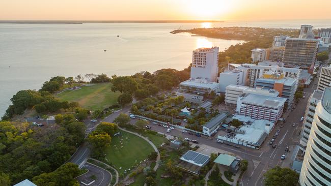
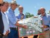
Data released to the public for the first time gives street by street level insight into just how hot Darwin’s urban areas can be – with the aim to help residents and urban planners find solutions to lower the mercury.
CSIRO has launched a new online portal, Darwin Living Lab, allowing residents to check tree canopy around their home, meaning they can find the coolest walking paths or check how exposed a potential property may be.
An interactive map of Darwin shows urban heat, tree cover, and heat vulnerability index – a metric that takes into account the proportion of vulnerable residents (such as the elderly), and those living in public or low income housing.
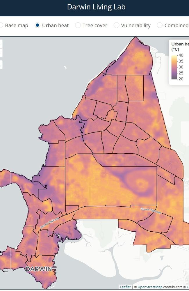
On a combined set of indicators, the map shows suburbs East Point, Millner and Jingili are most at risk of heat dangers.
Planners can also use the platform to explore how features like tree cover, green spaces, and urban density influence heat levels across suburbs.
The Darwin Living Lab, part of the Darwin City Deal, is a 10-year collaboration between CSIRO, the federal and Territory governments, and City of Darwin.
The lab tests and evaluates heat mitigation measures, informing tropical urban design for Darwin by using real world experiments.
Scientists are using the portal to analyse where Darwin can improve on the 3-30-300 guideline for tree canopy, which states every house, school and workplace should have a view of at least three trees, be in a neighbourhood with at least 30 per cent canopy cover, and be within 300 metres of high-quality public green space.
Although initially focused on Darwin, insights from the project will be applied to other regions throughout Australia.
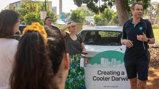
CSIRO Senior Environmental Scientist Stephen Cook said the data showed heat data down to the level of an individual tree.
“It helps highlight particularly low tree coverage areas, and helps us think about how that could be increased to reduce airconditioning load in homes, for example,” he said.
Extensive tree surveys were taken in 2011, 2016 and 2021, with 2024 data expected soon.
Mr Cook said Cyclone Marcus in 2018 had a significant impact on Darwin’s green space, wiping out a third of the city’s tree cover in just a few hours.
“We can see tree coverage went backwards over that period,” he said.
“Part of our work is collaborating closely with the City of Darwin thinking about their green strategy and thinking about what’s needed to achieve their green cover targets.”
More Coverage
Originally published as CSIRO Darwin Living Lab reveals tree by tree level heat data

‘Conflict of interest exists’: Senior bureaucrat sat in on friend’s public service interview, supplied reference
A senior NT public servant has got on the wrong side of ICAC due to a conflict of interest. Read what he did.
Woman charged with murder over man’s stabbing death in Darwin
A woman has been charged with murder over the alleged stabbing death of a man in a Darwin suburb. READ THE LATEST.