
Weekend weather warning: ‘Very, very dangerous’
Forecasters have said this weekend’s weather is so “unusual” it could include scorching heat, raging bushfires, hail and snow.

Weather
Don't miss out on the headlines from Weather. Followed categories will be added to My News.
Forecasters have warned of a wild few days of weather with “very, very dangerous conditions” that could lead to extreme fire dangers and millions sweltering in near 40C temperatures followed by the possibility of hail and even snow in some areas.
People in Adelaide, Sydney, Melbourne, Canberra and areas in between could see an “unusually hot autumn weekend” reported Sky News Weather.
“A shift in weather is on the way for south eastern Australia this weekend, as we move from hot, dry weather and elevated fire dangers to cool, showery weather as a cold front moves through,” said Bureau of Meteorology meteorologist Miriam Bradbury.

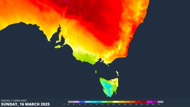
Much of the weather drama – from the heat to the cold – is being caused by a cold front sweeping through. These fronts often elevate temperatures ahead of their arrival.
The change should arrive on late Saturday or Sunday for South Australia and Victoria and later for New South Wales.
‘Very, very dangerous’
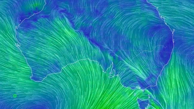
Ahead of the cold front, hot desert air is being dragged towards the south east baking major cities on its journey.
Hot air and windy conditions, which cold fronts produce as they barrel through, are a recipe for bush fires.
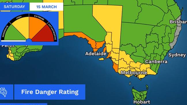
“We’ve got high fire dangers throughout Victoria and south east NSW with extreme fire dangers for much of southern South Australia,” said Ms Bradbury.
“Those extreme fire dangers will trigger fire weather warnings on Saturday, and will promote very, very dangerous conditions for any fires that are ongoing in the landscape, or any fresh fires that do develop as we go into Sunday”.
For South Australia, fire dangers may ease on Sunday but for NSW and Tasmania they could extend well into Monday.
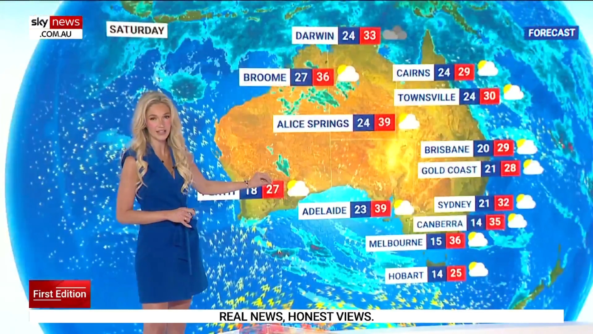
Adelaide is forecast to hit 39C on Saturday with an uncomfortable overnight minimum as high as 23C. Winds could reach 40km/h during some parts of the morning.
On Sunday, expect a still warm low of 20C with a much more manageable 26C high. Up to 9mm of rain could fall in the city. Monday’s low of 14C will be a full 10 degrees lower than Saturday.
Beyond Adelaide on Saturday, Port Augusta could peak at 42C before falling to 28C on Sunday, Murray Bridge could also see 42C and then drop by a full 17 degrees on Sunday.
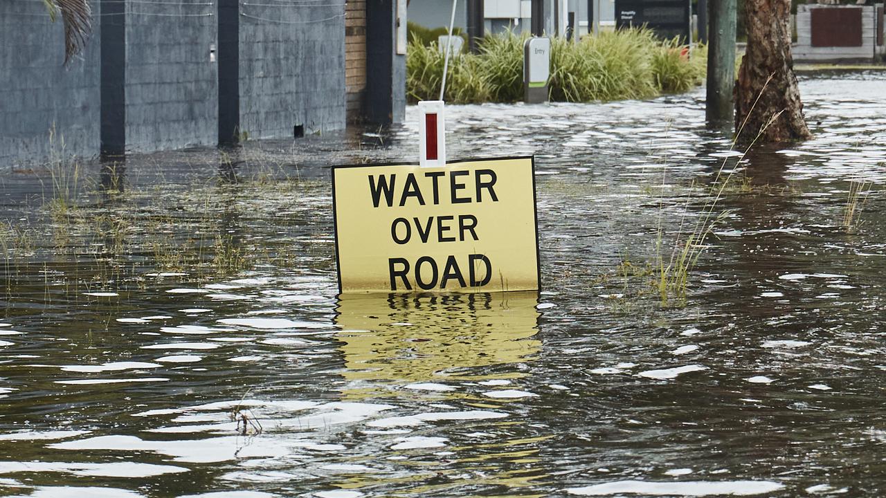
Melbourne will top out at 34C on Saturday, head down to 21C overnight, and then reach a maximum of 26C on Sunday when up to 20mm of rain could fall as storms associated with the front push through.
Monday will be cooler still with an 18C high.
Inland in Victoria, Stawell, Albury and Bendigo are looking at 37C on Saturday, Echuca 39C, Mildura 41C and Bairnsdale 29C.
Sydney looking at almost 40C
Canberra will see 35C on Saturday with 33C on Sunday with some light rain. The minimum will go from 16C overnight to Sunday to just 6C overnight leading into Monday.
Sydney is looking at a warm 32C on Saturday but as the front will take longer to reach the Harbour City, its hottest day will be Sunday. It’ll be a blistering 37C to see out the weekend.
Overnight weekend lows of 24C can be expected in the CBD. Monday could become windy with a high of 23C.
As ever, Sydney’s west will be hotter with Penrith likely to hit 37C on both weekend days.
Elsewhere in NSW, Wagga Wagga will go from 38C to 35C across the weekend, Dubbo will also hit 38C on Saturday, Tamworth 34C, Griffith 40C, Wollongong 30C and Newcastle 32C.
Snow possible
Hobart is forecast to hit 26C on Saturday followed by 23C on Sunday. Both days could see some rain. There will then be a dip to 17C on Monday. I’ll be a touch cooler in Tasmania’s north where 24C on Saturday will be the norm.
The change in conditions could be pronounced in Tasmania, said the BOM’s Ms Bradbury.
“It’ll be so cool, we may see small hail across parts of Tasmania late on Sunday and going into Monday – as well as possible snow flurries about the Tasmanian peaks.”
Tasmania could also see some damaging gusts on Sunday as the front progresses.
Brisbane can expect a few days bobbing around the 30C mark – 19C overnight – with dry conditions.
There will be showers in Townsville on Saturday, and a possible storm on Sunday bringing heavier falls, with the mercury also around 30C.
Thunderstorms in Darwin on Saturday with 33C highs across the weekend.
A sunny, partly cloudy weekend for Perth with temperatures edging up from the mid-twenties and then breaching 30C on Monday. Minimums in WA’s capital should be at 17C.
More Coverage


Originally published as Weekend weather warning: ‘Very, very dangerous’
What made Cyclone Alfred worse
A “decade of inaction” on climate pollution has cost Australians $1.2bn in the wake of Tropical Cyclone Alfred, experts say.
Heartbreak as farmers dump milk en masse
Unbelievable footage shows the heartbreaking moment Aussie dairy farmers were forced to dump hundreds of litres of perfectly good milk.