Fears ‘great wall’ of high rise buildings will line waterfront
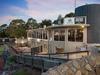
Frankston residents fear this is how their prized waterfront will look under a plan to make the seaside hub the capital of south east Melbourne.
South East
Don't miss out on the headlines from South East . Followed categories will be added to My News.
Residents warn a “Great Wall of Frankston” is coming to the beachside suburb amid fears its prized waterfront views will be hidden behind a row of high rise buildings.
An online petition against the council’s vision for the seaside suburb has been signed by more than 1500 people.
The petition shows a line of tall buildings dominating the skyline along the waterfront with the headline, “STOP THE GREAT WALL OF FRANKSTON.”
The council said the picture was “not an accurate representation of recent development applications/approvals”.
But those leading the campaign fear the council’s vision for the city will allow developers to turn the waterfront into “an ugly imitation Gold Coast”.
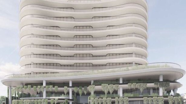
“The council has already approved a 14-storey building on the beach side of Nepean Highway and will soon consider another next door that’s even taller at 16-storeys,” petition creator Jennifer Young said.
“We’re going to end up with a great wall of high rises that will block the sun, the sky and views of the bay.
“The bay is for everyone to enjoy, not just those who can afford a front-row seat.”
Groups backing the petition include Port Phillip Conservation Council, Frankston Beach Association, Long Island Residents Group, Kananook Creek Association and Mornington Environment Association.
“There is concern right around the bay about this, it’s not about locals worried about how it will impact them,” Ms Young said.
She said mandatory height limits were needed to protect Frankston’s unique waterfront.
The council has released a draft structure plan for its metropolitan activity centre with the aim of making it the capital of south east Melbourne by 2040.
The proposal raised the existing maximum “preferred height” for buildings along Nepean Highway between Beach St and Ploughman Place from 32m (nine-storeys) to 41m (12-storeys).
This limit has already been surpassed with the council recently granting conditional approval for a 14-storey mixed use development at 446-450 Nepean Highway.
Another planning application for a 14 to 16-storey mixed use development at 438-444 Nepean Highway was also pending council consideration.
Developer Pace has already flagged its intention of creating a “premium residential building” with “breathtaking bay views” at the site.
Mayor Nathan Conroy said the council’s draft structure plan provided guidance on the height, shape and configuration of buildings.
“Those height limits can be exceeded, subject to strategic justification and are required to
meet the design objectives,” he said.
The draft structure plan also required upper levels to be set back with significant gaps to reduce the visual bulk of the building when viewed from the foreshore and surrounding areas.
Cr Conroy said the council’s ultimate plan was to activate the water front precinct including Kananook Creek, Nepean Highway, and nearby streets with retail, restaurants, cafes, arts and entertainment and support residential and office uses on upper levels of buildings.
The draft structure plan was expected to be finalised and considered by council mid-year.
It was likely to take up to two more years to be implemented.