
Bass Strait: drone footage over Gunnamatta sewage outfalls show healthy seaweed increase
WATCH VIDEO: High-tech drones are being used to assess the ocean ecosystem near sewage outfalls at Gunnamatta. Check out the footage.
South East
Don't miss out on the headlines from South East . Followed categories will be added to My News.
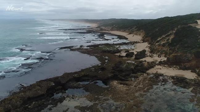
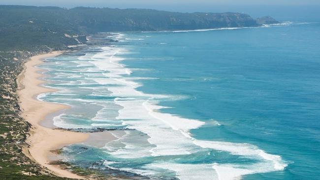
HIGH-tech drones monitoring the outfall near Gunnamatta on the Mornington Peninsula have revealed the environmental health of the ecosystem is bouncing back.
The Melbourne Water project at Boags Rocks has shown regrowth in previously diminished seaweed crops harmed by effluent discharge into the water.
SHIRE WANTS TREATED SEWAGE USED TO ‘DROUGHT PROOF’ AREA
RECYCLED SEWAGE WATER A POLITICAL TURN-OFF
DECADES OF WATER DOWN THE DRAIN
But Melbourne Water research has shown a major upgrade of the Eastern Treatment Plant in 2012, which means effluent is now treated by a range of measures including UV and biological filtration, had enabled Hormosira Banksii, or ‘Neptune’s necklace’ to better compete with other seaweeds.
“When nutrient levels go too high, other species will out compete the Hormosira and it will eventually disappear,” Melbourne Water research manager Dr Kris Coventry said.
“That particular quality makes it a very meaningful way we can measure nutrient levels beyond simple water testing, which we also conduct.”
Dr Coventry said Melbourne Water had been mapping the ecosystem of the intertidal zones along the coast since 2006.
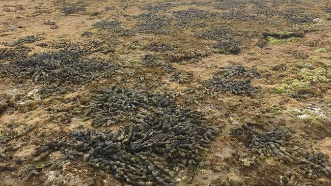
“Since the upgrade we’ve seen Hormosira Banksii populations returning to normal, healthy levels at Fingal’s Beach, near Boags Rocks, which is a great sign of the overall ecological recovery in the area,” Dr Coventry said.
He said photography from the drones could be used to create unique 3D images, virtual reality and 3D renders.
“We’ve never had this kind of insight into environmental data before so it’s a very exciting time to trial new technology,” Dr Coventry said.
Data from the drone monitoring trial is being assessed against the data mapped in the traditional way to determine the rigour of the drone data.
Dr Coventry said the process to collect this data traditionally involved people navigating rock formations with a handheld GPS to take detailed maps.
“Incorporating drones into the process virtually eliminates the risks to the operators, as well as reducing the time it takes to capture the data and cutting costs.”
He said there was still some areas that needed to be manually surveyed, but overall they expected manual workload may be reduced by as much as 90 per cent.
But prominent environmentalist Jenny Warfe said authorities needed to take the next step and look at closing the outfall altogether. “It’s 19th century technology to dump all our waste into the clean when we know it can be turned into a resource (for irrigation),” she said.
MORE NEWS:
OLD MAN SHIVERS IN SMASHED UP BUS SHELTER