
‘Prepare to isolate’: Warnings issued as NSW smashed by rain at end of long weekend
Residents have been warned to “prepare to isolate” as one state is smashed by rain in a wet end to the long weekend.

Environment
Don't miss out on the headlines from Environment. Followed categories will be added to My News.
Residents across NSW have been advised to “prepare to isolate” as the state is smashed by rain, with warnings flash flooding could lead to dangerous driving conditions while winds could damage property.
Residents on Darkwood Rd and Upper Darkwood Rd in Thora, northern NSW, were warned to prepare to isolate as the Bellinger River “may have an extended peak” around the minor flood level.
“You should monitor the situation and prepare to be isolated by floodwater,” the warning from NSW SES stated.
“Consider the effects isolation will have on family, work, and educational commitments.
“You may be trapped without power, water, and other essential services and it may be too dangerous for NSW SES to rescue you.”
Watch and Act warnings were also issued for the Willara Crossing, Wanaaring, Enngonia, Fords Bridge Bywash and surrounds, urging people not to enter the floodwaters.
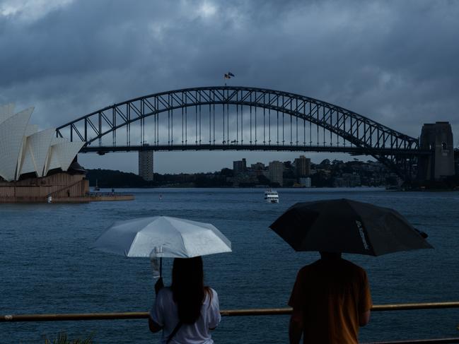
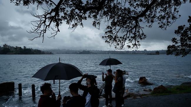
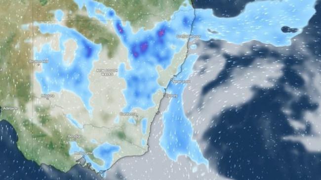
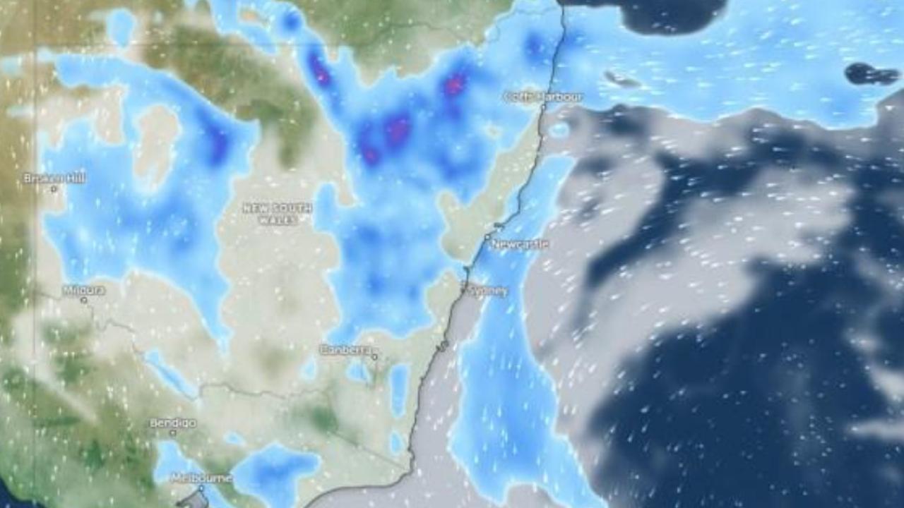
Sydney was expected to be hammered by up to 80mm of rain and possible thunderstorms through much of Sunday, with areas of the Mid North Coast and Hunter regions also likely to cop a drenching as a low-pressure trough develops off the coast, the Bureau of Meteorology says.
Bureau of Meteorology senior meteorologist Miriam Bradbury said Turners Flat recorded 154mm of rain in the 24 hours to 9am Sunday, followed by Bowraville at 99mm and Kempsey at 96mm.
She said areas in the Hunter Region and southern parts of the Mid North Coast were most likely to record six hourly rainfall totals between 50-100mm on Sunday.
“That’s a lot of rain to fall in a short space of time, and is likely to lead to flash flooding in some of these areas,” Ms Bradbury said.
“Damaging winds are also possible mostly along the coastal fringe, where those strong winds are wrapping around the low.”
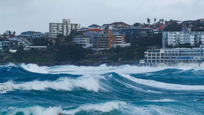
Severe thunderstorms are possible in those areas, as well as in The Central Coast, over Sunday and into Monday, while strong winds wrapping around the low-pressure system are likely to bring large waves and potentially dangerous surf.
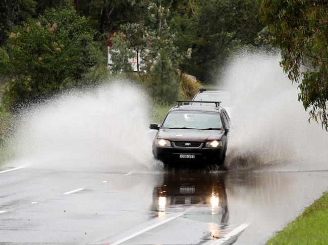
There’s also a risk of flash flooding that could lead to dangerous driving conditions, while winds could damage crops, trees and property on Sunday.
“When a lot of rain falls in a short space of time, our drainage systems can’t carry it away quickly enough,” Ms Bradbury said.
“This is particularly of concern today, on the last day of a long weekend, when many people will be travelling home from a weekend away.”
Ms Bradbury warned there may be further river rises over the next couple of days, while flood warnings could be issued for other catchments.
While the system is likely to move even further from the NSW coast on Monday, Ms Bradbury warned a “showery day is on the way” for eastern NSW, though rainfall totals are tipped to be much lower than Sunday.
“The risk of heavy rain will ease into this evening and overnight. We’ll still see showers through the east, but they’re less likely to bring those heavy falls and the flash flooding,” she said.
The Bureau earlier warned on Sunday morning that heavy rainfall may lead to flash flooding within hours along the southern Mid North Coasts, before shifting further south to the Hunter Region later on Sunday morning.
Those closest to the shoreline should also remain wary as damaging winds are possible in exposed coastal areas.
Six-hour rainfall totals of 75mm to 100mm were expected, with possible isolated totals of up to 140mm.
Flood watch alerts and flood warnings have been issued for locations including Taree, Newcastle, Gosford, Cessnock, Maitland, Putty, Wollombi, Dungog and Kulnura.
Collombatti and Aldavilla are among the areas in NSW that have already recorded more than 100mm of rain in the past 24 hours.
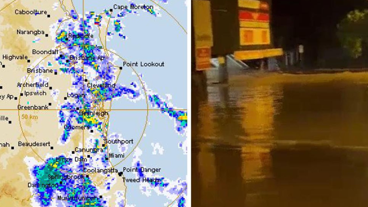
Parts of Queensland have also been lashed by wild weather through the long weekend, including the Sunshine Coast, where two women were rushed to hospital after their properties were struck by lightning.
Ms Bradbury said the low-pressure system would act as a “magnet” or sink for moisture and strong winds, pulling in from over the ocean and directing against the NSW coast.
“When a lot of rain falls in a short space of time, our gutters and drainage systems tend to get overwhelmed, and that’s when we see water moving quickly over roads, pathways, public areas, and private property,” Ms Bradbury said.
“This will quickly lead to some dangerous driving conditions where those heaviest falls occur.”
Residents in most of NSW can also expect cooler days, except for those in the state’s far northeast and southern inland areas where above-average temperatures may be on the way.
Isolated thunderstorms impacting mostly NSW have now spilt into parts of Queensland, which has led to flood warnings as rivers and creeks become inundated with rain.
The Mary River, Maroochy River, Upper Brisbane River, Cooper Creek, Thomson River, Barcoo River, Diamantina River, Eyre Creek, Georgina River, and Lower Flinders River have all been affected.
Melbourne residents are likely to experience calmer weather on Sunday, with a top of 18C and cloudy conditions with a slight chance of shower.
Those in Adelaide are also tipped to see possible showers with a maximum of 21C, and in Hobart a high of 18C with a potential late shower or two.
A slightly warmer day is predicted for Perth with a top of 23C, and a much warmer 33C in Darwin with the slight chance of a shower.
More Coverage


Originally published as ‘Prepare to isolate’: Warnings issued as NSW smashed by rain at end of long weekend
Sydney to cop drenching as state smashed by wild weather
Residents have been warned to “prepare to isolate” as one state is smashed by rain in a wet end to the long weekend.
Women injured by lightning amid Anzac deluge
Two women have been injured in separate lightning strikes after one Aussie state was pounded by more than 200mm of rain over Anzac Day.