
End of the road for traffic relief plan as road corridor quietly scrapped
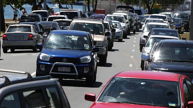
WELCOME to 2031 on the Gold Coast — home to 789,000 people and millions more visitors, all of whom are still stuck in the gridlocked hell that is the Pacific Motorway.
Traffic Reports
Don't miss out on the headlines from Traffic Reports. Followed categories will be added to My News.
WELCOME to 2031 on the Gold Coast — home to 789,000 people and millions more visitors, all of whom are still stuck in the gridlocked hell that is the Pacific Motorway.
That choking vision could become reality as the State Government works to dissolve a major transport corridor that had been preserved to take the pressure off the M1 through the expanding northern suburbs.
In a letter tabled at a planning meeting this week, Deputy Premier Jeff Seeney asked for 10 amendments to the Gold Coast City Council’s draft City Plan 2015 before his department would allow its release for public consultation.
Among the amendments was a requirement to “remove the Integrated Regional Transport Corridor — IRTC” from the council’s map and another requiring the council to rezone the corridor to “align with adjoining properties”, effectively deleting it from the city plan.
The change opens the door for the Government to sell its share of the land, although a statement from Mr Seeney’s office said land sales were not the reason for the request.
The IRTC runs parallel to the M1 for 40km, beginning at Stapylton and running south through Comera, Helensvale and Parkwood before merging with Nerang-Broadbeach Rd west of Surfers Paradise.
Councillors at the meeting resolved that Mayor Tom Tate write to Transport and Main Roads Minister Scott Emerson asking for the amendments to be reconsidered.
Planning chair Cameron Caldwell said the corridor was considered a “critical north-south link” for the city.
Questions to Mr Seeney’s office from the Bulletin were answered with a statement from Assistant Planning Minister Rob Molhoek, who said the council was welcome to retain the corridor on its maps for use as a regional road, but not as a state road.
He said that the IRTC was originally set aside as a second Gold Coast-Brisbane connection, a prospect that was quashed by the Bligh government, which was lobbied by protesters in the Logan area.
That part of the road — which became known as the “koala road’’ – had since been sold off, Mr Molhoek said, meaning the remaining section was “a road to nowhere”.
But councillors at this week’s meeting disagreed, with Cr William Owen-Jones imagining future residents battling the transport problems and blaming the previous governments.
“They’ll say `what about that council 20 years ago that didn’t think about the future?’,” he said.
Planning and Environment director Gail Connolly told the meeting she understood the Transport Minister “was not happy” with the amendments and that senior bureaucrats in his department had not been aware of them.
Mr Emerson’s office declined to answer the Bulletin’s questions on the loss of the transport corridor, its potential impacts, or his support or otherwise of Mr Seeney’s required zoning changes.
The State Government is reviewing its South East Queensland Regional Plan, which includes a policy to identify and protect future transport corridors that it describes as “critical” to support land use and development.

‘Almost given up in despair’: Upgrade for horror traffic jam spot
Northern Gold Coast residents are celebrating a long-awaited move to update one of the city’s most notorious congestion choke points. They now have one big question. FIND OUT MORE

Ready for takeoff: Green light for airport’s epic transformation
The Gold Coast Airport’s multi-decade masterplan has been given a significant boost, with plans to take the light rail to the terminal backed by its boss. FIND OUT MORE