
Storms, floods lash Townsville as residents wake to thunder
Businesses, homes and roads have been hit by flash flooding after two massive nights of rainfall. Get the latest here.
News
Don't miss out on the headlines from News. Followed categories will be added to My News.
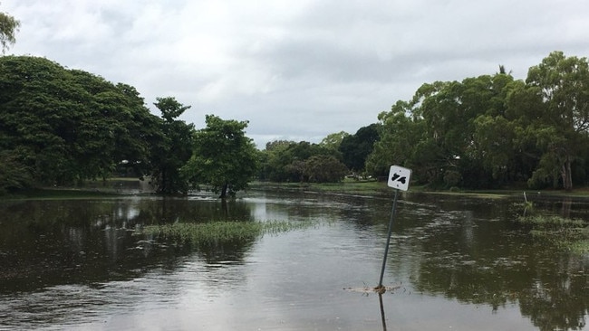
More than 40mm of rain fell on Townsville in two hours on Wednesday morning after 100mm drenched the region earlier this week.
According to the Bureau of Meteorology, 43.6mm fell between 5.48am and 8am at the Townsville Aerodrome weather station.
Vision of the morning downpour was captured and shared on the Townsville Storms Facebook page, with page operators warning followers to drive safely and turn on their headlights.
Followers also reported thunder in suburbs including Pimlico, Mysterton, Garbutt and Nellie Bay on Magnetic Island.
The morning drenching follows wild storms on Monday night which brought more than 100mm of rain to the city.
The BOM is predicting Townsville’s maximum temperature to remain at 32 degrees daily until Tuesday.
Apart from a few potential showers later today, no significant bursts of rain are expected until Tuesday, with the BOM predicting a shower or two and 2mm-20mm to fall.
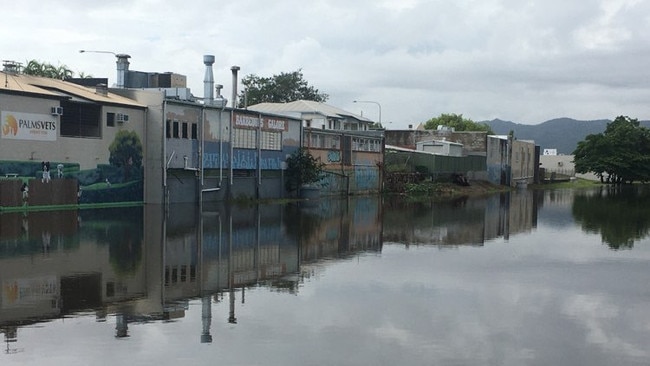
The wet and wild weather disrupted drives to work and caused flash flooding around the region as two days of storms broke over the city.
Rain fell from Kelso to the Townsville City CBD early this morning as residents woke to the sound of thunder.
One woman said she saw Da gum tree split on her way to work, while other homes and businesses woke to find flood water had rushed into their workspaces and yards.
Townsville based businessman Clynton Hawks shared a video of a work shed, filled with materials, that had been flooded overnight.
A spokesman for the Bureau of Meteorology said that while the rainfall and storm conditions on Monday night had necessitated a warning, the rainfall on Wednesday morning had been less severe, thanks to how the weather had formed.
“We use a range of criteria to determine when a warning is needed. First hand reports of significant hail, rainfall, winds are sometimes used.
“You can see the rates intensify on Monday as that trough moved through. It was initially moving northward and then moved across the Herbert and Lower Burdekin region, before heading out off-shore.
“That’s when we saw that increased heat, and then it swung back inland, thankfully there was no severe criteria measured on that Wednesday morning rainfall as it moved back inland.”
More Coverage


Originally published as Storms, floods lash Townsville as residents wake to thunder

Kids play centre returning to NQ in booming suburb
Townsville parents will soon have another entertainment option for the kids at a fast-growing activity hub.

200 riders cycle through NQ for cancer
Tour de Cure made its Townsville stop with 200 riders and support crew travelling through to fundraise money for cancer.