
Major levees in Renmark deemed ‘not fit for purpose’ ahead of 50-year high water levels
Authorities have deemed two levees in Renmark ‘not fit for purpose’ as Riverland prepares for highest flows in 50 years.
SA News
Don't miss out on the headlines from SA News. Followed categories will be added to My News.
Two major levees in the Riverland have been deemed “not fit for purpose”, as the region prepares for once in 50-year water levels.
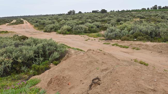
Engineers and flood planners inspected the Hospital Bank and Hale St levees in Renmark on Thursday and concluded the banks were heavily eroded and could collapse if called into action.
Manager of water delivery Chrissie Bloss said repairing the levees is a priority.
“One of the things that can be done with levees is reinforcing them with good quality compacted soil,” she told ABC Radio Adelaide.
“We’re not at that point yet, we will do some more investigations and analysis, looking at the crest heights and how the water level will tip against them.”
The levees in question have a capacity of 130GL to 150GL and restoration could commence within weeks.
SASES chief officer Chris Beattie will be meeting with council representatives and stakeholders in the region later on Friday to carry out further inspections.
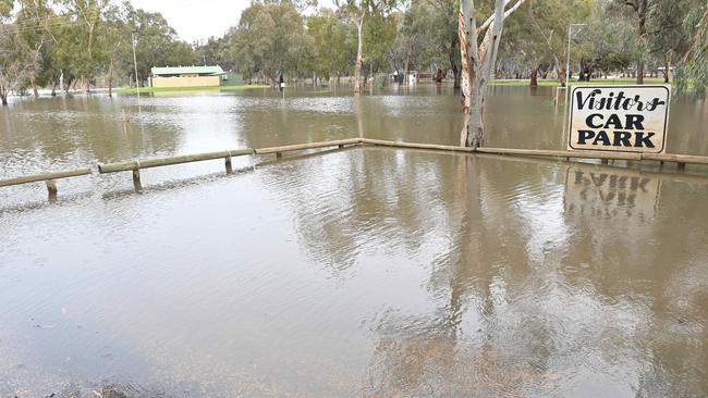
It comes as once in 50-year water levels are not expected to result in a “major flooding event”.
On Wednesday, the Environment Department revised their forecasting, now predicting 120 GL of water to start flowing through the Riverland per day from early December – the equivalent of 48,000 Olympic-sized pools.
However, Environment and Water Minister Susan Close has provided a glimmer of hope for worried Murrayland residents, saying the region will not be impacted like neighbouring states.
“We are not talking about a major flooding event,” she told ABC Radio Adelaide.
“We’re talking about existing low-lying shack areas, some low-lying roads, but we’re not talking about major infrastructure centre of town.”
Ms Close warned the forecast could be revised, but South Australia has time to prepare.
“People should certainly be preparing for high water levels … but water comes predictably over the border so we are able to plan,” she said.
“Even if the forecast is revised, the advice is it will still take a number of weeks to reach here.”
Ms Close said the department was responding to forecasts as they’re coming through.
“It’s quite a complex process, so the Murray Darling Basin Authority is very involved, as well as the Bureau of Meteorology,” she said.
“We find out what’s happening with the weather and we find out what’s happening with the management of the river and then we were able to assess what’s likely to come over the border and what we need to do about that.”
SASES will transport 70,000 empty sandbags and 50 tons of sand to the Riverland on Friday.
Mr Beattie said sandbags played an important role in assisting residents to prepare for flooding and to minimise potential impact to their properties.
“Additional bags and sand are a next step following the increased forecasts of floodwater crossing the border into South Australia from around 80,000 megalitres a day to 120,000 by early December,” he said.
“This will allow people the time to prepare themselves and properties well in advance of the expected increase of floodwaters.’’
About 40,000 sandbags will be delivered to the Loxton Unit followed by 10,000 bags to the Morgan Sporting Complex, including a large delivery of sand.
It follows the delivery of 20,000 sandbags to the Blanchetown Unit on Wednesday afternoon.
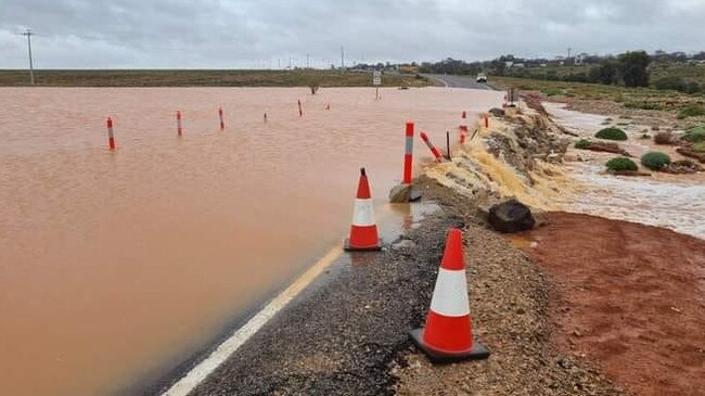
Further north, roads have reopened following flooding throughout the Flinders and Southern Pastoral districts, but with more heavy rainfall on the way, there are fears the worst is yet to come.
Thunderstorms lashed the region, with 50 to 75mm falling on some areas on Wednesday.
The severe weather event had caused flash flooding, triggering the closure of several roads, including a portion of the Olympic Highway near Woomera.
The Department for Infrastructure and Transport announced the highway had partially reopened Wednesday evening.
A flood watch remains in place for parts of the region ahead of more rain forecasted throughout the rest of the week.
More Coverage

Originally published as Major levees in Renmark deemed ‘not fit for purpose’ ahead of 50-year high water levels
Join the conversation

Supercars star revs PM’s Spelling Bee
Racing legend Mark ‘Frosty’ Winterbottom spells out the secret to his success as the father of three encourages Aussie kids to turbo charge their literacy skills in the PM’s Spelling Bee.
Read more

‘I said goodbye seven times’: Mother’s fears for her daughter
Theresa Tucker has said goodbye to her chronically ill daughter Hannah seven heartbreaking times, never knowing if she would live or die.
Read more