
Severe heatwave continues in central and southern NT this week with temperatures reaching 45C
The Bureau of Meteorology is keeping an eye on the path of ex Tropical Cyclone Jasper as it moves towards the Top End, as temperatures set to soar up to 45C across central and southern NT.

Ex-Tropical Cyclone Jasper is expected to move across the southern Gulf of Carpentaria on Sunday morning, progressing towards the Top End early next week.
A spokesperson from the Bureau of Meteorology said there was a “low chance of it redeveloping into a Tropical Cyclone over the next few days.”
“On Wednesday, there is a moderate (25 per cent) chance of redevelopment, however, there is still large uncertainty around both its movement and strength,” they said.
“The Bureau is closely monitoring the situation and will continue to issue information on our website: Tropical Cyclone 7 Day forecast.”
Once the low moves into the Gulf of Carpentaria BOM senior meteorologist Angus Hines there were a number of different paths it could take.
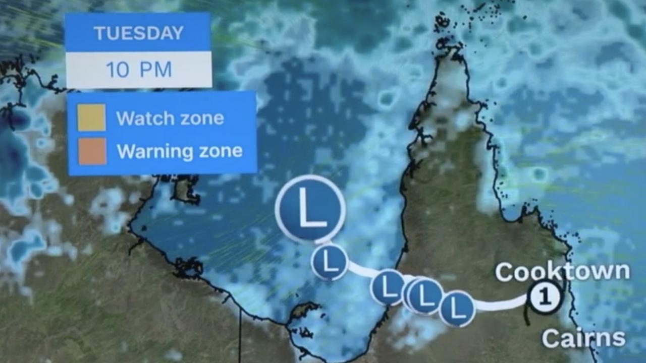
“It’s likely to meander over the Gulf as a tropical low pressure system,” he said.
“We do see a slight northward tilt to the track and as we move into the second half of the coming week we do expect to see the remnants of Tropical Cyclone Jasper moving slowly north.”
Mr Hines said the risk of reintensification would increase as the week progresses.
“We have a moderate chance of Jasper will turn back into a Tropical Cyclone through Wednesday until Friday,” he said.
“It may affect parts of the Top End of the NT or it could even double back and affect far North Queensland.
“All residents in Northern Australia advised to keep half an eye on the forecast and see how Tropical Cyclone Jasper evolves.”

Meanwhile severe heatwave conditions will continue across central and southern parts of the NT into next week with temperatures soaring up to 45C over the next few days.
A weak cool change will move across southern NT on Tuesday, bringing temperatures down to the mid 30Cs.
Isolated thunderstorms will also develop across Central Australia from Monday and showers and thunderstorms are expected to continue in the Top End this week.
In the event these thunderstorms are severe, damaging wind gusts are likely to affect Darwin Harbour and coastal waters.
More Coverage


Originally published as Severe heatwave continues in central and southern NT this week with temperatures reaching 45C

