
Queensland weather: 500km+ stretch in firing line for more severe storms
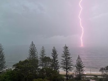
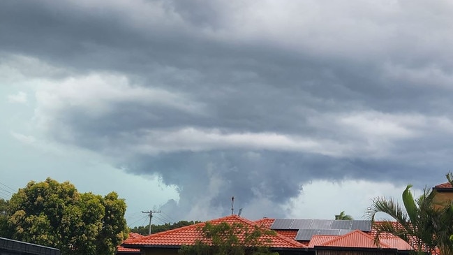
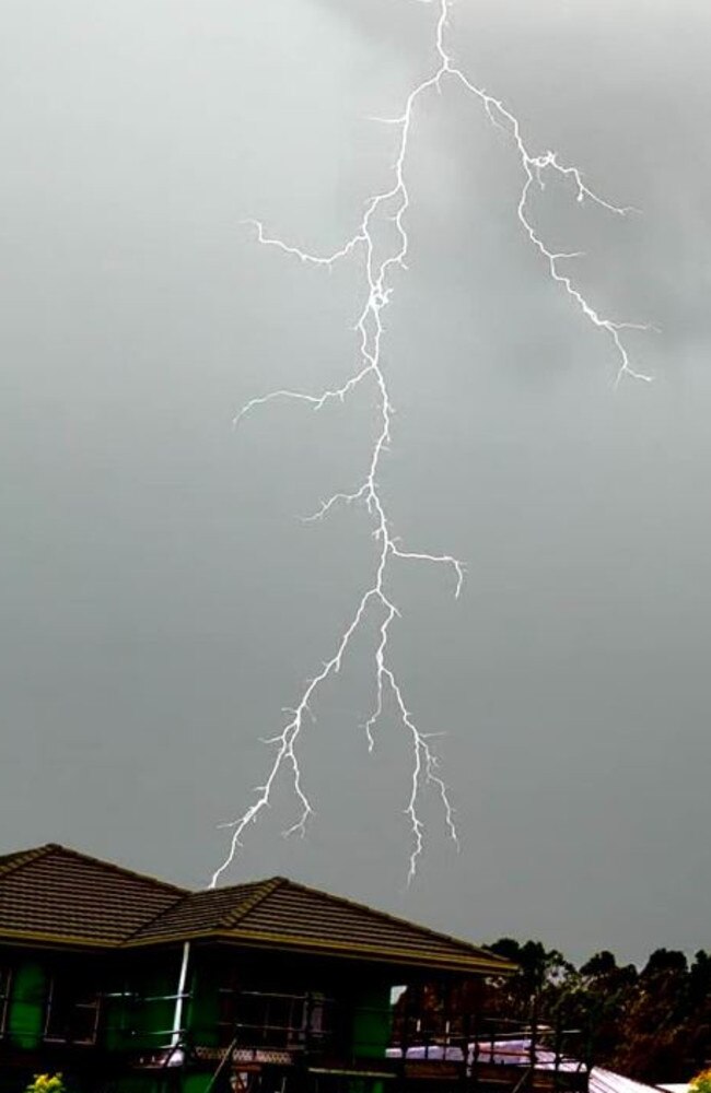
The Gold Coast was under assault from storms again on New Year’s Eve, with the Bureau of Meteorology warning of a “very dangerous” thunderstorm. LATEST UPDATES
QLD News
Don't miss out on the headlines from QLD News. Followed categories will be added to My News.
The Gold Coast was under assault from storms again on New Year’s Eve, with the Bureau of Meteorology warning of a “very dangerous” thunderstorm bringing intense rainfall that may lead to life-threatening flash flooding.
The slow-moving storm was detected at Little Nerang Dam and Tallebudgera about 7.55pm, and was forecast to affect Mudgeeraba, Canungra and Nerang by 8.25pm and Coolangatta, Miami and Mount Tamborine by 8.55pm.
The bureau said that in the 30 minutes to 7.45pm, 76mm of rainfall was recorded at Upper Springbrook and 63.2mm at Lower Springbrook.
The storm had passed by about 10.30pm, when the bureau cancelled its warning.
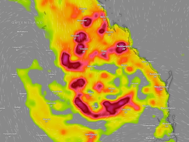
Severe storm warnings remained in place throughout regional Queensland, including the Central Coast and Whitsundays, Central Highlands and Coalfields districts.
Locations which may be affected include Mackay, Collinsville, Sarina and Eungella.
Dysart received 88.8mm in 30 minutes late on Sunday afternoon, while Peak Downs received 73mm in an hour and Bony Mountain 64mm in an hour
There were also warnings for parts of the Maranoa and Warrego and Darling Downs and Granite Belt districts.
Hottest day on record as 1000km ‘wave of storms’ brings carnage
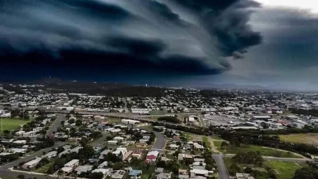
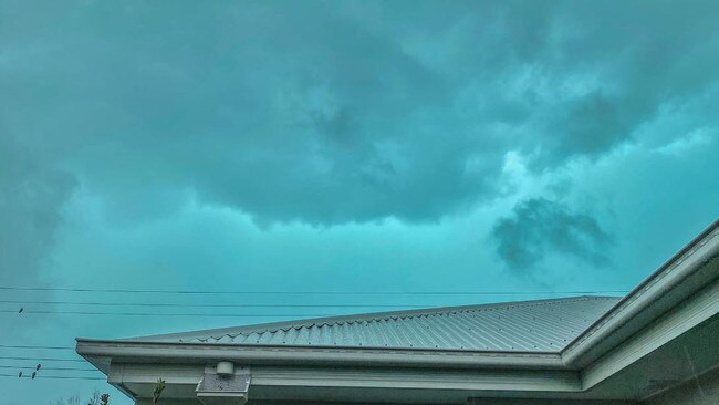
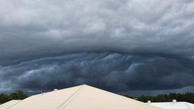
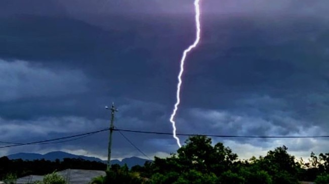
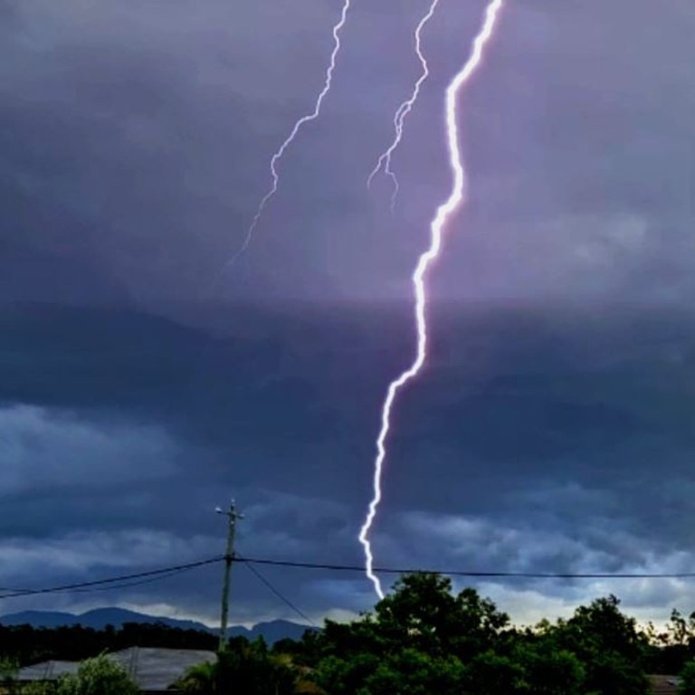
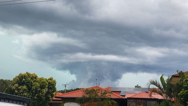
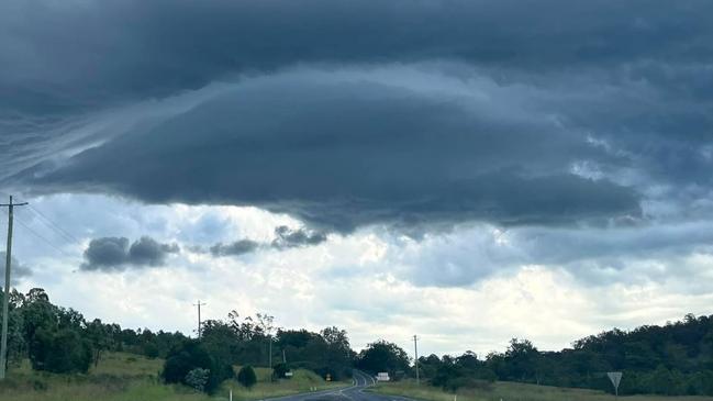
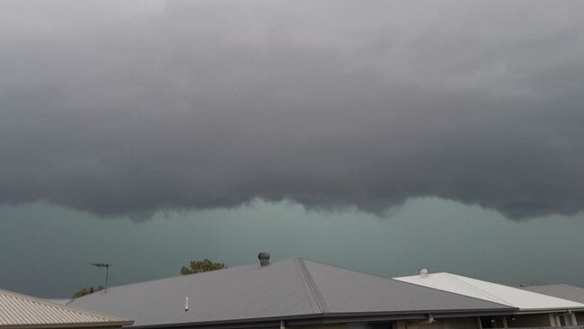
An outback Queensland town is believed to have recorded its hottest day in history on Saturday, as ferocious storms travelled 1000km across the state with roofs reportedly torn from houses amid giant hail, flash flooding and vehicles struck by lightning.
More than 40 of Telstra’s mobile base stations across Queensland are off the air with coverage to be impacted into 2024 following days of severe thunderstorm activity. More storms are forecast for Sunday.
It comes after a hot and stormy Saturday. Winton, in the state’s central west region, hit 47.2C on Saturday, surpassing the previous record of 46.9C from December 2006.
The area has recorded temperature readings since the 1800s. Bureau of Meteorology forecaster Steve Hadley said Saturday’s new high was likely a record temperature for the area seeing as it has kept readings for so long.
The likes of Longreach, Julia Creek, Mt Isa and Cloncurry all sweated through extreme heatwaves with temperatures of around 45C, he said.
A Telstra spokesman said customers in Brisbane, the Gold Coast and now in Central Queensland could be impacted from mobile coverage and capacity issues as more than 40 mobile base stations remain off the air.
The impacted sites include: Baralaba, Baroondah, Bauhinia, Beechmont, Biloela, Bluff, Cedar Grove, Coombabah, Dingo, Duaringa, Durramboi, Fortitude Valley, Gilston, Gogango, Kalapa, Lamington National Park, Mothar Mountain, Mount Tamborine, Mundoolun, Ogmore, Oxenford, Redbank Plains, Stony Creek, Tallebudgera, Tamborine, Tamborine Mountain, Undullah, Wallaroo, Westwood, Whiteside, Willows, Wongawallan, Woodgate, Woorabinda and Zillmere.
A Telstra spokesman said it was unlikely that all of the sites would be back running for New Year’s Eve celebrations Sunday night.
“We know how important mobile communications is, and getting mobile base stations back on air and people connected is our first priority,” the spokesman said.
“However, it is unlikely that we will be able to get all these sites back running again before tonight, so we urge people to check their connectivity when they arrive at their New Year’s Eve destinations in these areas.
“In most places payphones will still be working, so if you get stuck, look for a phone box to be able to make that call to a taxi for when it is time to go home.“
The spokesman said Telstra was working with local power authorities to gain more understanding of what restoration works were required.
“We have been fortunate that our sites haven’t suffered any major storm damage, so we expect once we get the electricity flowing again, mobile coverage should be restored,” he said.
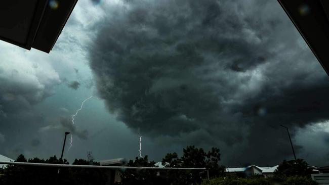
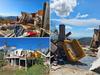
It came as houses reportedly lost roofs in wind gusts of up to 117km/h, amid giant hail, flash flooding and two vehicles struck by lightning in a day of wild weather that saw storms travel more than 1000km across the state.
Storms were reported from Tweed Heads, just over the NSW border, all the way to Mackay on Saturday.
As of 9.30pm, storms were still raging in the Whitsundays region and a new front had developed near Roma.
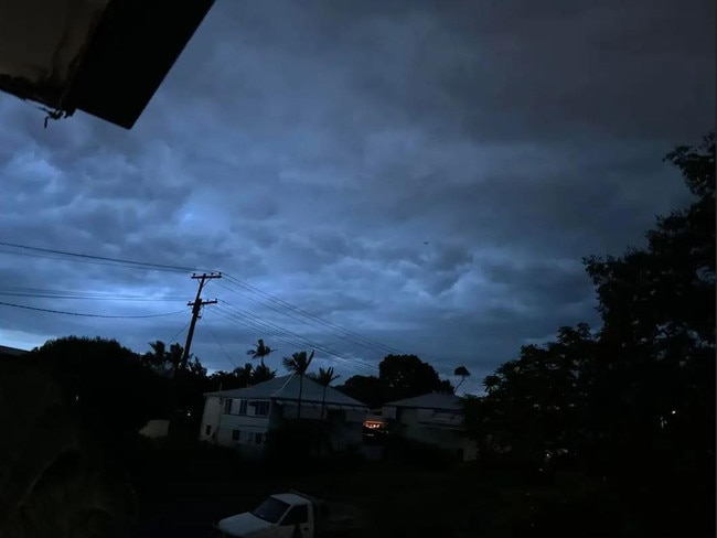
The warnings were cancelled overnight but Central Queensland was once again in the firing line for the threat of severe thunderstorms in the final hours of 2023.
“It’s a bit of a quiet period at the moment, the storms died away overnight but as the heat of the day develops the watch point is there for the afternoon and evening,” Mr Hadley said Sunday morning.
“As the trough shifts further north, severe storms could hit Charters Towers, Emerald, Moranbah and Blackwater again.
“It could have the threat of giant hail, damaging winds and intense rain that poses a flash flooding risk into the evening.”
Mr Hadley said the focus for the south east was showers with a chance of thunderstorms.
“We aren’t expecting to see severe storms for the big cities.”
A Queensland Fire and Emergency Services spokeswoman said authorities responded to more than 100 calls for assistance on Saturday.
The Gold Coast, which has been ground zero following days of severe thunderstorms, was largely spared on Saturday, however the region remains in recovery mode while thousands of residents are now days without power.
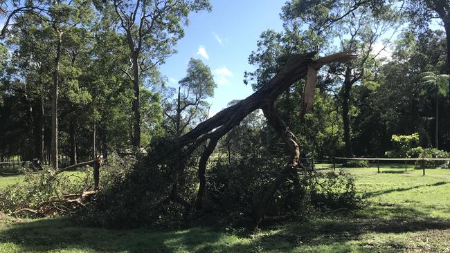
The spokeswoman said the majority of Saturday’s calls were in the Brisbane and the north coast regions in response to fallen trees and structural damages to properties.
Since 6pm on Christmas Day, crews have responded to more than 3000 requests for help with investigators having determined four houses have been “completely destroyed” and more than 750 sustained minor or severe damages, she said.
More than 21,000 residents across the South East remained without power on Sunday morning, with the worst impacted suburbs being Tamborine Mountain with 3500, Jimboomba with 1500, Maudsland with 1400 and Coombabah with 1400.
Several suburbs in the Logan and Sunshine Coast hinterland regions are also experiencing outages, according to Energex.
WIDESPREAD DAMAGE AS WILD WINDS, HAIL HIT STATE
A vehicle was struck by lightning as it was travelling on the Bruce Hwy at Burpengary around 9.20am Saturday. The male driver was taken to Caboolture Hospital in a stable condition.
Meanwhile, a man was taken to Sunshine Coast University Hospital with minor injuries after the excavator he was on was struck by lightning at a private address at 11.15am at Eudlo.
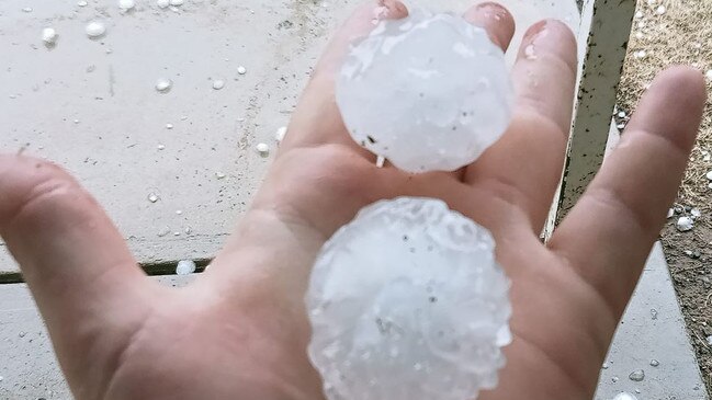
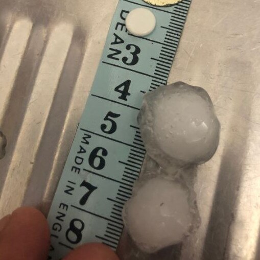
Giant hail fell in a number of centres, including 6cm stones in Chinchilla about 12.30pm, 4-5cm stones in Amby, near Mitchell, about 3pm and in Tara about 10am.
Minor flooding occurred on the Bruce Hwy northbound at Burpengary, which left traffic at a standstill. Beerburrum recorded 110mm in two hours to 11am, Landsborough recorded 67mm in half an hour to 11.15am, while Wamuran in the Moreton Bay region recorded 66mm in an hour to 9.19am.
Cedar Pocket Dam measured 64mm in the hour to 1.05pm, Eerwah Vale got 55mm in the half-hour to 12pm and Old Rnage Road got 51mm in the 30 minutes to 3.30pm.
There were also wind gusts of 93km/h recorded in Gympie around noon and a winds of 117km/h recorded at Blackwater Airport just before 6pm.
One Blackwater resident took to social media on Saturday evening to ask for urgent help to save her belongings after the roof was ripped off her house.
On the Sunshine Coast, a Valdora local on Sunday said she was “in shock” and felt “completely overwhelmed” by the clean-up job in front of them.
She said she believed the storm hit their property after 12pm Saturday.
“We were sitting on the porch watching the storm when it took a real turn for the worse,” she said.
“Over the back valley we saw a massive lightning strike and then sparks fly everywhere as it hit something.
“There’s powerlines down, fences down, trees down, branches everywhere.
“My husband’s got the chainsaw out for the fallen trees but it’s going to take us well over a week to clean it all up.”
SEVERE STORM WARNING: 800KM DANGER ZONE
Sunshine Coast train lines were delayed up to 30 minutes due to multiple signalling issues caused by the storms and rower outages are impacting 1133 properties across the Moreton Bay region. There were also 3759 power outages across Brisbane and the Sunshine Coast.
Overhead powerlines were down at Cooroy, forcing the Gympie North to Northgate train to be cancelled between the Gympie North and Nambour stations.
Queensland Police confirmed flash flooding was impacting roads across the Sunshine Coast, with the worst impacted including Beerburrum Rd and Steve Irwin Way.

Police said trees and power lines were down at Landsborough on Beach Rd, Calderwood Rd, and Gattera Rd.
One local driving from the Gold Coast to Kawana this morning said it was “scary on the roads”.
“I thought I was going to get electrocuted,” she said.
“The lightning was so close and everywhere.
“Too dangerous to be out there until the storm passes. Fallen trees and power lines everywhere.”
There has been heavy rain from Caloundra to Kawana from about 11am onwards this morning, along with strong winds, lightning, and ongoing thunder.
SES responded to 16 call-outs related to the storms on the Sunshine Coast since on Saturday.
A QFES spokeswoman said 12 of those were in regards to trees fallen onto roads, and two were for structural damage (such as leaking roofs). There was minor storm damage at Eudlo, near where a man was struck by lightning earlier this morning.
Staff at the Eudlo General store said the storm had mostly passed but they had witnessed significant winds, thunder, lightning and rainfall.
They said they believed a lot of the small hinterland town had lost power.
With multiple power lines down, and water across roads locals have been advised to avoid Landsborough in case they become trapped.
While the Sunshine Coast copped the worst hail, a severe system also impacted Gympie, Woolooga and Glenwood.
At Gympie, small hail has been reported on the town’s outskirts while trees have been downed and one is blocking Groundwater Road at Southside.
In the South Burnett, another severe storm is over Nanango where power is out.
At Rainbow Beach, “pebble” sized hail was reported but the damage was minimal compared to the Sunshine Coast further south.
Amid the heavy rain, traffic was delayed for more than two hours after a two-car crash 6km west of Rainbow Beach on the road to Gympie.
Three patients were taken to hospital in a stable condition.
Further inland at Woolooga west of Gympie, Petersen’s Farm, the home of the Rosella Festival, which notoriously copped tens of thousands worth of hail and flooding damage three times in 12 months was spared the worst of Saturday’s storm as it was on Boxing Day.
Part owner CC Diaz Petersen said she was still keeping an eye out in case another round hit over the weekend.
In the nearby South Burnett town of Coverty, emergency services were called to a two-car crash on Proston Boondooma Rd about 1.10pm. One of the cars had rolled.
Two patients were taken to Kingaroy hospital in a stable condition.
SEVERE STORMS FOLLOW HEATWAVE
It comes as parts of South East Queensland have sweltered overnight and into Saturday morning with temperatures in the high 20s and tropical-like humidity.
At 7am Saturday, Brisbane felt like 30.5C with the relative humidity a stifling 86 per cent and the dew point sitting at 23C.
It felt even hotter at Beerburrum, which at 7am had an apparent temperature of 34.5C, and on Sunshine Coast, which feels like 32.2C, while Queensland’s hottest place is Julia Creek at 31.4C.
The apparent temperature in Brisbane only dropped below 30C once overnight when it dipped to 29.5C at 4am, while the relative humidity peaked at a staggering 90 per cent at 11.30am.
It would have been an uncomfortable night for many with the actual temperature sitting above 25C all night.
The highest temperature recorded in Brisbane on Friday was 38.3C while Birdsville was the hottest town in the state at 46C.
More Coverage

Originally published as Queensland weather: 500km+ stretch in firing line for more severe storms

ICED OUT: Why cocaine is new king of meth-scarred cities
Meth’s decade-long reign of Queensland’s drug scene is over as experts warn white powder power is rising in its place. MAPPED HOTSPOTS, DRUG CRIMS NAMED
Read more

Young man dies after six-vehicle crash
A young man from Logan has died after a crash involving two trucks in Brisbane’s east on Tuesday afternoon.
Read more