
Qld weather: Storms, intense rainfall possible for South East
Parts of Queensland could cop as much as 50mm of rain a day as a weather system moves north into the state, with school holiday campers warned to be alert to “challenging” conditions.

QLD News
Don't miss out on the headlines from QLD News. Followed categories will be added to My News.
Parts of Queensland could cop as much as 50mm of rain a day as a weather system moves north into the state, with school holiday campers warned to keep an eye on the forecast.
Sky News Australia meteorologist Rob Sharpe is warning that an east coast low could form on the northern NSW coast, bringing wild weather with it.
“Widespread rain totals of 30-150mm are likely from southern Queensland (Darling Downs to Brisbane) through northern and central NSW (out to the central west) and down the NSW south coast,” Mr Sharpe said.
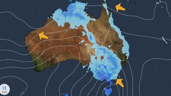
“There is potential for totals as high as 200mm, producing plenty of localised flash flooding.
“River flooding should mostly be minor because the river systems aren’t saturated, and the system will move relatively quickly.”
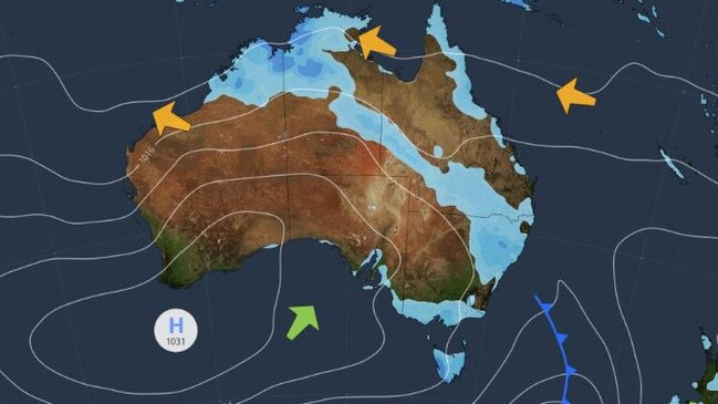
Morgan Pumpa, from the Bureau of Meteorology, said a trough was expected to move into the southeast by Wednesday, with storms possible.
“We do have a chance of some showers (on Tuesday), not as much as what we’re seeing over the upcoming days,” Ms Pumpa said.
“So we do start to see the chance of a thunderstorm from tomorrow, in the late morning and then Thursday and Friday … it’s a bit early to say whether or not those showers will continue into the weekend.
“As we get towards the end of the week, even on Thursday, the inland parts will get that little bit more. So we do see that even inland, west of Toowoomba, will be getting more than what we’re seeing along the coast.
“But then as we get towards Friday it does seem like that focus shifts a little bit more to the coastal area.”
Ms Pumpa said the trough heading towards the southeast is moving out of Victoria.
“It has been over Victoria over the last 24 hours or so. That is from the subtropical moisture from Central Australia. So we are seeing the remnants from ex-Tropical Cyclone Megan … where we did see some significant rainfall totals,” Ms Pumpa said.
“That’s why we get some of those higher totals including Goondiwindi with 15-60mm on Thursday, and then the Gold Coast with the 6-30mm.”
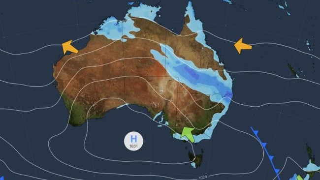
Ms Pumpa said the Bureau was monitoring an additional system moving towards South East Queensland and New South Wales.
“We will be monitoring how it deepens,” she said of the system, which is dropping significant and for the most part, with the system, which is still seeing some rather significant totals, including the central parts of the New South Wales coastline,” Ms Pumpa said.
“So it is a watch point at the moment.”
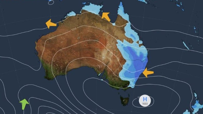
“We’re still looking at some rather high totals and wet conditions especially for people who are enjoying the school holidays, especially if you’re out camping around the Darling Downs and Granite Belts,” Ms Pumpa said.
“It is going to be quite challenging to be driving in, and challenging if you’re out camping or you’ve got people visiting.
“I recommend people to look at their forecasts and monitor the radar as we get towards especially Thursday, but starting from tomorrow and into the weekend.”
Originally published as Qld weather: Storms, intense rainfall possible for South East
‘A 20-tonne gum tree fell on our home because council, body corp did nothing’
A Brisbane family has been forced to couch surf after a 32-metre tall gum tree crashed through the roof “like a freight train” after a bitter five-year dispute over who owned the tree.

‘Go away’: Miles savaged over timing of Premier tirade
Steven Miles’ attack on Premier David Crisafulli over his handling of the ongoing wild weather impacting North Queensland has divided opinion. HAVE YOUR SAY