
Qld weather: Man dead after car inundated in floodwaters at Greenbank amid South East drenching
A man has died after his vehicle was found in floodwaters south of Brisbane after a 150mm deluge in the past 24 hours, with a major flood warning in place and road closures in parts of the South East.
QLD News
Don't miss out on the headlines from QLD News. Followed categories will be added to My News.
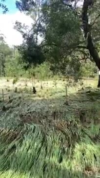
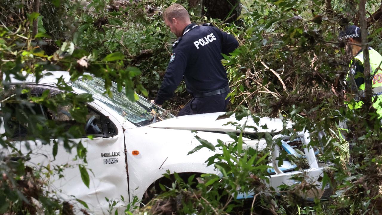
A 71-year-old man has died after his vehicle was found in floodwaters at Greenbank early on Thursday.
Police were called to conduct a welfare check of the car at a private property on Begley Rd about 5.20am. The man was found near the car.
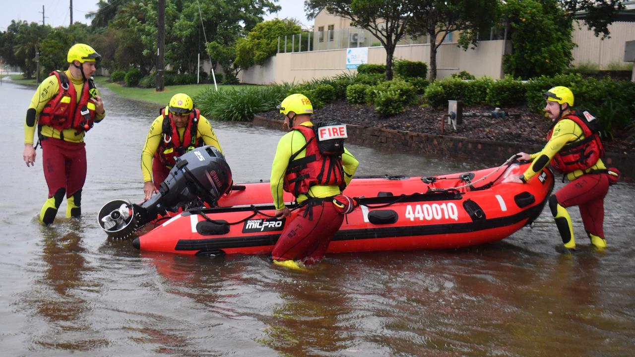
A number of other people had to be rescued in an incident in the same area.
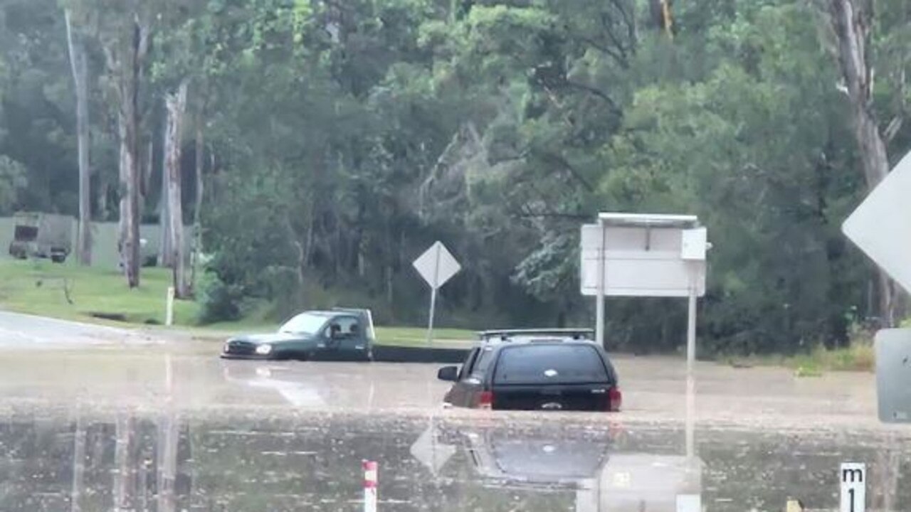
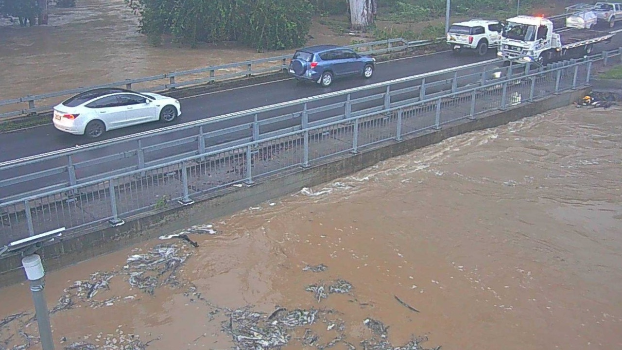
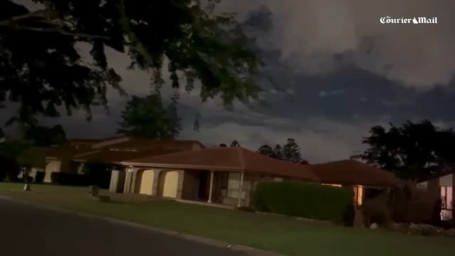
Areas south of Brisbane were the epicentre of huge falls and flash flooding overnight as a slow-moving storm dumped in excess of 100mm in an hour in some places, including 153mm at Greenbank.
“There was a very active cell that was slow moving, which caused over 153mm of rain in Green Bank,” Daniel Hayes, a senior meteorologist at BOM said this morning.
“The rain pretty much came down in two hours, so it was quite intense.”
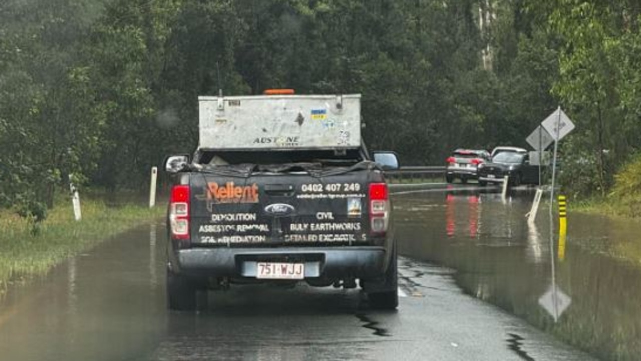
The SES was called out to a number of homes south of Brisbane in the aftermath of the storm and major roads were closed.
New Beith Rd at Greenbank was closed as floodwaters rose about 2am, with motorists forced to take refuge in a service station.

The biggest rainfall totals included 153mm at Greenbank, 153mm at Jingle Downs – including 108mm in an hour to 9.09pm, 110mm at Coulson, 87mm in an hour at Springfield Lakes, 77.8mm in two hours at Lyons, 71mm in two hours at Kalbar, and 81mm in an hour at Coulson Crossing.
The Bureau of Meteorology has issued an initial Major Flood Warning for the Bremer River and Warrill Creek, with waters continuing to rise on Thursday morning.
SES crews were called to six homes in Logan and Ipswich overnight, with most jobs were to assist with tarping.
Queensland Police have also closed New Beith Rd at Greenbank where more than a metre of water is over the road.
Mr Hayes said there was the potential for thunderstorms right across the southeast today.
“We’ll see fairly widespread shower activity today and we could be seeing 20 to 40 or even 50 millimetres out of that thunderstorm activity. It could take it into that 50 to 100 millimetre range again but those heavier falls are likely to be more isolated.”
A severe thunderstorm warning for parts of the Central West, Maranoa and Warrego districts has been updated.
The bureau warns that thunderstorms that are likely to carry heavy rain that may lead to flash flooding may occur in the warning area in coming hours. Mitchell and Augathella are in the firing line.
Heavy falls were recorded in the area overnight, with 91mm at Old Tambo Rd in the six hours to 8.30am, 78mm at Cooks Tank and 71mm at Augathella.
Mr Hayes said rainfall was expected to ease off early next week.
“It looks like at this stage while the focus will shift down to New South Wales, we will probably still have a trough lingering around the southeast coast area,” Mr Hayes said.
“In particular, we could see some fairly heavy shower activity continuing into the weekend, but probably less so across the northern parts of the southeast.
“So while there’s still likely to be some showers around the Brisbane area, and up to the Sunshine Coast area, we’re probably less likely to see the bigger falls and not so much thunderstorm activity.”

On the man’s death, Jordan MP Charis Mullen - whose electorate encompasses Greenbank - said the incident was devastating.
“Very sad news for our community this morning,” Ms Mullen wrote to social media.
“My deepest condolences to his family and loved ones.”
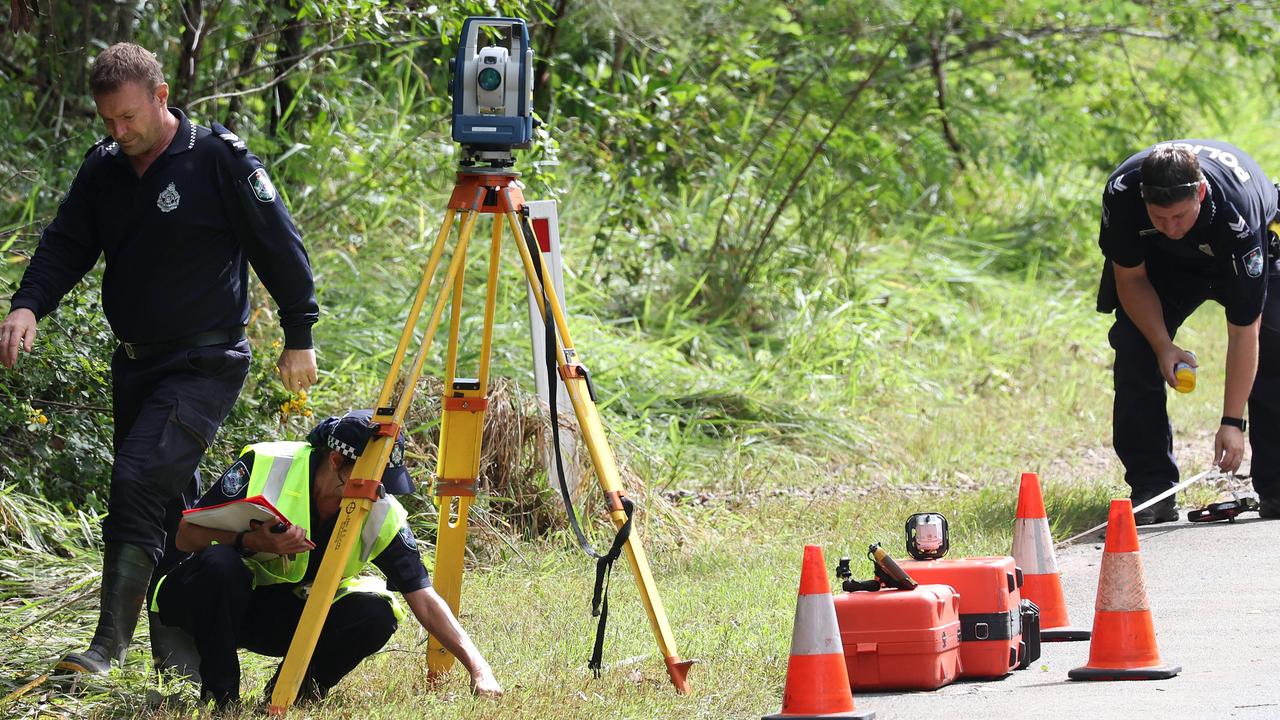
Queensland Police Acting Commissioner Steve Gollschewski described the death as “tragic”.
Acting Commissioner Gollschewski said investigations were ongoing.
Premier Steven Miles offered his sympathies during a media conference with Mr Gollschewski in Mackay.
Police and Emergency services were also called to do another rescue in the same area after several individuals became trapped by flood water.
“We see this every time people don’t recognise the risk, they don’t assess the risk and they take risks by driving into flood waters or areas that they’re not certain about, sometimes with tragic circumstances,” Mr Gollschewski said.
“The message is clear, if it’s flooded forget it.”
The bureau has also issued minor flood watch alerts for a number of rivers in the southern inland and southwest, including the Condamine, Macintyre, Weir, Moonie, Balonne, Warrego and Paroo rivers and Wallam and Mungallala creeks.
The Bureau of Meteorology’s Harry Clark on Wednesday said Queensland’s southern interior close to the border with New South Wales was already seeing the effects of the trough.
“Inland areas in the southeast could see heavy rainfall from this afternoon into this evening,” Mr Clark said.
“And then as we go into Thursday and Friday, basically the trough … is going to intensify a little bit.
“We could begin to see isolated thunderstorms and heavy rainfall from tomorrow in the southeast.”

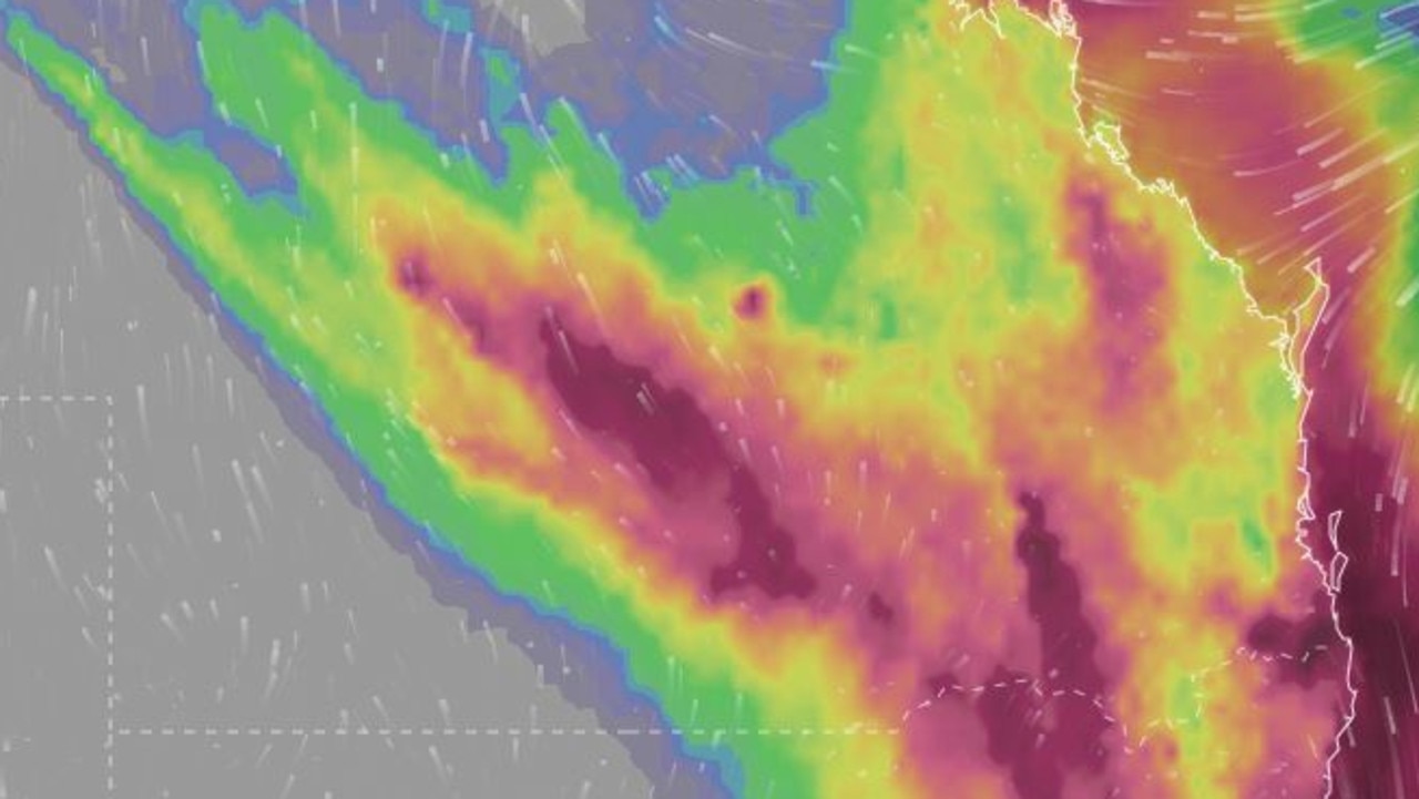
Amateur weather forecaster Dylan McKenna said while widespread falls of 50-150mm were possible for South East Queensland, severe thunderstorms could see some totals exceed 200mm.
Mr McKenna predicted the heaviest falls to occur on the Gold Coast, Beaudesert and communities along the NSW-Queensland border.
“This general area of rain and storms will likely remain slow moving to near-stationary, eventually becoming an area of near-stationary rain and embedded heavy falls early Thursday morning over southern South East Queensland, northern NSW and the Darling Downs and Granite Belt, including areas as far north as Brisbane,” he said.
“This rainfall will likely continue and even intensify throughout Thursday, Friday and into Saturday with rain areas and embedded severe storms containing heavy rainfall sitting near stationary over the region.
“We can expect some quite significant rainfall accumulations due to this.”

Originally published as Qld weather: Man dead after car inundated in floodwaters at Greenbank amid South East drenching
Join the conversation
500mm more to come: Fresh flood threat as NQ cops almighty drenching
North Queensland residents have been warned to expect severe and life-threatening flooding over coming days following a deluge that inundated homes, cars and streets. LATEST FORECAST
Read more

‘Sorry David, young criminals still rule the streets of Queensland’
Queensland’s adult crime adult time laws continue to divide many, particularly after two teens were granted bail. HAVE YOUR SAY
Read more