
Cyclone Oma, king tides to bring erosion and strong swell to coast
Forecasters are warning that a double-whammy of a tropical cyclone and 2019’s highest tides could cause inundation in Queensland’s southeast.
QLD News
Don't miss out on the headlines from QLD News. Followed categories will be added to My News.
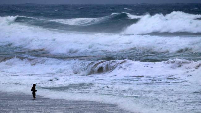
A DOUBLE whammy of cyclonic conditions and a king tide could cause mass erosion along the Queensland coast later this week.
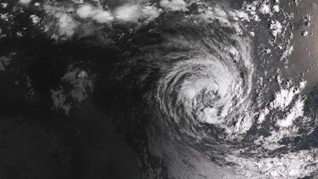
Tropical Cyclone Oma is sitting 1600km northeast of Brisbane as a category two storm and is expected to whip up damaging surf on beaches.
The Bureau of Meteorology this morning issued a dangerous surf warning stretching from the Capricornia Coast to the Gold Coast, with forecasters not ruling out the chance of dangerous four-metre waves.
Dangerous conditions for rock fishers, boaties and swimmers will intensify tomorrow as Oma moves closer to the Queensland coast, sideswiping New Caledonia.
Meteorologist Lachlan Stoney from the Bureau of Meteorology said swimmers would likely already be noticing the tropical cyclone’s presence.
“I think it’s fair to say that Oma is already enhancing the swell,” Mr Stoney said.
“From about from late Tuesday, things will potentially get hazardous. The worst conditions are from Friday to Sunday.”
Conditions would be made worse from the weekend, when the highest tides of the year are expected.

“From later in the week, there is swell of up to five-metres possible. That swell will be arriving on top of the high tide.”
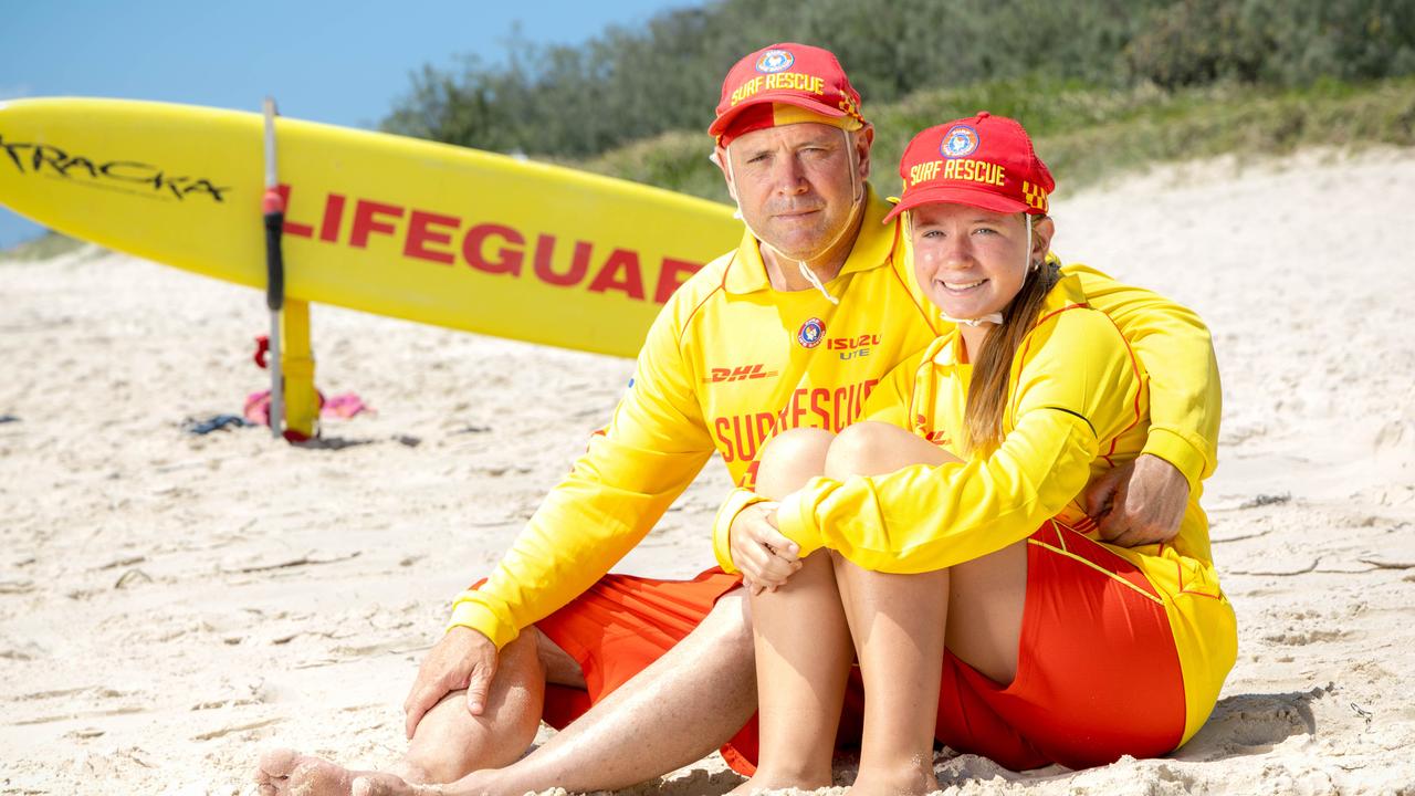
Surf Life Saving Queensland operations coordinator Jason Argent said people who swam in dangerous surf were risking their lives.
“We’re expecting to see swell to pick up from about Wednesday to waves about four-to-six metres in places,” Mr Argent said.
“We’re warning people to stay away from the beaches this week.”
He said most beaches would be closed by tomorrow afternoon, with the possibility of some closing today.
“These conditions are going to be very very powerful, very dangerous, and we are urging people to stay out of the water,” he said.
“It’s going to risk lifesavers’ lives if we have to go out and get you.”
Mr Argent recommended that the public follow advice and updates on conditions from the Bureau of Meteorology website and Surf Lifesaving Queensland’s social media.
He also recommended that people stay off sand dunes, since there was the chance that people could become trapped during erosion events.
Any coastal communities from Fraser Island to the NSW border were warned to expect a high risk of beach erosion and coastal inundation.
But there is little chance of Cyclone Oma making landfall the Queensland coast.

“The most likely chance is that it will stay offshore,” Mr Stoney said.
He said the system was likely to track closer to the coast, before moving westward toward New Zealand.
“In terms of rain, from Friday it’s expected to be quite showery on the coast.”
Boaties would see winds between 33-35 knots along the southern Queensland coast, with sustained winds of 40 to 50km/hr in some coastal communities along the weekend.
Oma is currently a category two storm, which can pack sustained winds of between 89 and 117km/h.
Southeast Queensland will be feeling the heat until the middle of the week, with temperatures rising from a maximum of 31C on Monday, to a top of 35C on Thursday.
Originally published as Cyclone Oma, king tides to bring erosion and strong swell to coast

Watch: Veteran’s heartbreak after pitbull kills loved pet at park
A Qld family is distraught after their jack russell-pomeranian cross was killed by a pitbull which also attacked and left one of them covered in blood at a popular dog park. VIDEO, PHOTOS.
‘It’s Charlize’: Moment ‘broken’ dad learns his daughter was taken by shark
The heartbroken father of 17-year-old Charlize Zmuda who was killed in a fatal Bribie Island shark attack has recounted the harrowing phone call that informed him of the tragedy. WATCH THE VIDEO