
Northern Rivers and Mid North Coast weather: Heavy rainfall and possible flash flooding
Eight schools across Northern NSW remain non-operational while the region remains on high alert following an overnight lashing. It comes after a man was rescued from rising floodwaters. Here’s the latest.
Tweed Heads
Don't miss out on the headlines from Tweed Heads. Followed categories will be added to My News.
Eight schools across Northern NSW have sent children home and remain non-operational after heavy rains cut access routes and inundated some locations.
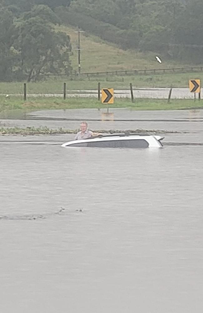
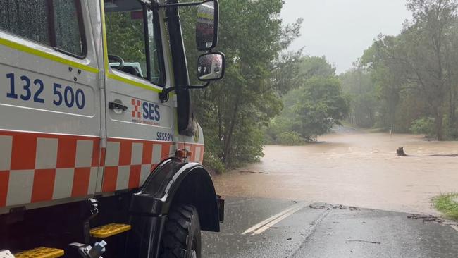
It comes as a man was rescued from the roof of his car by resident Keith Graham in rising floodwaters on Lismore’s Boatharbour Rd, which was shown in dramatic photos shared with NewsLocal.
Currently in the Lismore LGA, Coffee Camp and Corndale public schools remain no-go zones until waters recede.
Baryulgil public school in the Clarence Valley and Orama public school near Bellingen are also out of operation.
Longneck Lagoon Environmental Education Centre, Megalong Public School, North Star Public School, and Tulloona Public School all have stay at home safety alerts in place.
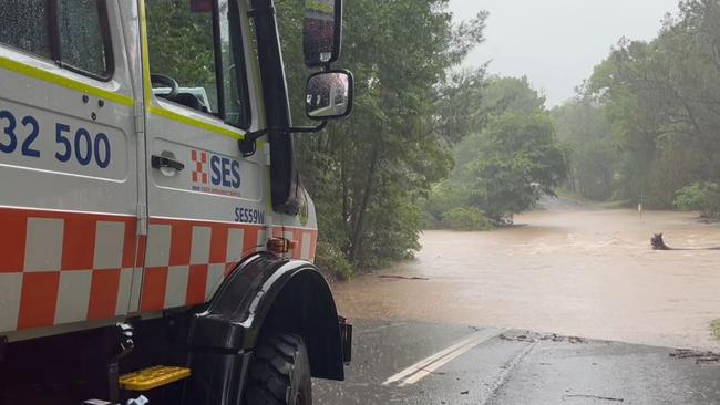
SES Zone Commander, Greg Swindells said on Friday said the largest overnight rainfall occurred at Nashua (80mm), Houghlahans Creek (93mm), and Coopers Shoot (86mm).
“The weather system affecting our area is slowly heading south with some rainfall still forecast for our area.
He said NSW SES and the Bureau are monitoring the situation closely.
“A Flood Watch is still current for Coffs, Tweed and Rous Rivers and the Bellinger River and minor flood warnings are current for the Wilsons River at Lismore, Richmond River at Coraki.”
The Bureau of Meteorology released an update at 10am Friday stating flooding is no longer expected in the Wilsons river at Lismore.
The Wilsons River at Lismore (AHD) peaked at 3.80 metres around 03:00 am Friday April 5, below the minor flood level (4.20 m).
The river level is currently at 3.55 metres and falling.
THURSDAY, APRIL 4, 2023
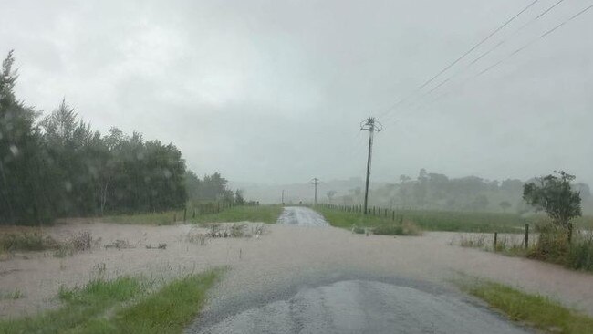
Northern NSW is being warned to prepare for heavy rain over the next 48 hours before the worst of the weather moves south.
Experts say rainfall totals exceeding 100mm are possible over wide areas and isolated totals of up to 200mm may be possible. There is also the threat of flash flooding across the region.
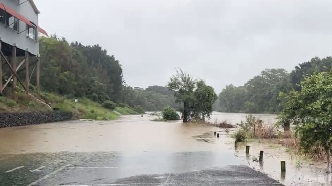
As of 11am on Thursday, Boatharbour Rd just outside Lismore had already been inundated by floodwater.
According to a spokeswoman from the Bureau of Meteorology (BOM), the rain will hit northern NSW the heaviest over the coming days.
“Over the next 48 hours we are looking at really heavy and locally intense rainfall, with the risk of flash flooding and riverine flooding,” she said.
The NSW SES confirmed catchments with a minor flood risk in the region are the Bellinger, Kalang and Nambucca rivers.
On Thursday, April 4, the worst of the downpour is expected to hit the Northern Rivers, with the rainfall intensity picking up overnight.
Locations on high alert include Lismore, Yamba, Grafton and Coffs Harbour, the BOM spokeswoman confirmed.
On Friday, April 5, the heavy rainfall is expected to move south of Grafton, hitting Coffs and the Mid North Coast.
Heavy and intense falls, flash flooding, strong gale force coastal winds and hazardous surf conditions could impact parts of the region.
By then the rain is also predicted to have eased slightly in the Northern Rivers, with Lismore looking at approximately 15 to 25mm of rain, down from approximately 50mm.
NSW SES Assistant Commissioner Sean Kearns has urged the community to stay informed of the conditions in their local areas.
“To stay up to date with current warnings and advice, people should download the Hazards Near Me app and set up a watch zone for their home neighbourhood, or the place they could be visiting,” Assistant Commissioner Kearns said.
“We’re urging the community to prepare ahead of the weather impact, by tying down loose items, moving their cars from underneath trees, clean your gutters, trim branches away from properties and understand what your flash flooding risk may be.
“If you do come across a flooded road, please do not drive, walk or ride through it. Stop, turn around and find an alternate route.”
For emergency help in floods and storms, call the NSW SES on 132 500. In life threatening situations, call triple-0 (000) immediately.
Rain wreaks havoc on wildlife sanctuary
The Byron Bay Wildlife Sanctuary (BBWS) was inundated on Thursday with heavy falls submerging half of the animal shelter within half an hour.
Wildlife carers and staff frantically leapt into action to ensure the safety of their animals.
“We’ve lost vital perimeter fences, endured substantial damage to enclosures, pathways, and buildings, and the threat of more rain looms over us,” A spokesman for the BBWS said.
The Sanctuary remains closed until further notice while the team assess risks and endeavour to restore the sanctuary.
Members have set up a GoFundMe to help get back on their feet.
More Coverage

Originally published as Northern Rivers and Mid North Coast weather: Heavy rainfall and possible flash flooding

Flying, falling and feminism: Hilarious duo redefine womanhood
From trapeze tumbles to feminist triumphs, this “sassy, honest and funny as f--k” duo are fearless post-menopausal cabaret circus performers flipping the script on age, gender – and how to take a wee.
Read more

Legal costs awarded to crash death accused after trial delayed
A man claiming he suffered a covid blackout behind the wheel before the road death of a northern NSW farmer has been awarded legal costs due to ongoing delays ahead of his trial.
Read more