
Severe weather warnings as big surf batters NSW coastline
The state’s coastline has been battered by huge swells while our mountain peaks have been sprinkled with snow as NSW experiences a cold snap.
NSW
Don't miss out on the headlines from NSW. Followed categories will be added to My News.
The state’s coastline has been battered by huge swells while our mountain peaks have been sprinkled with snow as NSW experiences a cold snap.
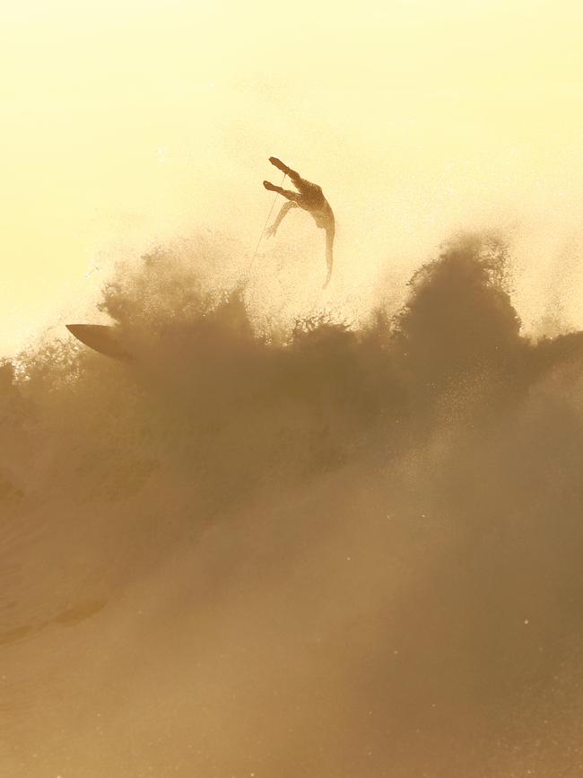
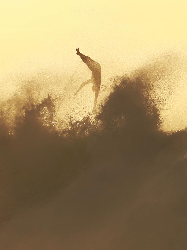
Brave boardriders took the water around Sydney with some surfers snapped riding the waves in Bronte yesterday.
The heavy walls of water forced the Bureau of Meteorology to issue severe weather warnings for The Hunter, Illawarra, Sydney and south coast regions.
Meteorologist Helen Reid said the swell will be back to normal size by tomorrow.
“We have a deep low-pressure system sitting over the southern Tasman Sea. The low-pressure system means that there is an increased wind strength. The wind energy is then transferred into the swell which builds as it travels towards the coast,” she said.
“The Manly Hydraulics Laboratory provides our swell measurements and there have been some huge numbers this morning. At Port Kembla, there is about a 2.5-metre swell while off Sydney’s coast it has gotten up to 3-metres.
“This system is not directly related to the cool temperatures we have had lately. Those will ease off during the week before coming back on the weekend.”
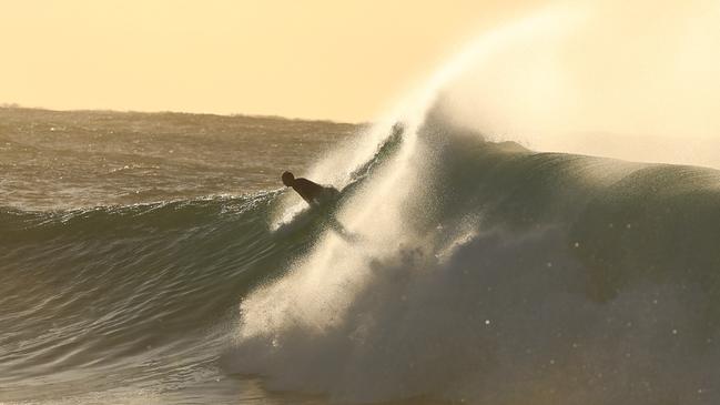
Suited in full-length wetsuits surfers paddled out to the largest breaks on the northern side of the beach.
They were not deterred by the chilly dawn temperatures with the mercury sitting around 12C at sunrise.
The weather will start to turn on Wednesday with a top temperature of 29C expected in Sydney and 27C on Thursday.

The Bureau said in a statement that most parts of NSW were between five and seven degrees below average.
The frosty temperatures have been exacerbated by the wind chill factor which is making it seem even colder.
Another cold front will begin to move over Sydney on Friday with max temperatures dropping back down to 23C.
Meanwhile, the state’s mountains were covered with the first significant snowfall of the season.
The dusting atop the Snowy Mountains will be mostly melted by now after falling on Sunday night however more is expected later in the week.
“The cold front that comes over at the back end of this week will be bringing cool, dry winds. This means that there will be a similar amount of snowfall. We are not expecting any big dumps until a weather system with more moisture moves over,” Ms Reid said.
In Jindabyne, near the major ski fields it is expected to get as cold as 3C on Saturday morning.
More Coverage


Originally published as Severe weather warnings as big surf batters NSW coastline

NSW’s largest council to jack up rates $170 for a year
Blacktown, the state’s most populous council, has unveiled a plan to hike rates to avoid a looming $700m blackhole.

Mayor’s plea: Give us the bat bite vax
Ballina’s Mayor has led calls for a potentially lifesaving bat bite treatment to be stocked at regional hospitals amid claims a lyssavirus victim was sent home because it was not stocked.