
Large swells hammer NSW coast as wild weather lingers over Sydney
Emergency crews have responded to hundreds of calls for help across NSW. But when will the crazy weather finally end?

NSW
Don't miss out on the headlines from NSW. Followed categories will be added to My News.
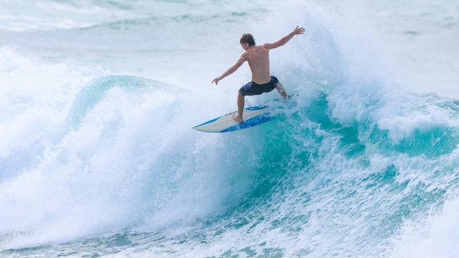
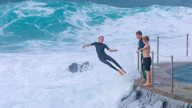
Massive swells have been hammering the NSW coastline, with waves set to peak between 6-8ft on Thursday as wild weather continues to lash parts of the state.
At Bronte Beach, thrillseeking surfers could be seen carving through powerful 4-6ft sets, making the most of the rough conditions despite grey skies and gusty winds.
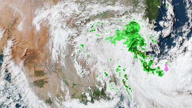
Emergency crews have been kept busy across NSW after torrential rain and flash flooding triggered more than 800 calls for help over the weekend.

Heavy rain and strong winds lashed parts of the Hunter Region and the Mid-North Coast, with a deep low pressure system sitting off the coast fuelling the wild weather.
The worst of the conditions have now passed, but SES spokeswoman Emily Barton said crews are continuing to monitor river levels and urged drivers not to risk driving through floodwaters.
“We’re just urging the community to not take the risk of driving through that floodwater if they come across a flooded road when they’re returning to work or school after the holidays, stop, turn around and find an alternative route,” Ms Barton said on 2GB.
The intense weather saw Moparrabah, a small city in the Hunter Region, record 112mm of rain in just 24 hours, nearly double its average rainfall for April.
According to Weatherzone, rainfall totals are continuing to climb across parts of the state, with showers expected to linger over coastal areas for several more days.
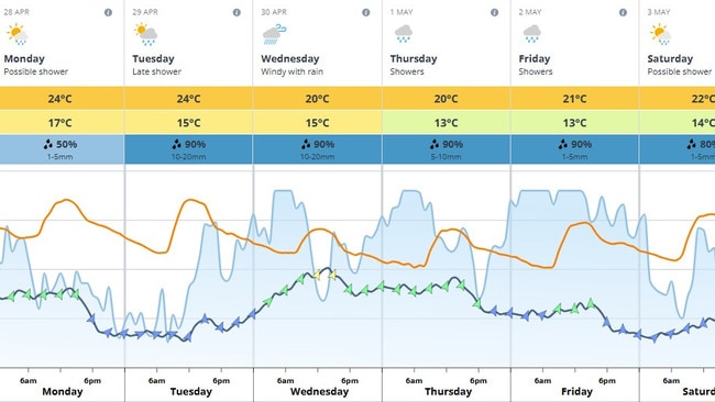
The Bureau of Meteorology forecasts showers easing today for Sydney, but predicts a high chance of more rainfall through Tuesday, Wednesday and into the weekend as moist southerly winds persist.
Sydney is expected to reach a top of 24C on Monday, with a high chance of showers along the coastal fringe becoming less likely later in the day.
Looking ahead, a weak trough is expected to cross the southeast midweek, bringing further showers to central and eastern parts of the state.
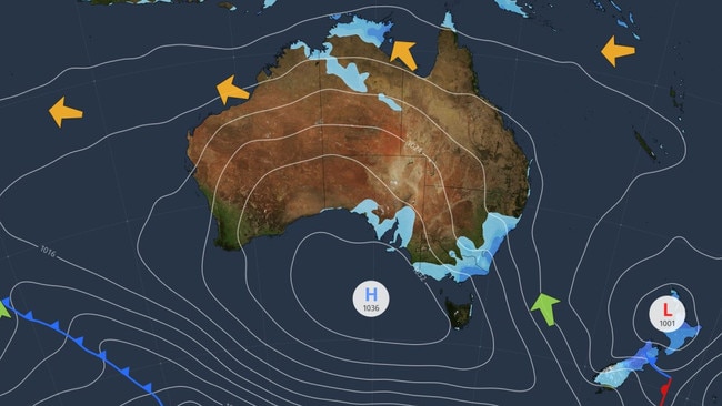
Inland regions are likely to see clearer, drier conditions as a ridge of high pressure moves in.
By mid to late week, Sydney is forecast to experience high chances of showers and possible thunderstorms, particularly along the coast, with maximum temperatures cooling slightly to around 20-22C.
Authorities are warning residents to stay up to date with local weather warnings and to remain cautious around flooded areas.
Do you have a story for The Daily Telegraph? Message 0481 056 618 or email tips@dailytelegraph.com.au
More Coverage


Originally published as Large swells hammer NSW coast as wild weather lingers over Sydney

Man dies after being shot during hunting trip
A police probe is under way after a man died from a gunshot wound sustained during a hunting trip in the state’s west, with several weapons seized for examination.

Man badly injured as he falls from balcony onto truck
A man has been taken to hospital in a serious condition after falling from a third-floor balcony on the Northern Beaches.