
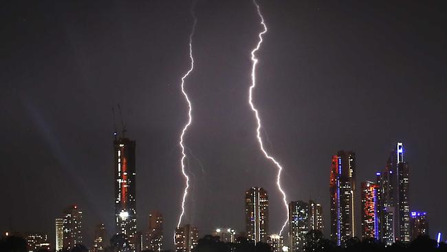
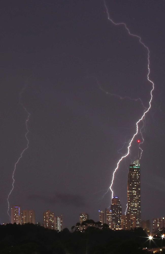
Severe thunderstorm lashed Coast overnight, makes way for hot days and clearing showers this week
The Gold Coast was hit by a severe thunderstorm with damaging winds and heavy rainfall on Sunday – but the forecast for the rest of the week is looking much sunnier.
Weather
Don't miss out on the headlines from Weather. Followed categories will be added to My News.
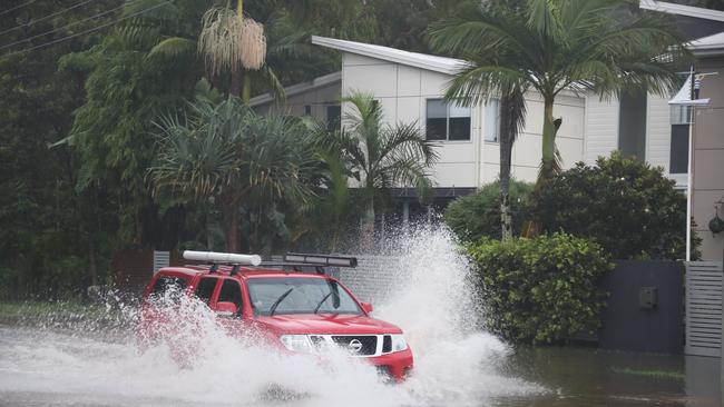
The Gold Coast was hit by a severe thunderstorm on Sunday afternoon, with damaging winds and heavy rainfall lashing the city.
But the weather is looking up for the week ahead, with a slight chance of thunderstorms and showers, and a maximum temperature of 30C.
There were hundreds of people affected by power outages across the Coast, with Energex reporting their site was experiencing delays “due to the severe weather event.”
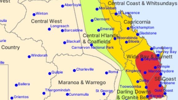
Earlier, the Bureau of Meteorology forecasted severe weather to hit southeast Queensland after midday, with atmospheric scientist Brooke Pagel warning of isolated, dangerous thunderstorms in areas that could produce giant hail and intense rainfall.”
However, she said the Coast will receive a reprieve from the wild weather moving into Monday.
Ms Pagel said the city would still have showers through the week but the storm threat should pass.
“The Gold Coast should be clear of the storm by early Monday,” she said.
“There’s a chance of showers Monday with temperatures forecast to reach 27C.
“The rest of the week will see hot temperatures with showers but the Gold Coast does not have any storm activity predicted.”
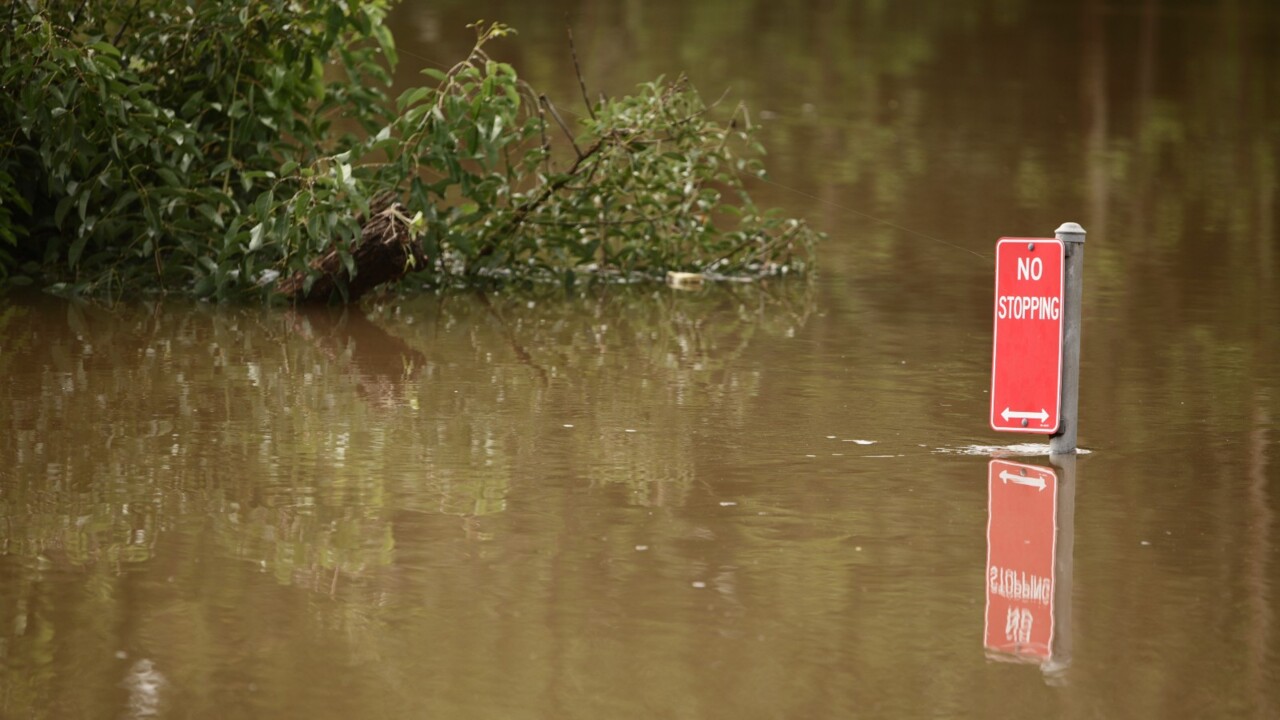
Ms Pagel warned people to check road closures and be careful driving because of potential flash flooding from Sunday’s rain.
“Creeks and streams will respond to those higher rain falls, so further flash flooding is a possibility,” she said.
The Bureau of Meteorology issued a hazardous surf warning on Sunday for areas stretching from the Fraser Coast south to the Gold Coast, with deceptively powerful surf and swell conditions expected.
All Gold Coast beaches are closed due to hazardous surf conditions.


In pictures: Gold Coast celebrates Australia Day 2025
Thousands of revellers have crowded Gold Coast beaches for Australia Day celebrations. See all the pictures.
Read more

Lightning strikes, roof collapses in wild Coast storm
A Gold Coast home has reportedly been struck by lightning during a wild weekend storm. Read the latest
Read more