
Flash flooding warning as severe storms threaten Gold Coast on Wednesday
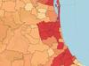
More rain, hail and thunderstorms are due to hit today with the Bureau warning of a severe system moving over the Gold Coast, which could lead to flash flooding.

Gold Coast
Don't miss out on the headlines from Gold Coast. Followed categories will be added to My News.
Weather experts have warned the Gold Coast will likely be struck by severe thunderstorms later on Wednesday, which could lead to flash flooding due to the region’s swollen waterways.
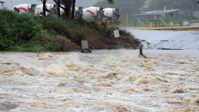
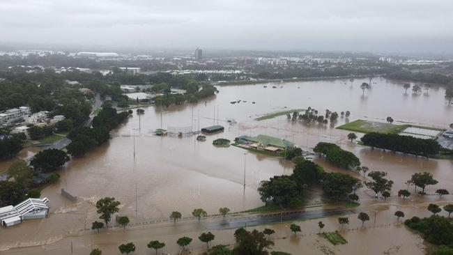
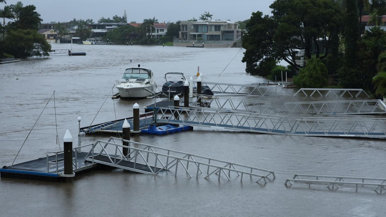
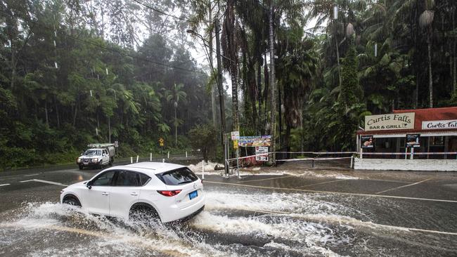
It comes as southeast Queensland and northern New South Wales have been mopping up after devastating, and in some cases record, flooding last week.
Two people died on the Gold Coast during the severe weather event - Gabrielle Sale at Mudgeeraba and Troy ‘Trog’ O’Keefe, who perished with his dog at Currumbin Valley.
The Bureau of Meteorology has forecast a high (70 per cent) chance of showers on Wednesday and warned of the likely storm.
“A thunderstorm (is) likely, possibly severe with damaging winds, large hail and heavy rain which may lead to flash flooding during this afternoon and evening,” the bureau stated.
The storms are likely across southeast Queensland, from Wide Bay to the Coast.
Meteorologist Harry Clarke was not able to rule out “high-end, very dangerous thunderstorms” in the afternoon and evening.
However, the situation will depend on a potential south-easterly wind change.
“The atmosphere is broadly unstable across southeast Queensland and that’s due to an upper trough,” he said.
“The south-easterly wind change is essentially going to be the trigger for the storms.
“So it’s unstable and the south-easterly change will come through and kick off a lot of that activity.”
DAUGHTER’S INVITE TO PM: ‘TAKE IN THE STENCH, DESTRUCTION, FILTH AND HEARTBREAK’
“It’s not just the rainfall with these storms, there’s also the chance of damaging wind and large hail as well.”
Mr Clarke said storm activity was expected to track north late on Wednesday, but showers could stick around the south east towards the end of the week.
“There will be a few showers in the southeast corner, but the thunderstorm activity should be more around Capricornia, Central Queensland and across the Darling Downs by the time we get to Thursday,” he said.
“In saying that, there could still be a couple showers around coastal parts but nothing too extraordinary at this point and really quite cooler as well.
“That south-easterly change will be a cool change.”
The bureau has forecast light winds blowing northerly at 15-20kmh in the middle of Wednesday, before it shifts south-easterly late in the afternoon.

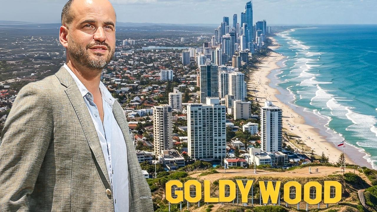
Welcome to Goldywood: Why Coast is high on A-list radar
A-list producer and Baz Luhrmann production house boss Schuyler Weiss has revealed how the Gold Coast could be on the verge of a golden age of movie magic. Read the full interview.
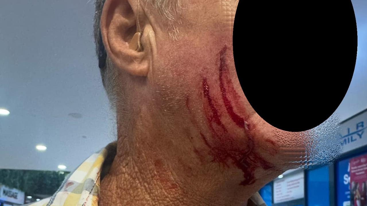
‘Pulled out small knife’: Senior attacked at GC shop centre
Shocking images have surfaced from Nerang Fair Shopping Centre where a 68-year-old man was attacked at knifepoint allegedly by a young male teen.