
Gold Coast weather: BOM warns of thunderstorms with ’giant hail’, destructive winds and intense rain leading to flash flooding
The Bureau of Meteorology is warning Gold Coast residents are in for a wild afternoon as “very dangerous thunderstorms” threaten the city

Gold Coast
Don't miss out on the headlines from Gold Coast. Followed categories will be added to My News.
- Coast childcare centre’s plan to turn around ugly national rating
- Coast icon Cav’s destroyed by wreckers
- Gold Coast graduates to ‘thrive in uncertainty’
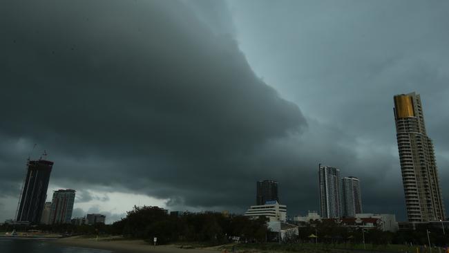
THE Gold Coast could be smashed by giant hailstones, destructive winds and intense rain leading to flash flooding during storms this afternoon, warns the Bureau of Meteorology.
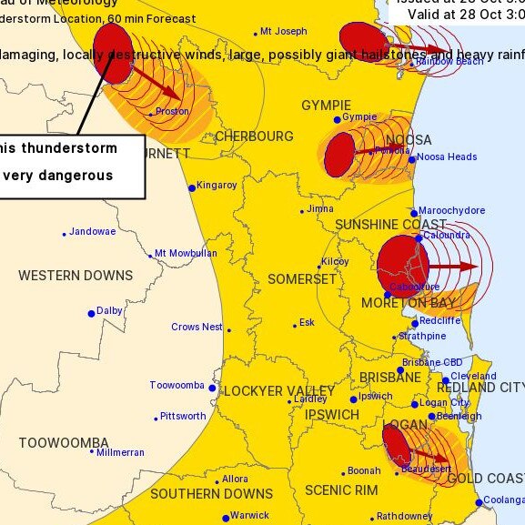
As of 3pm, Gold Coasters were being warned about “very dangerous thunderstorms” and “damaging, locally destructive winds (and) large, possibly giant hailstones”.
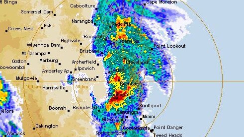
The BOM has also warned it’s likely “intense rainfall” would likely “lead to dangerous and life-threatening flash flooding
The thunderstorms are moving towards the east to southeast.
BOM has flagged that an updated warning would be issued about 4pm.
Insurance companies including Budget Direct have been sending text messages to Coast residents warning of a “high probability of hail” for some suburbs.
Queensland Fire and Emergency Services (QFES) advises anyone facing severe storms should:
- Move your car under cover or away from trees.
- Secure loose outdoor items.
- Never drive, walk or ride through flood waters. If it’s flooded, forget it.
- Seek shelter, preferably indoors and never under trees.
- Avoid using the telephone during a thunderstorm.
- Beware of fallen trees and powerlines.
TUESDAY: WHAT TO EXPECT AS THUNDERSTORMS THREATEN COAST
GOLD Coasters can expect a drenching, lightning and strong winds this afternoon, but there’s only a small chance the city will be battered by storms packing hailstones.
Bureau of Meteorology (BOM) forecaster Felim Hanniffy said the Coast would probably miss the worst of storms around southeast Queensland today, but commuters face a wet trip home.
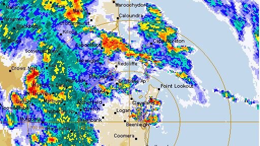
The BOM has advised in its latest Severe Thunderstorm Warning todays' storms have “quickly merged into rain areas while some embedded, heavy thunderstorms remain severe”.
“Large hail is now considered unlikely, particularly since weak supercells have now weakened,’ the warning read.
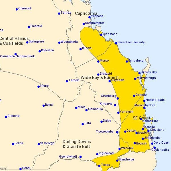
Further, Mr Hannify said: “Most of the action is further west around the Darling Downs and up north around the Sunshine Coast.”
“The storms have kind of merged into a big rain area, which are training down towards Brisbane and eventually the Gold Coast,” he said.
“It will probably turn quite showery, quite wet, for a time, probably from about mid to late afternoon. Right around the time people will be commuting.
“There could be some thunderstorm activity, some lightning flashes, but the main hazard in that will be heavy rain and maybe damaging winds.
“Hail is unlikely now we’re getting these big rain areas.”
Mr Hannify said the most intense storms had passed, “but for the commute home it’s looking like a wet one.”
Rain, heavy in parts, is expected to stick around into Wednesday and early Thursday, when thunderstorms may again threaten the Coast.
“There looks like another round to come tomorrow driven by a trough system over the Darling Downs at the moment,” he said.
“That system is becoming more mobile and will move toward the Coast tomorrow. That will bring a renewed threat of severe storm activity across the southeast.
For emergency assistance phone the State Emergency Service (SES) on 132 500.

How GC film industry became the stuff dreams are made of
Fifteen years ago when she left the Gold Coast to pursue a career as a writer, Maria Lewis couldn’t have imagined it would become the best place in the world to fulfil those dreams.

Former nurse fined for masturbating in car park
A former nurse fined for masturbating in his van was reported to police after three girls saw his vehicle rocking in a Molendinar car park. Read the full story here.