
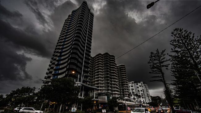
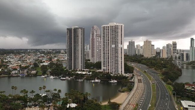
Gold Coast weather: Sunny skies may stay despite BOM warning 'super cell thunder storms’ could bring ‘giant hail’
Super cell thunderstorms expected to lash Gold Coast, bringing “giant hail” at the weekend may not come to fruition. LATEST DETAILS
Gold Coast
Don't miss out on the headlines from Gold Coast. Followed categories will be added to My News.
SEVERE thunderstorms earlier predicted to bring “giant hail” to Gold Coast on Saturday afternoon may not come to fruition.
Bureau of Meterology forecaster Helen Reid said the chance of a super cell thunderstorm had reduced due to a southerly wind change moving through the region.
While risks had eased this did not mean The Glitter Strip was in the clear as conditions could again change, Ms Reid said.
“There is thunderstorm action around, however, the Gold Coast might be a little less likely, but that’s not to rule it out completely,” she said.
“We have been expecting the wind change to move through ahead of the trough, so that is expected to reduced the likelihood or severe storms for the Coast.”
It comes after BOM on Friday warned residents to park their vehicles under shelter amid concerns giant hail and strong winds could batter the coast.
‘Super cell thunderstorms’ could pelt Gold Coast with ‘giant hail’
October 30, 2021
A FORECASTER has warned the Gold Coast can expect a possible thunderstorm later on Friday before the wild weather ramps up over the weekend, potentially packing “giant hail” in “super cell thunderstorms”.
Bureau of Meteorology (BOM) meteorologist Pieter Classen said cloudy conditions across southeast Queensland “ahead of an upper trough” could lead to “patchy rain this afternoon”.
“There may be some showers and the odd thunderstorm around later this evening,” he said.
“The shower and storm activity for southeast Queensland is going to be fairly isolated and patchy for this evening.
“But it looks like it gets a lot more interesting from Saturday afternoon though.
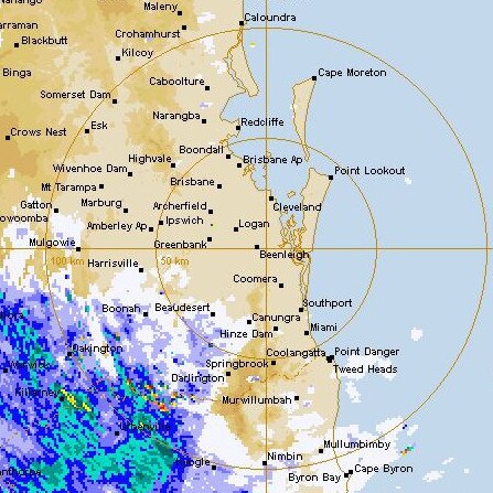
“We do have a south-easterly change working its way up the southeast Queensland coast, so that’s going to act as a trigger point from tomorrow afternoon for showers and thunderstorms as well – potentially severe thunderstorms.”
Mr Classen said the Coast “could be in the firing line” and he warned of “damaging wind gusts, large hail and heavy rainfall”.
“There’s even a chance of higher end super cell thunder storms around the Gold Coast and southeast Queensland more broadly,” he said.
“There is the potential for locally destructive winds and giant hail as well.”
He said it was likely the storm activity would ease at the start of next week.
Mr Classen said storms in recent days had brought minimal rain to the coastal areas of the city, but some parts of the hinterland and northern Coast had received something of a soaking.
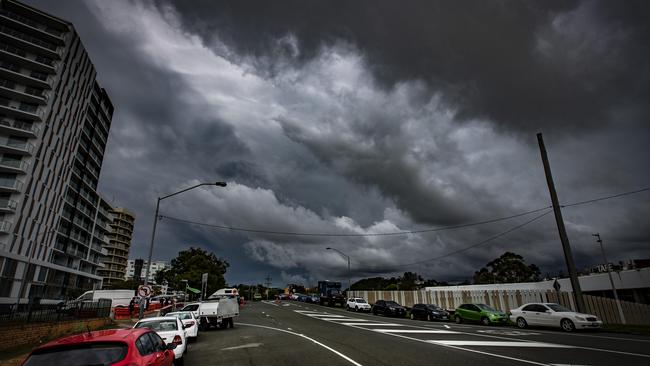
Hail hits Coast as booming thunderstorm descends on city
October 20: The Gold Coast is due to be hit by more wild weather after a booming thunderstorm dumped hailstones and heavy rain on the city on Monday.
More than 20 calls for help were attended to by the State Emergency Service (SES).
RACQ received 74 insurance claims by Tuesday afternoon – 18 claims for home damage and 56 for motor vehicle damage.
Bureau of Meteorology (BOM) meteorologist Helen Reid said the storm cell which descended on much of the city brought 103 millimetres to Molendinar.
Coolangatta, at the “edge of the storm”, received just 25mm, while the Gold Coast Seaway was drenched with 40mm in a short period of time.
Continuous hail pelted the city, causing damage to some vehicles not stored safely undercover, while deafening thunder rocked homes.
Energex recorded 2,964 Gold Coast residents without power on Monday afternoon in suburbs including Arundel, Benowa, Molendinar, Parkwood and Worongary.
Molendinar was the worst affected with close to 1000 homes suffering outages from the storm.
Ms Reid said the “action-packed” storm was “right on top” of suburbs like Southport and “just kept on going”.
“There was a lot of severe action, widespread action yesterday in the thunderstorm,” she said.
“It was due to so much moisture in the atmosphere and the warm temperatures.
“Also, a trough not just at the surface but all the way to the atmosphere helped the storm to become quite well developed.”
BOM meteorologist Felim Hanniffy warned the “unstable air mass” creating the storms still loomed over the Gold Coast on Wednesday and are predicted to remain for the rest of the week.
“Storms are forecast for inland Gold Coast later today and overnight,” he said.
“It looks like it’ll clear midmorning but storm activity is predicted to return on Thursday afternoon.
“Storms are not likely to move until Monday with the chance of activity across the weekend.”

Temperatures are expected to drop to a minimum of 16C on Thursday and a maximum of 31C on Sunday.
Showers accompanied by possible storms have been forecast until Monday.
RACQ spokeswoman Kirsty Clinton said: “Our research shows many Queenslanders aren’t taking simple precautions to protect their properties ahead of storm season, with only 32 per cent saying they regularly clean their gutters and only 31 per cent saying they regularly trim their trees.”
“With more bad weather predicted, now’s the time to make sure your home is properly prepared to reduce your risk of needing to make a claim,” she said.
“Clean out your gutters, remove any dead branches near your house, make sure your roof is in good shape and there’s no leaks, and prepare an emergency plan.”
Hailstorm hits Coast, thousands without power
October 18: Gold Coast residents are seeking cover for their cars as heavy rain and hailstones move through the region.
A severe thunderstorm warning was issued for Southeast Queensland including the Gold Coast, Redland City and parts of Logan at 4:20pm on Monday.
âš ï¸â›ˆï¸Severe thunderstorm #warning update: multiple severe thunderstorms being tracked in the east and southeast, including #Brisbane, #SunshineCoast, #GoldCoast. Primarily heavy rainfall with a slight chance of large hail. Details and updates: https://t.co/FBmpsInT9opic.twitter.com/fBbJHuLOsX
— Bureau of Meteorology, Queensland (@BOM_Qld) October 18, 2021
Meteorologist Helen Reid said the trough which was creating the severe thunderstorms was not likely to move away from the Southeast Coast.
“The trough is helping life the moisture and heat which is creating the storms,” she said.
Energex recorded 2,964 Gold Coast residents without power on Monday afternoon in multiple suburbs including Molendinar, Arundel, Benowa, Parkwood and Worongary.

Molendinar was affected the worst with close to 1000 homes suffering outages from the storm.
Ms Reid said the Coast was forecasted a wet and humid week with 8 to 20mm of rain on Tuesday which will most likely hit in the morning and a maximum temperature of 24 degrees.
The Bureau of Meteorology said they received reports of tornado activity southwest of Toowoomba on Monday morning.


Join the conversation

Prominent tycoon breaches suspended sentence via DUI crash
Gold Coast developer and businessman Craig Gore, whose father developed ritzy enclave Sanctuary Cove, admitted sideswiping a vehicle on the Glitter Strip the morning after celebrating a business deal.
Read more

Construction paralysed: 77k homes, Olympic venues at risk
Productivity in Queensland’s construction industry has plummeted while the cost of projects will surge unless there are major reforms, a damning new report reveals.
Read more