
Gold Coast weather: City on track to record wettest month ever, wet weather to drag into the weekend
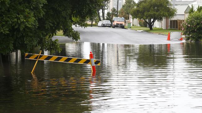
The persistent wet weather has shut schools, flooded homes and businesses and turned roads into rivers. Even the city’s iconic theme parks have shut up shop due to the deluge.
Gold Coast
Don't miss out on the headlines from Gold Coast. Followed categories will be added to My News.
RELENTLESS rain bucketing down on the Gold Coast has led to the wettest February ever – and the city is on track to mark its wettest month in recorded history.
The continual wet weather has shut schools, flooded homes and businesses and turned roads into rivers. Even the city’s theme parks shut up shop due to the deluge.
Gold Coast City Council opened Coomera Indoor Sports Centre as an evacuation centre, or “place of refuge”, on Thursday afternoon, but no one had taken advantage by the night-time.
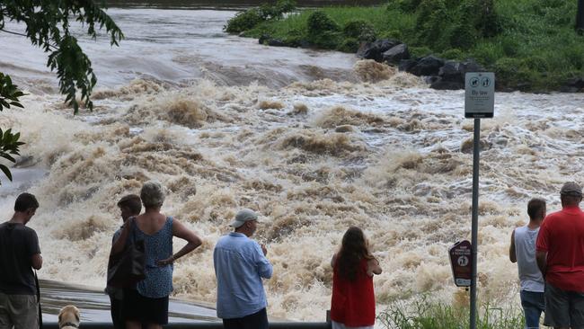
Waterways reduced to barely a trickle as drought impacted the region in late January are now teeming with floodwaters.
The Gold Coast Titans home at Parkwood Village resembled a lake on Thursday.
The State Emergency Service (SES) had attended nearly 190 jobs by Thursday night and 450 over the past week.
Meteorologist Shane Kennedy from the Bureau of Meteorology (BOM) triple checked preliminary data and was surprised to discover the record-breaking totals for the city.
“The Gold Coast is on track to get its wettest month ever,” he said. “You’re pushing towards the annual monthly record. You just need a few more showers.”
In the past seven days, the Coast received varying rainfall totals of up to 520mm – more than three times the February average of just 170mm, BOM data showed.
Coolangatta has already received 616mm so far this month, the most on the Coast. That eclipses the highest February rainfall total of 507mm in 1995 and nears the highest ever rainfall total for any month of 645mm in April 1988.
However, Mr Kennedy said conditions will likely have eased by Friday, resulting in patchy showers for the rest of the week.
“The main sort of synoptic driver we’ve had has been an upper trough sitting over southeastern Queensland, that really helps intensify the rainfall and leads to the widespread falls, particularly overnight,” he said. “It’s really good at keeping the rainfall going, but that’s expected to weaken this afternoon.
“From (Friday) we’ll likely just see more isolated totals between 5-10mm for the days into next week.”
Mr Kennedy said Ex-Tropical Cyclone Uesi was not tracking towards Queensland and would not influence rainfall much. But the system is causing hazardous conditions on the water, prompting BOM warnings.
On Thursday night, a council spokeswoman said the “immediate floodwater threat” was easing for Oxenford, Hope Island and Helensvale.
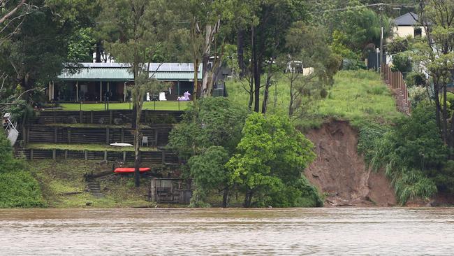
Earlier, residents were warned they may have to consider moving to higher ground.
Mount Tamborine was also affected by floodwaters, as were roads across the region and localised areas across the city.
Queensland Police urged drivers on the Coast to steer well clear of floodwaters.
More than 15 roads were declared closed due to flooding by Thursday afternoon, but many other streets experienced some inundation.
The Department of Education closed more than two dozen schools and early childhood centres on Thursday.
Parents were urged to visit the department’s school closures website first thing in the morning to check their school’s status.
In a life threatening emergency call triple-0 (000) and for storm or flood related assistance call SES on 132 500.

Leadfoot lawyer in hot water for failing to disclose dire traffic record
A Gold Coast lawyer has been fined and publicly reprimanded for omitting to tell the Queensland Law Society about a series of traffic-related matters he was required to disclose.

Hobbiton, glow-worm caves: New direct flight from the Gold Coast
Australian airline passengers, from a popular international destination, have touched down on the Gold Coast for the first time in years amid confidence in a foreign flights bounce back.