
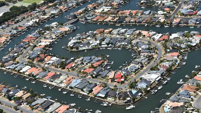
Surfers Paradise beachfront residents stop Oceanway being built to Broadbeach in sudden legal move
Work was supposed to start on the contentious $6.1m project as early as next month – but that has now been waylaid by an unexpected legal manoeuvre.

Council
Don't miss out on the headlines from Council. Followed categories will be added to My News.
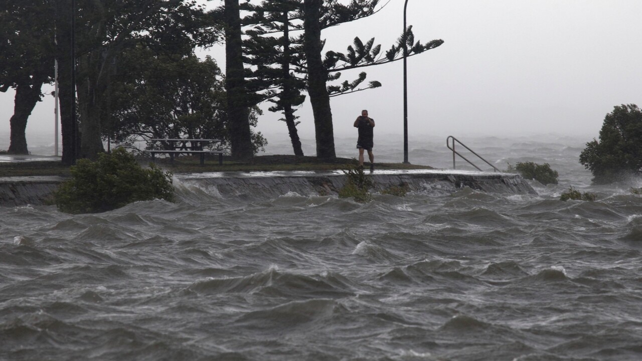
The long-running stoush over the Surfers South Oceanway is back in court, meaning work will not start next month on the $6.1 million path.
The Surfers Beachfront Protection Association (SBPA) has lodged fresh papers in the Court of Appeal, alleging a Planning and Environment Court judge “erred in law” in his decision to allow the 1.6km path to proceed.
Judge Michael Rackemann found the SBPA had failed to show that the Gold Coast City Council’s approval of the path was not compliant with its planning scheme.
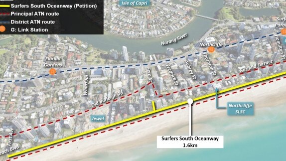
Work was expected to start in April. The Surfers South Oceanway will run between Laycock Street and First Ave at Broadbeach.
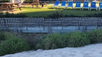
SBPA is concerned about liability if the pathway was damaged during a storm and concrete slabs impacted the A-line rock wall protecting beachfront properties.
A SBPA spokesperson said: “We live on one of the most breathtaking coastlines in the world, the last thing Gold Coasters want is for council to build anything that puts that coastline at risk.”
On behalf of concerned property owners, the Bulletin asked the council:
* Were councillors advised at an August 2019 brief that the Surfers South Oceanway would be built predominantly east of the A-line seawall protecting homes?
* If the City would assume responsibility for the maintenance of the A-line to protect public infrastructure?
* Would the City carry out emergency works to the A-line in the event of erosion to protect private property?
* How will the City maintain the A-line after they install a 4-metre wide concrete path on the dunes with each segment weighing 6.5 tonnes?
* Would the City indemnify Surfers South property owners in the event of erosion that put private property at risk?
Residents said councillors were told “very little” and not advised that the seawall required an 8m setback.

They understand council will not be responsible for private seawalls, and owners would have to alert the City to remove the path to maintain the A-line outside their homes.
“We are responsible for our private seawalls, and who knows what happens if pieces of concrete footpath come crashing through private property,” a resident said.
A City spokesperson did not respond to the specific questions, but maintained the Surfers South Oceanway was the subject of a comprehensive assessment.
The investigation had demonstrated that the Oceanway avoids impacting on coastal processes or increasing impacts from coastal erosion, the spokesperson said.
“Private property owners continue to be responsible for protecting their property,” the spokesperson added.
“State and council approval requirements continue to regulate foreshore seawall construction and maintenance.”
CITY BEAT: Plan to fix Gold Coast’s rental crisis falls over again
A Gold Coast City Plan overhaul which would tackle the housing and rental crisis plus give developers certainty is in limbo after a third State Government delay of the reforms.
The Coast’s social housing stock is flatlining while thousands live on the street as latest data show 0.1 per cent of housing available for rent is affordable for people on very low incomes.
The Bulletin has learned the Government, after getting City Plan amendments in December last year, has again asked for more time. It is prompting agitated city leaders – who say ticking off the City Plan is urgent – to call the Deputy Premier Steven Miles’ office.

Acting Mayor Donna Gates confirmed the Government asked for a third ‘pause’ in consideration of the amendments as she told colleagues council would reach out to Mr Miles.
“Housing affordability on the Coast is a huge issue and we need this amendment package approved so we can give certainty to residents and developers. No indication had been provided regarding the request to pause in their correspondence,” Cr Gates said.
Planning chair Cameron Caldwell was blunt about the delay impacts, aware the package was sent to the State in December after a “long period of informal discussions with State officers”.
“Housing affordability is a critical issue in our city so council will look to endorse the package as soon as possible. As with all changes to City Plan, the State provides a window that allows applications to be made under the old provisions, for a period of 12 months,” Cr Caldwell said.
Asked if he was confident the amendments would be ticked off, he replied: “I cannot stress enough that the package needs to be finalised as a matter of urgency.
“The community rightly expects their feedback and wishes are reflected in City Plan as soon as possible and council’s submission is largely based on community feedback, after four periods of community consultation.
“The amendments envisage new and affordable housing in Labrador, Southport and Biggera Waters which is great as we need to get more supply into the market and deal with affordability issues.
“Further, the amendments protect the character of Palm Beach through a reduction in height and density along the beachfront and Jefferson Lane.”
A department spokesperson outlined City Plan changes were challenging: “The proposed amendment is a large and complex package, including hundreds of proposed changes. There has also been substantial public consultation and community discussion.
“The Department of State Development Infrastructure, Local Government and Planning is undertaking a thorough and comprehensive assessment to ensure the proposed amendment meets all requirements and there are no unintended consequences.”
Main Beach Association leader Sue Donovan in a letter for Mr Miles said many community organisations were “deeply frustrated” by government failure to approve City Plan Amendments 2 and 3.
“Having put many months of work into submissions regarding the draft amendments, community groups such as ours were relieved when the final version was finally sent to State Government in mid December,” she said.
“The current, deeply flawed, City Plan permits the building of ‘too much on too little’ — bulky towers on house-sized building sites.”
Ms Donovan said council planners had informed her group until the Government signs off on the amendments no action could be taken on further reforms. The process could take 18 months.
“The community’s concern is the development industry, which gains huge financial benefits from the current relaxations, will no doubt be lobbying your government to delay or even refuse the proposed Amendments,” she wrote in her letter.
“Every week of delay means more chance of enhanced profits for developers because there is a 12 to 18 month phase — in period for the new provisions to take effect.”
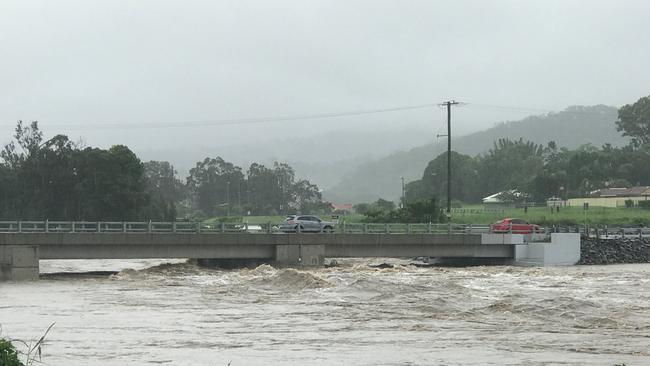
True impact of the Coomera River flooding revealed
March 23: A flood-hit riding club will be relocated to save ratepayers $8m.
Councillors have voted to move the Oxenford Pony Club and its 55 members from the eroding banks of the Coomera River to an old farm at Yatala.
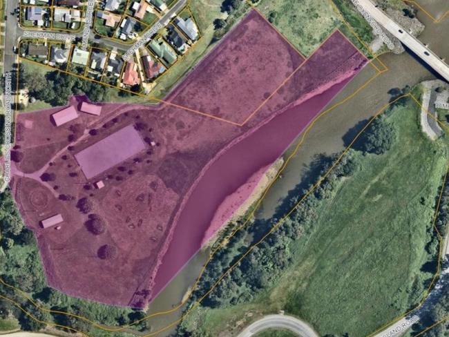
The council land will continue to be eroded but in the meantime can become the potential new home for the Oxenford Men’s Club which requires only a storage facility.
New surveying shows the river bed and banks have eroded by a further five to 30 metres and deepened by up to one metre in some upstream locations.
“They have lost around eight metres of land in the latest weather event,” Deputy Mayor Donna Gates said.

A revised estimate for scour protection works had increased from $1.97m to about $7.8m.
“No residential properties are currently subject to an existing erosion hazard,” officers said. “The nearest residential properties are well set back from the existing riverbank erosion and not likely to be subject to erosion hazard in the future.
“Due to the significant increase in funding required, combined with the risk of the works potentially being impacted by future flooding events, consideration has been given to the value proposition of the proposed protection works.”
Cr Gates gained unanimous support when recommending officers investigate moving the pony club to the old Enkleman farm site in Stanmore Road, Yatala.
Officers are to report back by November on relocating the men’s club, currently based just south of the Oxenford shopping precinct, to the pony club’s Charlies Crossing Park site.
The council has no obligation to stop the river from eroding its own land.
“The City would still undertake general maintenance activities such as actively monitoring the future erosion and undertaking maintenance of fencing to ensure public safety,” officers said.
Councillor William Owen-Jones said it was important for residents to know that erosion of the river banks was not close to their properties.
The erosion had occurred for 60 years and much of it was due to the mining of rock and sand downstream, which had stopped, he added.
“At some time it (the river) will sort itself out,” Cr Owen-Jones said.
But creating a rock wall on the western side of the river could cause more flooding problems on the eastern side close to a major state road.

Oceanway secret visit: Mayor Tom Tate’s clue on beach path future
After a private beach inspection with engineers on Tuesday, Mayor Tom Tate has given the biggest sign yet that the Oceanway will be completed. Full details.

‘Must-see, must-do’: How to supercharge Southport’s streets
Southport’s Chinatown could be transformed into a vibrant hub of night markets and bustling street life under bold new proposals to revitalise the area. ALL THE DETAILS