
Four projects to future-proof Far North from natural disaster impacts
Public use of Quaid Road, a water pipeline from Lake Mitchell to Port Douglas, de-amalgamation of Douglas Shire and hitting go on the Daintree micro-grid have been pitched as Far North future proofing projects in the wake of the disastrous post-Jasper deluge.


Cairns
Don't miss out on the headlines from Cairns. Followed categories will be added to My News.
The public use of Quaid Road, a water pipeline from Lake Mitchell to Port Douglas, de-amalgamation of Douglas Shire and hitting go on the Daintree micro-grid have been pitched as Far North future-proofing projects in the wake of the disastrous post-Jasper deluge.
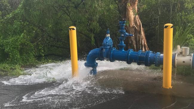
Sustained heavy rain in the days following the coastal crossing of Cyclone Jasper at Wujal Wujal triggered a one-in-a-hundred year flood event that destroyed road networks and caused chaos for the Douglas Shire water supply.
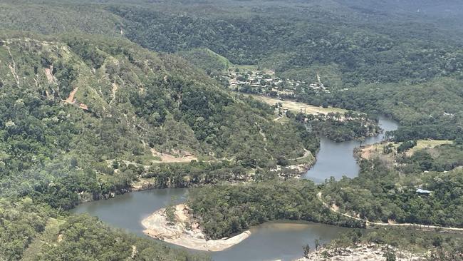
Three months on the fallout is still impacting access from Cairns to the Atherton Tablelands, into Cape Tribulation, and households in the Douglas shire.
Leichhardt MP Warren Entsch has proposed a suite of measures to act as an insurance policy to safeguard drinking water, secure Tablelands access and keep the lights on at the Daintree.
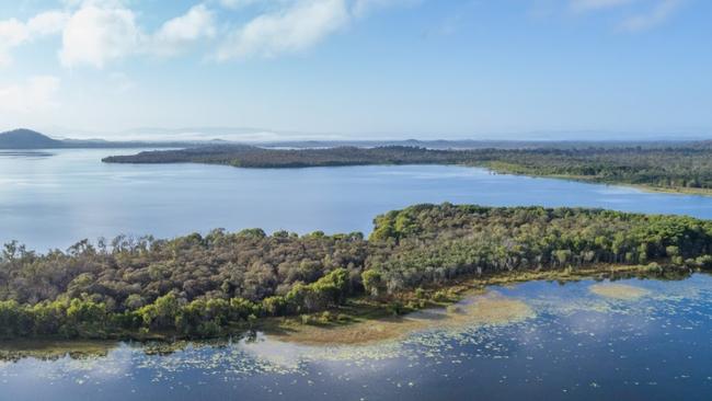
Opened in 1987 as an ornamental lake, Quaid Dam or Lake Mitchell at Southedge and its capacity of 129,000ML could service water needs of the entire Douglas Shire, if water can be fed into the existing network.
The idea is a radical rethink to secure reliable drinking water.
Currently the shire’s water delivery and filtration systems are vulnerable to landslides and have been plagued by turbidity, in part due to a lack of a reservoir feeding the Douglas system.
Mr Entsch has proposed a 30km gravity-fed pipeline to connect the Quaid Dam into the Douglas network.
The pipeline has been priced at $2000 a metre, meaning the 35km distance to the coast would cost in the vicinity of $70m.
“They have to do something, do we fix the problem or do we stick a few Band-Aids on it and hope it goes away,” he said.
“The Mitchell River catchment has a water allowance available at Quaid Dam of 65,000ML.”
In terms of road access the ungazetted Quaid Rd, which links the Mulligan and Captain Cook highways and is not open to the public, was the only Tablelands access route unaffected during the rain event, Mr Entsch said.
Landslides cut the Rex, Kuranda, Gillies and Palmerston routes.
The controversial road was completed in early 1989 but was prevented from ever opening to the public due to an application made under the World Heritage Properties Conservation Act.
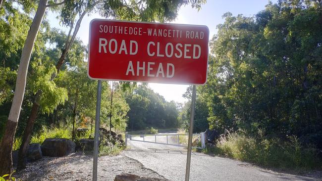
“(Transport and Main Roads) are arguing it was never built to specification but it was the only road that was fully open … because it was built on top of a spur,” Mr Entsch said.
“It shouldn’t be discounted because of politics or some historical argument.
“It will never be a commercial road for heavy vehicles but it is something that could be used for local traffic and tourists.”
Given the struggles of an ill-equipped Douglas Shire to keep water flowing and restore access into Cape Tribulation and Wujal Wujal via the Bloomfield Track, Mr Entsch backed a proposal by former mayor Michael Kerr to de-amalgamate the region into three neighbouring local government areas.
A referendum on whether to secede from the Cairns region was successful in 2014 despite Queensland Treasury Corporation advising against Douglas Shire going it alone due to a large financial burden on a small ratepayer base.
The shire did previously exist as a local government entity from 1903 until 2008.
Recovery from the ex-TC Jasper flood event was proof of limited resources being spread too thin across a massive area, stretching from north of Ellis Beach to the Bloomfield River, Mr Entsch said.
Under a proposed deamalgamation plan, Kuranda and Port Douglas would be incorporated into the footprint of Cairns Regional Council, Mossman and Daintree Village would move into the Mareeba Shire, Degarra and all areas north of the Daintree River would be annexed by the Cook Shire.
Kuranda, Speewah and Koah under the proposed redivision would join Cairns Regional Council.
“I just think we need to be smart and do things a little differently, or at least have a look at it,” he said.
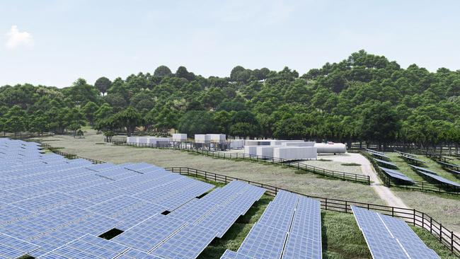
The final measure was to build the Daintree Microgrid.
Mr Entsch squeezed nearly $20m in funding from Scott Morrison in 2022 for the green energy project, which has been committed to by the current federal government who have awarded Volt Advisory Group $18.75m to build the system.
Before Cyclone Jasper the 8MW solar farm and 1MW clean hydrogen plant was due to come online this year.
“All the approvals are done, but they have not been able to get a 100t crane across the Alexandra Range to start work on the solar and hydrogen farm,” he said.
More Coverage


Originally published as Four projects to future-proof Far North from natural disaster impacts

Man hospitalised after serious assault in Far North Qld
A 27-year-old man was taken to hospital with serious injuries after an alleged assault, prompting police to appeal for public assistance in piecing together the moments leading up to the attack.
‘Unusual behaviour’: Man hid from police in croc-inhabited creek
A wanted man who evaded police for hours by hiding in a creek known to be crocodile habitat has been sentenced on a slew of assault, drug and obstruction charges.