
Google Maps censors mysterious ‘nuke island’ that visitors are banned from going near
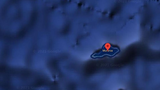
Eagle-eyed internet users have come across an island in French Polynesia that appears to be clear on one side, but blurred and hidden on the other.
Travel News
Don't miss out on the headlines from Travel News. Followed categories will be added to My News.
There’s something a little fishy about the photos of this remote tropical island on Google Maps.
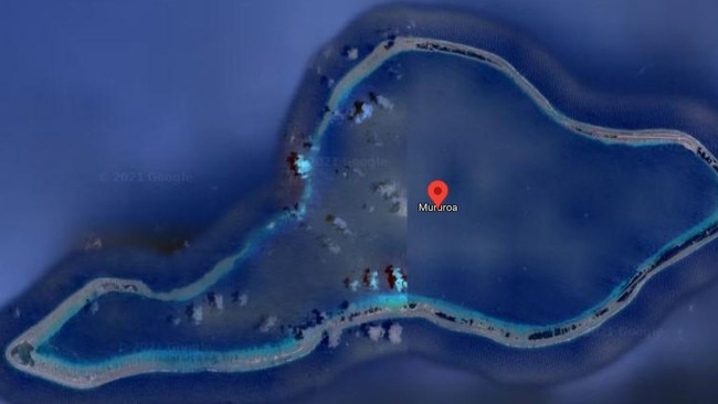
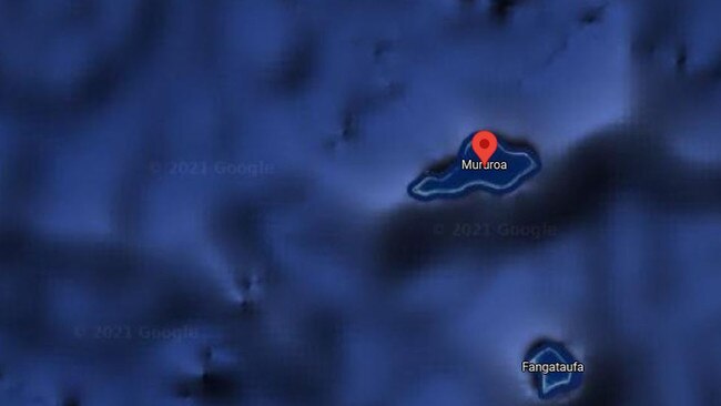
Satellite imagery provided by the digital map service shows the left side of Mururoa in French Polynesia, but blurs the other half.
In place of satellite imagery is a blueish blob that obscures whatever lies beneath from users.
Moruroa is a small atoll in the southern Pacific Ocean.
It’s not clear why much of the island is censored, but some suspect it relates to the island’s nuclear history.
France undertook significant nuclear testing on the atoll between 1966 and 1996 – with as many as 181 tests performed during this time period.
Some of the explosions at the island are said to have been 200 times the strength of the bombs dropped on the Japanese city of Hiroshima in 1945.
A study by Greenpeace found that it contaminated the water as far as Peru and New Zealand, with radiation levels of 12 millirems reported.
Unsurprisingly, the island is off limits to visitors.
Testing at the site stopped in 1996 after then-French president Jacques Chirac ordered the dismantling of nuclear testing facilities.
Mr Chirac said live on the radio that “the safety of our country and of our children is assured”.
Due to safety concerns, the island is still guarded by French troops – which could explain why it’s blurred out by Google.
In 2018, France’s government asked Google to pull all images of French prisons and other sensitive sites from the web.
The order followed a daring escape from a prison near Paris that involved a helicopter that flew it into the courtyard.
It’s thought that notorious killer Redoine Faid and his accomplices used Google Maps to scout out the layout of Reau prison.
This article originally appeared on The Sun and was republished with permission
Originally published as Google Maps censors mysterious ‘nuke island’ that visitors are banned from going near
Crazy queues as airport chaos returns
Passengers flying out of Sydney airport are in despair over staggeringly long queues stretching out of the terminal.
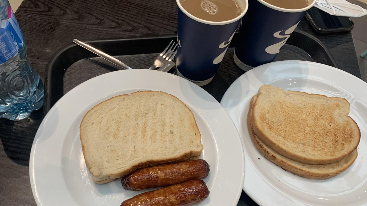
Wild cost of world’s worst breakfast
An airport fast food outlet has been slammed after charging customers $28 for one of the most pathetic meals seen.