
When Australia’s heatwave will end — don’t get excited expert warns
AS parts of Australia swelter through a record-breaking summer, a forecaster has given a dire prediction on when we can expect a reprieve.
technology/environment
Don't miss out on the headlines from technology/environment. Followed categories will be added to My News.
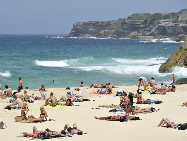
AUSTRALIA is experiencing a blistering summer heatwave, that doesn’t look set to end any time soon.
Across the country residents have been sweltering in scorching temperatures from the high 30s and into the 40s.
Andrea Peace from the Bureau of Meteorolgy said the heatwave has been caused by a high sitting in the middle level of the atmosphere. That high is preventing cooler frontal systems from pushing the hot air out.
MORE: Australia is getting hotter
SEVERE WEATHER UPDATE: High temperatures across central Aus. Current at 3 pm AEDT 8 Feb. For #heatwave forecasts see https://t.co/HsXXMdRJBT pic.twitter.com/dZHvAkiP3j
— BOM Australia (@BOM_au) February 8, 2017
But if you were hanging out for the cooler months to bring an end to this weather you may have to wait a little longer according to Martin Babakian, a consultant meteorologist and conjoint lecturer at Newscastle University.
“I don’t think it’s going to end, I think it’s going to carry on until May,” Mr Babakian told News Corp Australia.
“We’re going to see temperatures above average in April and May, the conditions will be warmer and warmer.”
While the current heatwave is not unusual for this time of year, the prolonged heat to come is new Mr Babakian said, who added that climate change was to blame.
“Definitely climate change is playing an important role,” he said.
“The dynamic of the atmosphere is changing and this [the heatwaves] are going to become part of it.”

SYDNEY
After two days of intense rain which saw flash flooding in some parts of the state, Sydney is sweltering through consecutive days of high heat.
Today the temperature will reach a top of 38C in the city. Tomorrow will reach 39C followed by 30 on Sunday. The cool change won’t come into effect until Monday when it drops to 25C.
There is a fire warning much of NSW and the ACT as very hot conditions associated with a warm airmass, together with fresh W/NW winds, will bring severe fire danger.
#SydneyWeather Stay hydrated today. City expected to get to a high of 38C, low to mid 40s in the west. https://t.co/Gf2P0OaNx5
— BOM New South Wales (@BOM_NSW) February 9, 2017
ACT
Residents in the ACT are suffering through 41C today and tomorrow. There is a severe fire danger for the state thanks to very hot conditions associated with a warm airmass over the ACT and much of NSW, together with fresh W/NW winds.
The temperature will drop to 32C and windy on Sunday followed by 26 on Monday and 27 on Tuesday.
SOUTH AUSTRALIA
South Australia is baking under scorching temperatures across the state. After a string of days in the 40s, today will see a top of 39C followed by 36 degrees tomorrow. The cool change will finally hit on Sunday when the temperature drops to 24 and cloudy.
Records for today: Hottest day on record Yunta (45.5°C). Hottest Feb day on record for Tarcoola (48.2°C) and Woomera (46.5°C).
— BOM South Australia (@BOM_SA) February 9, 2017
South Australians were left fuming after power was deliberately cut amid soaring temperatures to 40,000 households and businesses.
QUEENSLAND
Brisbane will experience temperatures in the mid to high 30s over the next few days. Today will see a top of 32C followed by 36C tomorrow, 39 on Sunday, 36 on Monday, 29 on Tuesday and 30 on Wednesday.
And there is no relief in sight. The Climate Council’s severe weather report found Queensland was in line for an increased number of 35C-plus days, more frequent thunderstorms and more intense cyclones during the coming years.

WESTERN AUSTRALIA
Perth has received a much needed cool change bringing rain and relief to emergency services who were fighting a bushfire.
The bushfire was threatening lives and homes on Perth’s south-eastern fringe after it started in Bedfordale. The fire was burning in a semi-rural area on the eastern side of South Western Highway.
Perth is now bracing for rain and thunderstorms over the next five days. The temperature today is 27C with rain. The temperature will slowly increase throughout the week until a high of 31 on Monday.
Perth's 2nd wettest ever day with 106mm since 9am 9th Feb....still 4 hours to go! 120.6mm fell on 9th Feb 1992. #hissingdown
— BOM WA (@BOM_WA) February 9, 2017
BOM issued a severe weather warning with flash flooding.
A rain band lies over the southern Lower West district, northern parts of the Southwest district and the western Great Southern and is moving slowly south. Heavy rainfall which may cause flash flooding has been observed on the Serpentine Radar over southern suburbs of the Perth Metropolitan Area, the Peel Region (Mandurah) and western Great Southern district, with Perth Metropolitan weather station at 4am Friday receiving 102.6mm of rainfall since 9am Thursday. A number of locations through the warning area have received more than 50mm in the 3 hours to 4am Friday morning.
Not far from home. #bushfire #perth #australia #dfes #westernaustralia pic.twitter.com/fXbXcH2tsm
— Domino Wade (@Domino_W) February 8, 2017
Huge Perth #bushfire pic.twitter.com/UrX0rmCgSb
— Cecily Ryan (@ryancecily) February 8, 2017
VICTORIA
Melbourne has a top of 28C today and will have rain for the next four days with temperatures in the twenties, dropping to a low of 18C on Monday.
MORE: See how a huge dust storm turned day to night in Melbourne in 1983
Hottest February night on record for #Mildura with 31°! 😓 #Heatwave #VicWeather How hot was it near you? Check here https://t.co/WLZUxfaVUF
— BOM Victoria (@BOM_Vic) February 8, 2017
Originally published as When Australia’s heatwave will end — don’t get excited expert warns
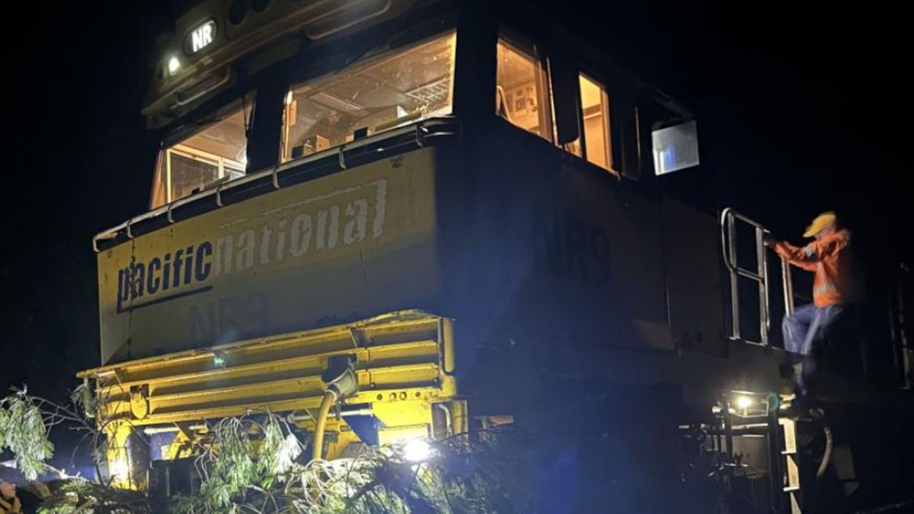
Train crash causes diesel spill in beloved region
Emergency services are mopping up a diesel spill in a winery region after a train crashed into a tree.
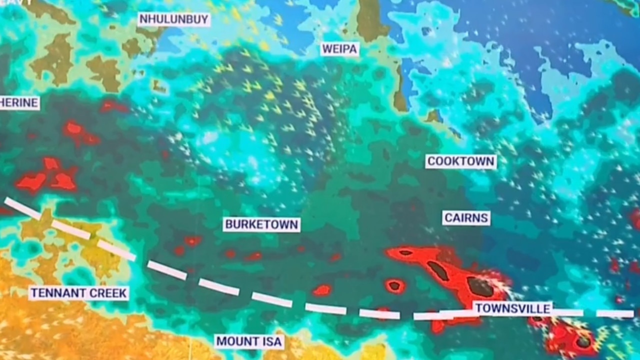
Worst news possible for flood-ravaged towns
Already flood-ravaged areas of Far North Queensland are bracing for the next deluge, with warnings in place for flash flooding and torrential rain.