
Weather forecast for regional NSW and Victoria: Heavy rain, high winds
MAYBE you should’ve stayed in bed. The commute home could be the slowest of the year with strong winds and heavy rain on the way.
technology/environment
Don't miss out on the headlines from technology/environment. Followed categories will be added to My News.
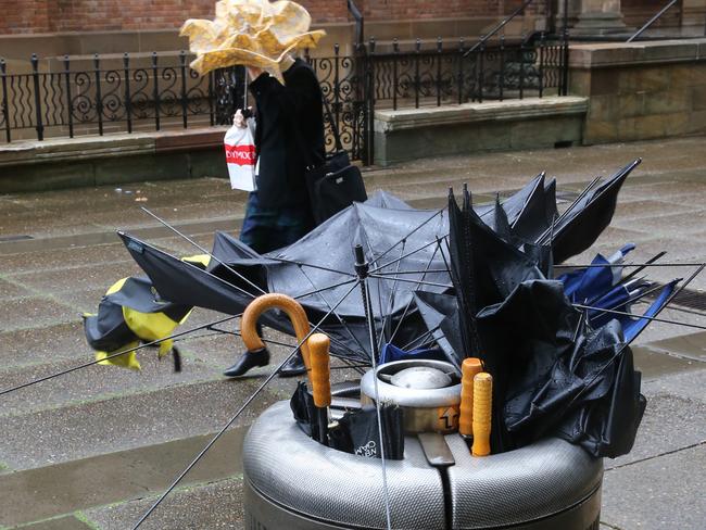
THE worst of the winds may be gone but don’t let go of the umbrella yet.
The low pressure system that caused damaging gales throughout New South Wales and flooding in Sydney today is slowly moving north tonight and is expected to move away from the eastern seaboard in the morning.
However a severe weather warning for high winds in the Hunter and Illawarra districts is still in place tonight.
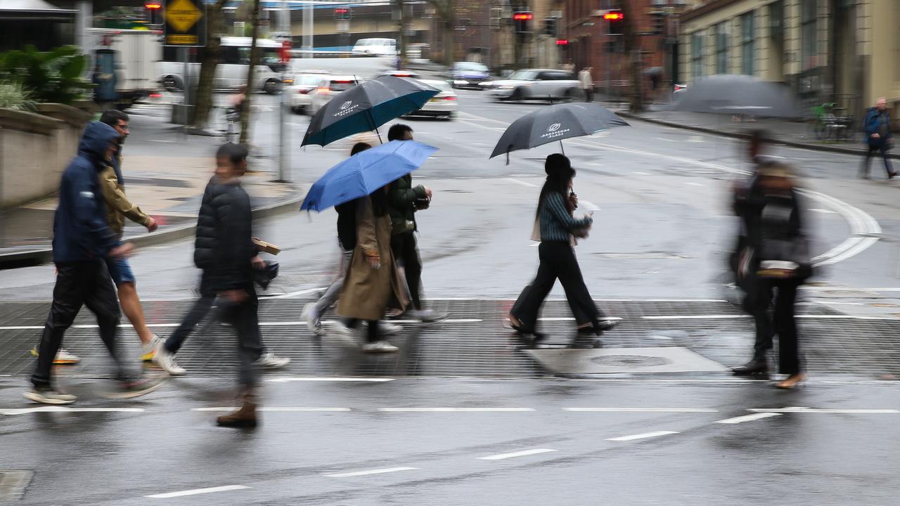
The rain and gale force winds have caused commuter chaos throughout Sydney for much of the day.
Buses were cancelled tonight and many roads closed due to surface flooding and power lines being down.
There were several serious car accidents, including a car flipping on the Anzac bridge, but no serious injuries have been reported.
Emergency services say they have been busy with weather-related call-outs. The NSW Ambulance service tweeted they were expecting a busy night while the SES and police urged people to drive to the conditions and be patient.
The Bureau of Meteorology has issued a severe weather warning for heavy rain and damaging winds for the Sydney metropolitan, Hunter, Illawarra and south coast.
Up to 10mm of rain is expected in an already sodden Sydney tomorrow.
In Melbourne commuters got a much easier journey home with most of the rain and wind in Victoria happening in east Gippsland.
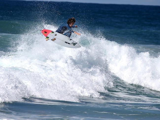
Of “more concern” was the heavy surf off the southern NSW coast and coast of Victoria, the spokesman said.
Those conditions are expected to continue tomorrow with warnings remaining in place.
Queenslanders have also seen the worst of the bad weather with the rain that has lashed the southeast of the state easing.
In New South Wales most of the damage today was because of fallen trees, power lines and damage to roofs.

@newscomauHQ #rainpic #Sydney not a good day for Sydney cyclists! pic.twitter.com/NknlwPzelv
— Lisa Fryar (@lisafryar) August 17, 2014This morning, a Qantas captain was forced to abort a landing today at Sydney Airport due to strong wind gusts but was eventually able to land safely.
Flights in Sydney have been delayed for up to an hour with some flights cancelled.

A Qantas spokeswoman said some domestic flights were cancelled this morning.
“Today’s weather has certainly had an impact on flights ... The bulk of the delays were through the morning and into the early afternoon, and that was mainly because the high winds reduced the arrival and departure rate into Sydney Airport.”
The spokeswoman said the airline was working hard to keep delays “to a minimum”.
“Customers are encouraged to check qantas.com for real time flight status updates prior to their flight.”
Motorists were told to allow extra time for their journey to the airport.
Flights were still being affected mid-afternoon by the weather with both domestic departures and arrivals hit by up to hour long delays.
Delays of up to 60 mins for domestic departures & arrivals due to high winds. Please check with your airline for updates on your flight.
— Sydney Airport (@SydneyAirport) August 18, 2014
The Fire Service has been to 230 weather-related incidents for storm damage in Sydney — and that’s before the most damaging winds are expected to arrive this afternoon.
The bulk of the fire call-outs was for trees and power lines down.
A large tree at a Darlinghurst school partly came down on a toilet block, damaging some tiles and a light pole in the schoolyard. No one was injured.
A large tree down at Darlinghurst Primary School. No injuries. @NSWSES Photo by @John__Donegan #sydneyweather pic.twitter.com/cMN837D4mQ
— 702 ABC Sydney (@702sydney) August 18, 2014
Buses are replacing ferries in #parramatta today after the weir overflowed. pic.twitter.com/J5n9Iifg0F
— The Advertiser (@Parramatta_News) August 17, 2014#FRNSW responding to numerous reports of trees and wires down across the #Sydney area. Take care out there.
— Fire & Rescue NSW (@FRNSW) August 17, 2014
A woman was taken to hospital this morning after a car accident on the Princes Highway in heavy rain near Batemans Bay.
Emergency workers also had to rescue drivers from their cars as flash flooding inundated creeks on Sunday night along the NSW south coast.
The NSW SES said its volunteers have responded to more than 500 call-outs across Sydney, the Illawarra and South Coast in the past 24 hours as a result of the heavy rain and strong winds.
The highest gusts of wind over the last day have been recorded at Wattamolla (Royal National Park) at 120km/h and 94km/h at Molineaux Point, on the Sydney coast.
The NSW SES Crookwell Unit are responding to a flood rescue of people stuck in their car in water at a creek crossing at Crookwell.
— NSW SES (@NSWSES) August 17, 2014#FRNSW responding to numerous reports of trees and wires down across the #Sydney area. Take care out there.
— Fire & Rescue NSW (@FRNSW) August 17, 2014
In Victoria, a severe weather warning for damaging winds has also been issued.
Winds up to 90km/h were expected this morning in the Alpine areas of the north east, west and south Gippsland and east Gippsland areas.
While in Western Australia, showers and thunderstorms will affect areas in the southwest corner of the state.
That state has already been battered by the weather, which has resulted in delays for commuters. Nine News reported some train services could be out for days after a cargo ship broke itsmoorings and drifted into the Fremantle Rail Bridge.
And Bunbury may have been hit by a tornado. Some homes have had their roofs damaged while trees and power lines are down.
Council workers begin removing debris from Waterwitch street in Carey Park @9NewsPerth #9newscomau pic.twitter.com/eFZJNxct8b
— Rachel Cary (@CaryRachel) August 18, 2014Trees down and roofs damaged along Twilight terrace in Bunbury. Hit by suspected tornado #9newscomau @9NewsPerth pic.twitter.com/s0dz3sIWI5
— Rachel Cary (@CaryRachel) August 17, 2014WEEKEND RAIN
A Bureau of Meterology spokesman said a complex low pressure system which impacted Queensland residents on Friday and Saturday was now moving south.
Charleville, in Queensland’s south west, recorded its wettest August day since records began in 1879 with 52mm of rain falling between 9am Friday and Saturday morning.
Another town in the region, Cunnamulla, also had record falls, recording 58.2mm, its wettest August day since records began in 1942.
More than the monthly rainfall average was dumped in 24 hours as heavy rains drenched the Gold Coast on the weekend.

In NSW, the highest rainfall fell at Porters Creek Dam near the coast town of Ulladulla south of Sydney, with 171mm recorded overnight.
There was also heavy rain in the far north coast around Ballina, with 118mm recorded from 9am Saturday.
In Sydney the highest rainfall was at Camden, in the city’s south west, which recorded 66mm of rain overnight.
FORECAST
The Bureau of Meterology is predicting rain will ease tomorrow in most areas but in Sydney the showery weather is expected to continue for the rest of the week.
“At this stage there is still some chance of showers this weekend,” the bureau spokesman said.


Originally published as Weather forecast for regional NSW and Victoria: Heavy rain, high winds

Horror moment as magpie season kicks off
A chilling video has revealed that the season Aussies dread most has arrived earlier than expected.
Months of ‘destructive’ weather to hit Aussies
One state has been warned to anticipate destructive storms and high temperatures over the coming months, with experts urging people to prepare their homes.