
Showers, wild winds and thunderstorms forecast for southeast Australia
Australians have been told to prepare for wild weather for the rest of this week, with major and severe warnings in place.
Environment
Don't miss out on the headlines from Environment. Followed categories will be added to My News.
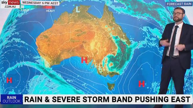
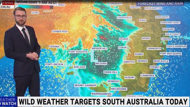
Parts of southeast Australia are getting a taste of La Nina-style showers, winds and thunderstorms this week, with severe weather and major flood warnings in place across the country.
NSW and South Australia are expected to experience the worst of it on Tuesday due to a series of cold fronts, while Victoria and Queensland will also be impacted.
The Bureau of Meteorology has warned residents in those areas it could be cold, wet and windy for the rest of the week.
“A series of cold fronts will bring cool, wet and windy conditions to southeast Aus for the rest of the week. Thunderstorms for inland areas may produce heavy rainfalls,” it said.
A series of cold fronts will bring cool, wet and windy conditions to south-east Aus for the rest of the week. Thunderstorms for inland areas may produce heavy rainfalls.
— Bureau of Meteorology, Australia (@BOM_au) September 19, 2022
âš ï¸ #Flood Warnings remain current and renewed flooding is possible. Latest: https://t.co/4W35o8i7wJpic.twitter.com/ztG0bgd66K
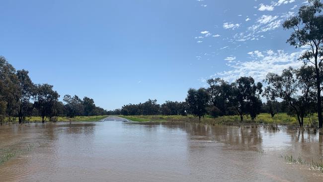
In NSW, flood warnings are in place across the state, with the potential for major flooding at multiple river catchments on Tuesday.
Along the lower Lachlan River, major flooding continued at Euabalong on Monday and peaked at 6.83m. It is likely to remain above the major flood level through to Friday.
The Lachlan River flood peak may also cause major flooding at Jemalong from Tuesday.
The Namoi River at Wee Waa (Glencoe) has been experiencing major flooding since Sunday morning. The river level is likely to peak near 6.9m overnight on Wednesday into Thursday.
Along the Narran River, major flooding is possible at Angledool from Tuesday as the floodwaters extend downstream.
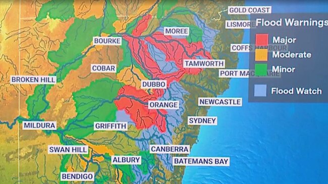
While some areas are expected to get a reprieve from Tuesday, the bureau has warned of renewed river level rises and prolonged flooding on Wednesday and Thursday.
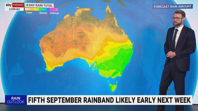
“A low pressure system is forecast to bring widespread moderate rainfall to inland NSW during Wednesday and Thursday,” it said.
“Rain is expected to initially develop in the west and is likely to spread through most of the state on Wednesday into Thursday as the low makes its way to the east during the later part of the week.
“The highest falls are likely through the inland, particularly in the Central West and North West Slopes and Plains.
“This rainfall may cause flooding along rivers in parts of the North West, Central West and South West inland catchments from late Wednesday, many of which are experiencing ongoing flooding due to previous rainfall in recent weeks.”
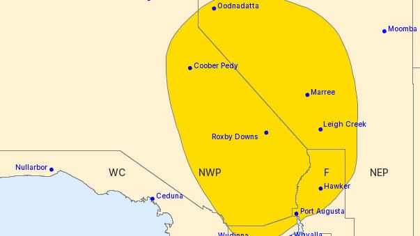
In South Australia, a severe weather warning for damaging winds is in place for Flinders and parts of the Eastern Eyre Peninsula, North West Pastoral and North East Pastoral districts.
Peak gusts of around 90km/h are possible from late Tuesday morning, with the SES advising residents to move their vehicles under cover or away from trees, secure loose items around their property and stay indoors and away from windows while the conditions are severe.
There were two incidents of fallen trees in Greenhill and Golden Grove respectively around 6am.
Adelaide is expected to be soaked on Tuesday, with a very high, near 100 per cent, chance of showers forecast in the CBD, Elizabeth, Glenelg and Noarlunga.
A separate severe thunderstorm warning may also be issued later in the day for northeastern parts of the state.
In Queensland and Victoria, minor to moderate flood warnings are in place for river catchments across both states.
Moderate flood warnings have been issued for the Balonne, Bokhara and Paroo rivers in Queensland.
In Victoria, moderate flood warnings are in place for the Loddon, Ovens and King rivers.
Originally published as Showers, wild winds and thunderstorms forecast for southeast Australia

Millions brace for brutal cold snap
Residents in the southern part of Australia should rug up extra warm this weekend as a cold snap settles in, bringing lashings of rain and damaging wind.

Delays as Bali flights resume after volcanic eruption
A volcanic eruption in Indonesia has disrupted travel for more than 14,000 passengers with delays and backlogs still expected.