
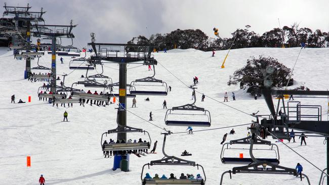
Windy, rainy winter for east coast and less snowfall over southern states
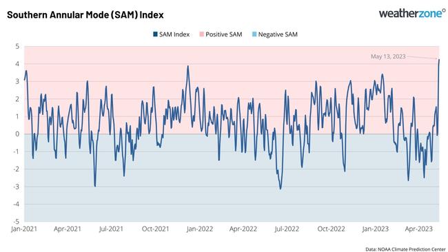
A climate driver index used by meteorologists to gauge weather shifts has recorded one of its highest daily readings on record.
Environment
Don't miss out on the headlines from Environment. Followed categories will be added to My News.
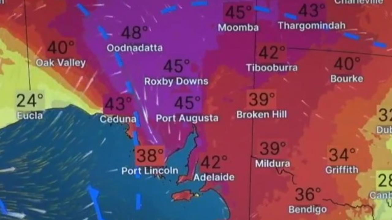
Extreme weather conditions are about to intensify over the east of Australia according to meteorologists, who are reporting more rain and strong winds for some states.
One of the main weather mechanisms which influences the climate in Australia, the Southern Annular Modular (SAM), just returned one of its strongest levels on record.
The “exceptionally high” value of +4.2 was recorded by meteorologists on May 13 and is among the top nine highest values reported in over 50 years.
The figure reaffirms Australia will be impacted by a positive phase of the SAM this winter.
“A positive phase of the SAM during winter moves the rain and snow-bearing cold fronts further south and causes easterly winds to increase over eastern Australia,” Weatherzone meteorologist Ben Domensino said.
“This typically reduces rainfall and snowfall over parts of southern Australia and allows more rain to fall in parts of Queensland and NSW.”
What is the weather going to be like for the rest of the week?
NSW
The temperature is not forecast to rise above 20C over the next seven days in Sydney.
Mostly sunny days are expected, but cold mornings, with a low of 8C, are likely.
VIC
There is a very high chance of showers in Melbourne in the coming days. However, the daily rainfall total should not exceed 4mm in the next week.
Northwesterly winds of between 20km/h and 30km/h are expected to be consistent in the mornings.
QLD
A week of mostly sunny weather is ahead for Brisbane residents, with a high of 23C in the next seven days.
Light winds are possible into early next week with a chance of a shower on Tuesday.
WA
Perth is experiencing a blast of warmer weather, with a run of two consecutive 26C days on Thursday and Friday.
Wind gusts of up to 60km/h are possible about the hills and foothills, increasing the risk of bushfire.

As of 10.45am, about 70 firefighters are working to control a blaze burning at Whitby and Mundijong, 50km south-east of Perth.
A warning has been downgraded to advice level, as there is no threat to lives or homes.
However, there remains a lot of smoke in the area and residents have been advised to shut their doors and windows.
SA
A week of persistent showers is forecast in Adelaide, with temperatures dropping to a high of 15C on Thursday.
Light winds of between 20km/h and 30km/h are expected over the weekend.
TAS
Showers are also likely to stick around in Hobart for the most of the next seven days.
The sun is set to poke out on Sunday with a top of 15C.
Wind gusts of between 15km/h and 30km/h are forecast for most days.
ACT
The mercury is expected to plummet below zero this week in the nation’s capital.
On Friday, an icy morning low of -2C will bring patches of frost and fog for some parts of the territory.
Skies will stay mostly clear and sunny for the next seven days.
NT
Darwin residents can enjoy a run of seven days with the maximum temperature soaring above 30C.
Wind gusts of between 15km/h and 30 km/h are expected most mornings.
What is the SAM?
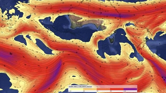
The SAM refers to the displacement of the powerful westerly wind belt which flows around Antarctica all year.
These winds carry cold fronts and low pressure systems which are responsible for seasonal rain, snow and wind in southern Australia.
It can have a recognisable influence on weather in different parts of Australia, though the influence is usually at its strongest during winter and summer.
Phases typically last for around one to two weeks and the fluctuation between positive and negative can be random and difficult to predict.
The SAM index has come close to reaching its current height twice in the last two years – in January 2022 and January 2021, according to US Climate Prediction Centre data.
Originally published as Windy, rainy winter for east coast and less snowfall over southern states
Building company fined for asbestos dumping
A construction company has been fined after providing false information to authorities about dumping asbestos at a property.
Major city swelters as temp soars to 43C
Aussies in one state are being urged to keep cool as temperatures climb above 40C while other parts of the country battle bushfires.