
Sydney a sweltering tinderbox: 35C by midday, and rising
GENERALLY when it’s sweltering the beach offers relief. Not today. Bondi is almost as hot Bankstown. Sydney Harbour’s a sweatbox. And NSW is on high fire alert.

technology/environment
Don't miss out on the headlines from technology/environment. Followed categories will be added to My News.
NEW South Wales is a tinderbox as Sydney swelters through Sunday and temperatures climb across the State, with the total fire bans and fire weather warnings in 11 areas of NSW.
As temperatures in Sydney soared past 35C at midday, Greater Sydney, Greater Hunter, Illawarra/Shoalhaven, Far South Coast, Monaro Alpine, Southern Ranges, Central Ranges, North Western, Lower Central W Plains, Sthn Slopes and the Eastern Riverina regions remained on high alert due to the hot, windy weather.
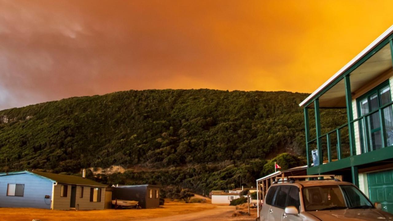
Two bushfires are out of control near Bega in the southeast of NSW as the entire state experiences hot and windy conditions.
The NSW Rural Fire Service on Sunday afternoon issued watch and act alerts for the fires at Bega and another near Goulburn, northeast of Canberra.
Temperatures in some areas today were tipped to top 40 degrees — 15 degrees above average for autumn — combined with winds between 30 to 60 kilometres an hour.
It’s the hottest start to Sydney autumn in almost two decades, and wind gusts expected to last all day will up the bushfire potential, rather than offer respite from the heat.
Total fire ban in place for Greater Sydney, Greater Hunter, Illawarra/Shoalhaven, Far South Coast, Monaro Alpine, Sthn Ranges, Central Ranges, Nth Western, Lower Central West Plains, Sthn Slopes & Eastern Riverina areas today. Hot, dry and windy conditions are forecast. #NSWRFS pic.twitter.com/lT9o8Xp48o
— NSW RFS (@NSWRFS) March 17, 2018
At midday, it was 36.4C at Sydney Airport; 34.7 in the CBD, 35C at Sydney Olympic Park and 35.7 at Bankstown. Richmond it was 37.2 at midday. Canterbury hit 35.1 at noon, and Penrith, 36.5C.
And it just got hotter.
By 3pm the CBD had hit 38, and Sydney Airport hit 40.2C half an hour later.
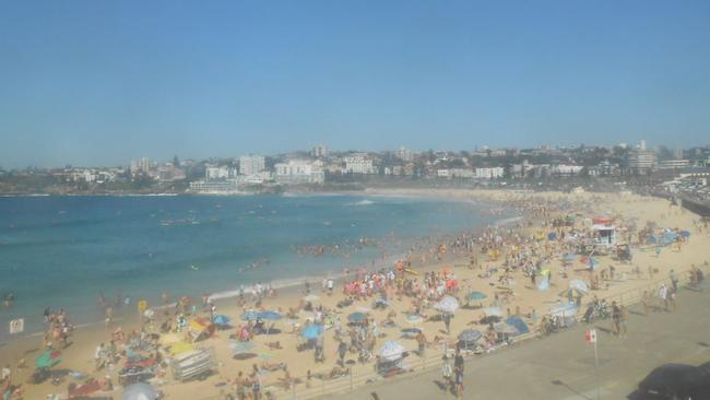
Sydneysiders thinking the beach might offer sweet relief were in for a shock.
Temperatures at Bondi are expected to hit 39C — the strong north-westerly winds fanning bushfire concerns also trumped any hope of a sea breeze which usually keeps temperatures about 10C lower than in the west. On Sydney Harbour, it was 37.5C at 3pm.
Snow again in the UK and I’m suffering with 40 degrees in Bondi 😂⛄ï¸
— Conway (@Just_Conway) March 18, 2018
“Normally there’s a big difference between the CBD and western Sydney because of the sea breeze, but the north-westerly winds are expected to be so strong on Sunday that there will be no sea breeze felt anywhere,” Weatherzone meteorologist Jessica Miskelly said.
In the west, the Lower Central West Plains and Eastern Riverina have total fire bans with temperatures in the high 30s.
In Bega the mercury hit 38.4C at 3pm while at Goulburn it was slightly cooler at 33C.
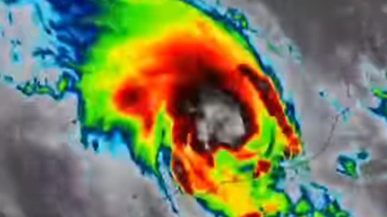
CYCLONE MARCUS
In Western Australia, Tropical Cyclone Marcus is expected to hit the Kimberley coast today as the clean-up gets underway in Darwin.
The category two system is continuing to intensify as it moves over the southern Timor Sea.
Wind gusts of more than 150km/hr are predicted to lash the WA coastline on Sunday, with the cyclone expected to hit the far north Kimberley Region about 8am AWST (11am AEDT).
Heavy rain and flooding in low-lying areas is also likely over the next 48 hours.
The Bureau of Meteorology predicts the cyclone should move off the coast on Monday morning, but it is unlikely to move far enough south to impact Broome and Derby.
The cyclone battered Darwin on Saturday, as 130km/hr winds brought down trees and power lines.
More than 25,000 properties remain without power.
#Wind is starting to pick up in the southeast. See latest #warning at https://t.co/QtaGyXGJQz and latest observations at https://t.co/602wJ8Ixfc or on MetEye. Winds expected to ease later today. pic.twitter.com/sa2z8HMDhd
— Bureau of Meteorology, New South Wales (@BOM_NSW) March 18, 2018
Already starting to see dangerous fire weather conditions in many areas. Temps in the high 30s and winds of around 50kph, like in Condobolin, Forbes, Parkes and Temora - and will intensify this afternoon. If you see any new fires, report them to 000 immediately. #NSWRFS #nswfires
— NSW RFS (@NSWRFS) March 18, 2018
Originally published as Sydney a sweltering tinderbox: 35C by midday, and rising
Community forced to self-evacuate in cyclone
A remote community in the Pilbara was forced to self-evacuate overnight as floodwaters in the wake of Cylcone Zelia threatened the town.
‘Volcanic’: Aussies battle raging fires
Residents in one state have captured startling photos showing apocalyptic scenes as they confront a complex web of bushfires.