
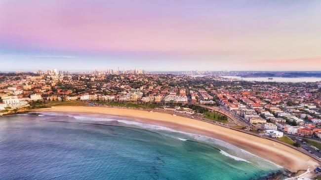
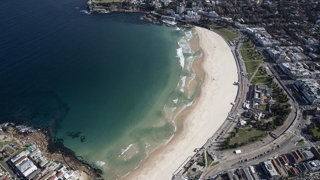
Bondi flood risk: New flood modelling for Waverley Council
As water recedes in the worst-affected parts of western Sydney, some Bondi residents were shocked to discover the flood risk for their properties had increased.
Wentworth Courier
Don't miss out on the headlines from Wentworth Courier. Followed categories will be added to My News.
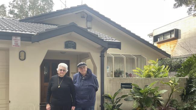
Eva Vargas was horrified when she opened a letter telling her the flood risk on her Bondi home had been raised.
“We’ve been quite upset about that,” Ms Vargas told the Wentworth Courier.
The surprise stems from a new flood study adopted by Waverley Council last April, with new modelling taking into account the potential impact of climate change on future flood events.
This has led to the flood risk for parts of Beach Rd and Curlewis St off Bondi Beach, O’Brien St in North Bondi and Ramsgate Ave, raised to a medium or high risk.
In response to the new modelling and new clauses introduced by the NSW Government to Waverley Council’s Local Environment Plan (LEP), council has reviewed and updated planning controls with the proposed changes now on exhibition.
“As a result of Waverley’s Flood Study and the NSW Government’s reform, planning controls have been reviewed and updated to ensure any new development in flood prone areas adequately reduces the risks and impacts of flooding,” a council spokeswoman said.
Ms Vargas, 71, said she can’t recall the consultation process referenced in the council letter informing her of the proposed changes to local planning controls, despite attending almost every precinct meeting held in her local ward.
“Anything that’s going on, we’re pretty clued up on what’s happening. But there has been nothing. The first thing we knew was getting that letter from the council,” she said.
A council spokeswoman said residents impacted by the change in flood risk and new planning controls were told how to give feedback via email, with the plan remaining on public exhibition until Thursday.
The spokeswoman also said community consultation stook place on the changes to the LEP between 2017 and 2021, including flyers to 31,000 households and businesses, community information sessions and resident interviews.
However, feedback about the new flood modelling or categorisation of risk will not be considered by council.
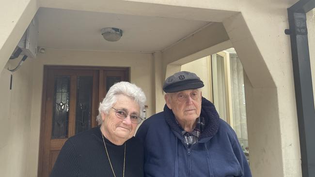
Ms Vargas was worried about the financial impact the changes in flood risk could have on her insurance costs as a self-funded retiree. She estimated her insurance could increase by $2000 once the new risk level is adopted by council.
“It would mean that my insurance will go sky high further than what it already is,” she said.
“It would cause financial problems to some degree, because we own two properties [and] we pay insurance on two properties.”
Ms Vargas, who has lived at King St in Bondi for 61 years, said she had seen low-lying areas of Rose Bay and Double Bay flood – but never Bondi.
Particularly not on King St which is off Bondi Rd and halfway down the hill to the beach.
“It‘s such a ridiculous thing,” Ms Vargas said.
Associate Professor Brian Cook, an expert in environmental risk, development, and flood management at the University of Melbourne told the Wentworth Courier that councils across Australia are re-examining flood risks across the board – even in areas not impacted by the recent devastating floods.
“Is it reasonable for the council to come to someone and say ‘hey, we used to think that you had low flood risk, but it turns out it‘s medium flood risk? You know, it‘s unpleasant. But it’s not unreasonable,” he said.
Mr Cook said as extreme weather events become more frequent, councils were engaging in more sophisticated modelling which could see changes to flood risk likely to become a more widespread concern.
“Some people might say ‘geez, you bought that property, it’s your asset, you’re responsible for whatever happens’, he said.
“And then someone else might say ‘the local council approved this, you know, they told you it was safe to build here. They allowed you to build there, they‘ve charged you fees and taxes’.
“But it will be a negotiated process between local councils, homeowners, and probably state and federal governments. It’s really a debate that Australia needs to have, because we’re very much going into a period of increased flood risk of more and more situations like this.”


Push to brighten up Paddington by relaxing heritage colour rules
The rules policing the colour palettes of iconic heritage listed terraces could be toned down, in a move which could allow businesses to turn their brightness up in Sydney’s inner east.

‘They’re off’: $962m king’s look into real estate woes
Australia’s newly crowned best-selling property agent has revealed an eye-opening look into what really happens behind the scenes when it comes to selling and buying our homes.