
BOM have enacted a flood watch for Riverina catchment areas
Heavy thunderstorms are forecast to roll in on Thursday, with up to 35mm of rain to hit the Riverina according to the Bureau of Meteorology. Find out more.
The Wagga News
Don't miss out on the headlines from The Wagga News. Followed categories will be added to My News.
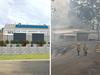
A flood warning has been issued for the Riverina, with the Bureau of Meteorology forecasting up to 35mm of rain on Thursday.
A series of troughs and a cold front are forecast to bring rainfall and vigorous winds to much of the state, including the Riverina, from Wednesday to Friday.
The bureau warns that moderate to possibly heavy rainfall may cause moderate to major flooding along the Tumut and Murrumbidgee Rivers from Thursday.
It comes as Water NSW increased Burrinjuck Dam releases from 2900 to 15,000 megalitres per day earlier this week due to the forecast rainfall.
“Moderate to possibly heavy rainfall is likely about South Western and Central Inland NSW,” a bureau spokesperson stated.
“This may cause minor to moderate flooding along the Castlereagh, Bell, Macquarie, Belubula and Queanbeyan Rivers, with moderate to major flooding possible along the Tumut and Murrumbidgee Rivers from Thursday.
“Renewed flooding is possible along the Bogan and Lachlan Rivers where flood warnings are current.”

On Thursday, be prepared for a top of 18 degrees, with heavy rainfall and thunderstorms likely, before conditions ease on Friday.
The bureau is continuing to monitor the situation and will issue further catchment specific warnings if and when required.

BOM meteorologist Stephen Stefanac said the wild weather conditions have been caused due to a unusual warm air mass.
“There will be a risk of thunderstorms (on Wednesday) evening in Wagga and risk of severe and damaging wind gusts throughout the Riverina into Thursday,” he said.


VOTE NOW: NSW local footy’s top cult hero
We’ve introduced you to more than 60 of the most enthralling cult heroes in NSW local footy. Now it’s time to have your say. VOTE for your favourite to be crowned the best in the state.

Hair today, stars tomorrow! City v Country passion, power, top shots
There were big hits and some hair-raising action – literally – at the 2025 City v Country junior rugby tournament. Check out some of the top shots.