Flood watch: Crews work to keep Kangaroo Valley open amid renewed rains
Traffic crews will remain on-site at Kangaroo Valley 24-hours a day to keep the town open to traffic, the state government has said as heavy rains and winds batter the state once again.
The South Coast News
Don't miss out on the headlines from The South Coast News. Followed categories will be added to My News.
Traffic crews are working to keep Kangaroo Valley open to motorists, with staff on-site 24-hours a day less than a month after landslides left the area completely cut-off.
This comes as heavy rains of up to 140mm are forecast to batter the state on Thursday, with minor flood warnings also being issued for the Shoalhaven River and St Georges Basin areas.
A Transport for NSW spokesperson said staff were escorting all motorists across Cambewarra Mountain to keep Kangaroo Valley open to residents, businesses, and visitors.
“The poor weather and significant damage have meant Barrengarry Mountain northwest of Kangaroo Valley is closed to all traffic,” the spokesperson said.

“Visitors are reminded they can still access Kangaroo Valley from the southeast via Cambewarra Mountain. While Cambewarra Mountain has also been damaged, crews are onsite to escort motorists safely through every half-hour with minimal delays being experienced.
The spokesperson said TfNSW was working to keep roads open, however the slope issues on Barrengarry Mountain were complex and that the agency had engaged specialist workers to assess the damage and plan repair work.
“This repair work is significant and we are anticipating it could take up to six months to restore access to Barrengarry Mountain. This timeline may change as further assessments are carried out,” the spokesperson said.

It is expected to take up to two years to restore the full length of Moss Vale Road to pre-flood condition.
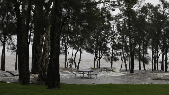
The Bureau of Meteorology issued numerous warnings of severe weather throughout the week, warning of renewed storm conditions, including heavy rains, dangerous winds, and possible flash flooding.
Many local councils carried out emergency works throughout the week to prepare areas already left damaged by storms over the past month for Thursday’s forecast.
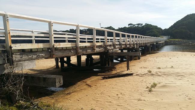
In the Bega Valley Shire, the council warned homes could be inundated after damaging waves shifted large quantitates of sand under the historic Cuttagee Bridge.
Video widely shared online showed waves crashing against the prized, historic bridge last week, only months after emergency work was carried out on the structure.
“Of immediate concern is the amount of sand that has been transported from the beach and dunes and deposited under and around the bridge effectively closing the lake entrance.”
The Bega Valley Shire Council said it anticipated that a major mechanical opening would have to occur to relieve the possibility of any inundation, but said any operation was weather dependent.

Further north, the Shoalhaven City Council announced on Wednesday it had mechanically opened Tabourie Lake after criticism from residents that the council had been too slow to open waterways at Shoalhaven Heads and in Tabourie during previous storm events.
“Although only 2mm of rainfall has been observed in the catchment during the past 48 hours, the lake level increased from 1.07m AHD to 1.35m AHD,” the council said.
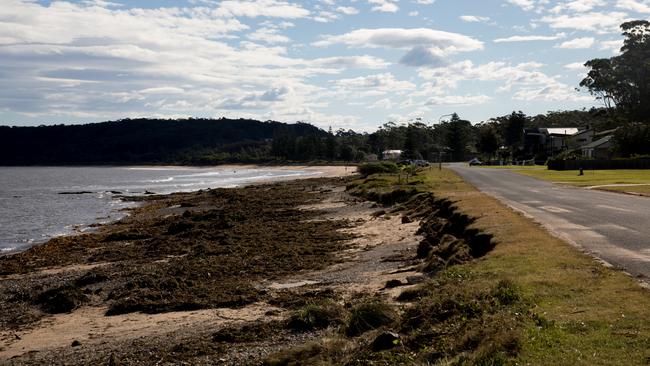
In the Eurobodalla, Long Beach, Surfside, Tomakin Cove and South Broulee beaches experienced significant erosion in the past week.
The Eurobodalla Shire Council said it was investigating options to protect Bay Rd at Long Beach after the dunes receded within one metre of the road.
The Moruya Breakwall, managed by Transport for NSW, was also damaged and is expected to be closed until repairs can be made in May.
Council’s coastal and flood planner Cameron Whiting said there were no “big surprises” in terms of impacts from the weekend’s one-in-20-year event. He said it reflected modelling outlined so far in the council’s Open Coast Coastal Management Program (CMP), which looks to identify areas at risk of coastal hazards, as well as appropriate measures to protect them.
“The storm reinforced our understanding of the areas that are vulnerable, how they will behave under certain conditions and that our coastal hazard assessment mapping has been on the right track,” he said.

Mr Whiting said that as part of the CMP process, Council would present a range of mitigation options for the community to consider in the coming months, including for the high priority areas.
“We’re modelling a range of ‘soft and hard’ solutions for high priority areas, which include Surfside, Wharf Road, Long Beach and Caseys Beach,” he said. “These range from rock walls, groynes and levies to beach nourishment and revegetation,” Mr Whiting said.
“Significant works such as these need to be considered thoroughly – they require detailed design, costing and agreement from the community, government agencies and Council – and of course then they need to be funded.”
TfNSW has also said: “Motorists are reminded that with the closure of Barrengarry Mountain, detours are in place via Hume Motorway, Picton Rd and the Princes Hwy. Light vehicles can also detour via Jamberoo Mountain Rd, adding up to an additional 30 minutes to travel times.
“Vehicles over 10 metres, vehicles over 12 tonnes, buses and vehicles towing caravans of any size need to detour via Hume Motorway, Picton Rd and M1 Princes Motorway, adding up to an additional 60-90 minutes to travel times.
“Transport for NSW is also investigating options to carry out maintenance work on Hampden Bridge while the road is closed to avoid further closures once roads reopen.”


