
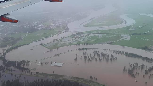
Newcastle, Hunter flood watch: Hunter River breaks its banks, supplies air-dropped to isolated Putty residents
The SES has urged residents in low-lying areas of the Hunter Valley town of Singleton to consider leaving early and prepare for evacuation with flood levels expected to reach 11.8m on Wednesday night.
Newcastle
Don't miss out on the headlines from Newcastle. Followed categories will be added to My News.
THIS LIVE BLOG HAS NOW ENDED
THURSDAY 10AM:
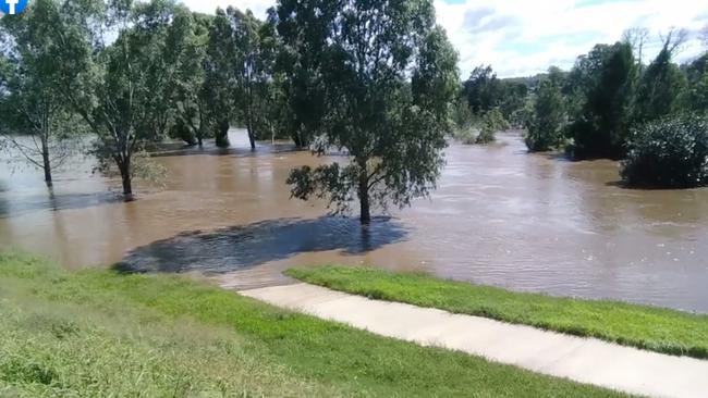
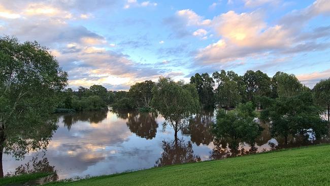
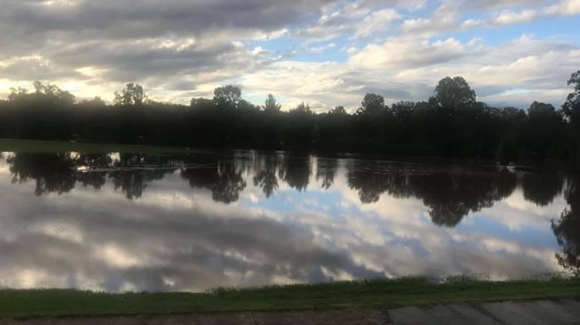
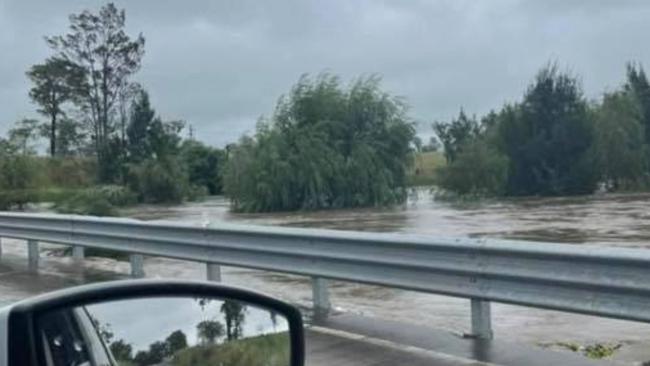
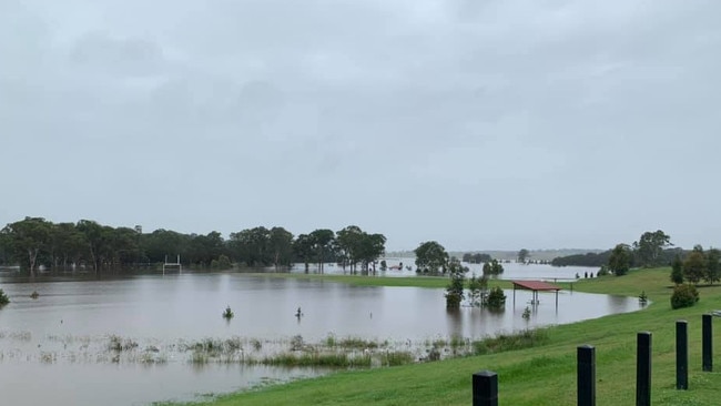
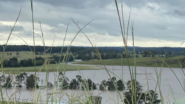
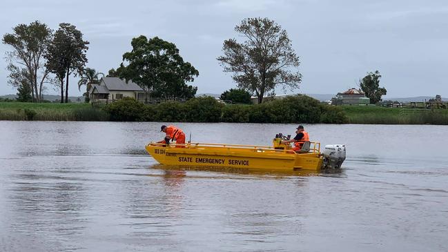
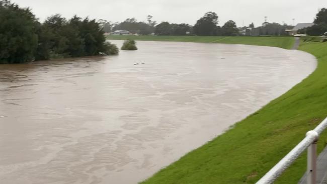
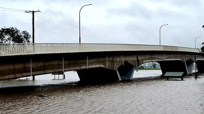
The Hunter River at Singleton peaked at 12.17m early this morning and is slowly falling. Moderate flooding is occurring.
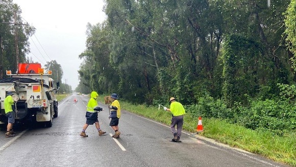
A number of roads throughout the Singleton Shire remain closed, including Bridgman Rd.
The river is expected to peak at Maitland at 7.3m tomorrow.
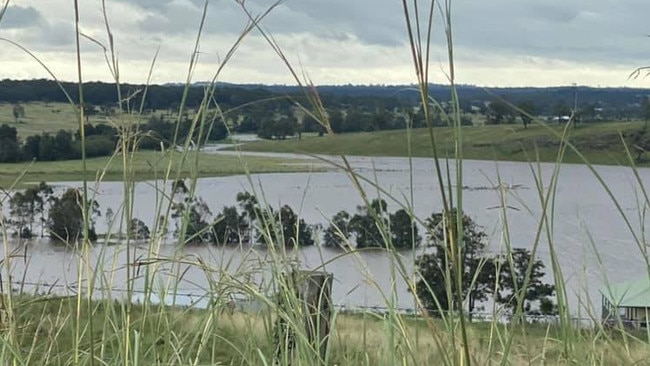
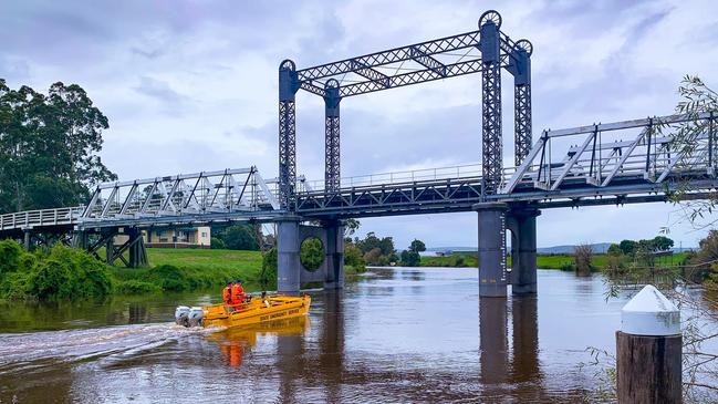
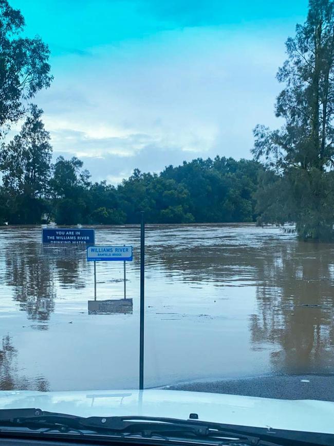
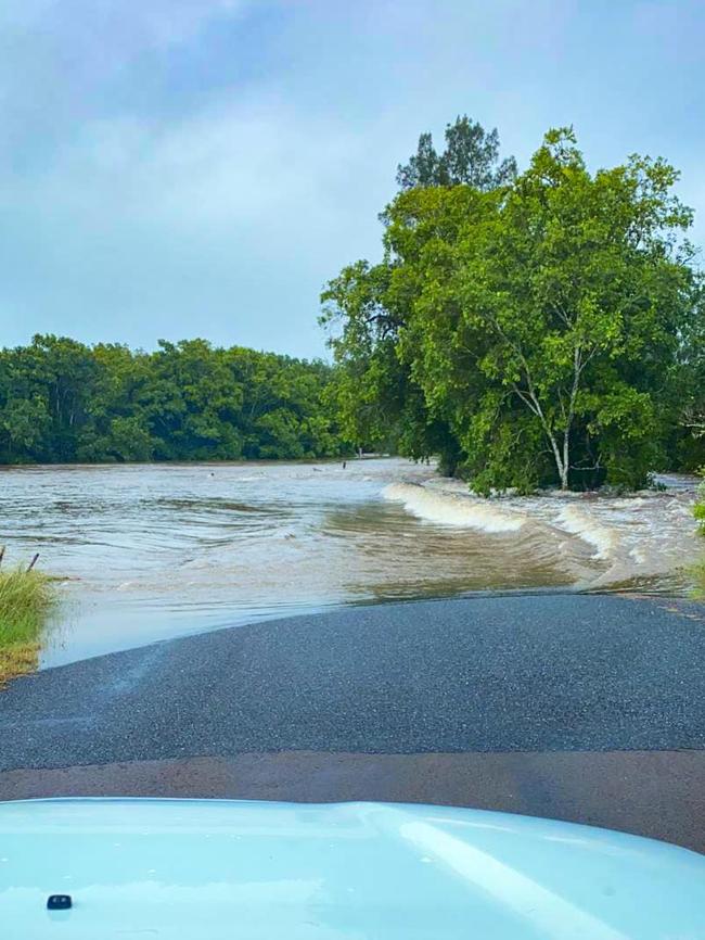
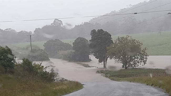
Major flooding of the Wollombi Brook at Bulga is still occurring but is falling slowly after peaking on Tuesday.
WEDNESDAY 4.30PM:

The Hunter River is nearing its peak at Singleton, currently at 11.47m and still rising.
The river is expected to reach its highest point at 11.8m later tonight.
An evacuation warning remains in place for low-lying areas including Whittingham, Scotts Flat, Glenridding, Dunolly and Combo Lane.
Residents have been told to prepare to leave at the direction of the SES.
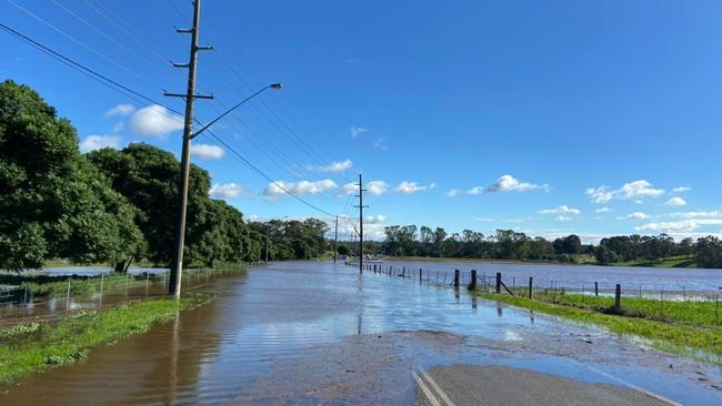
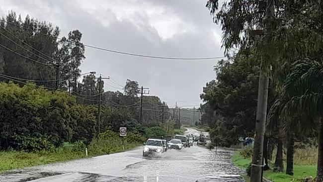
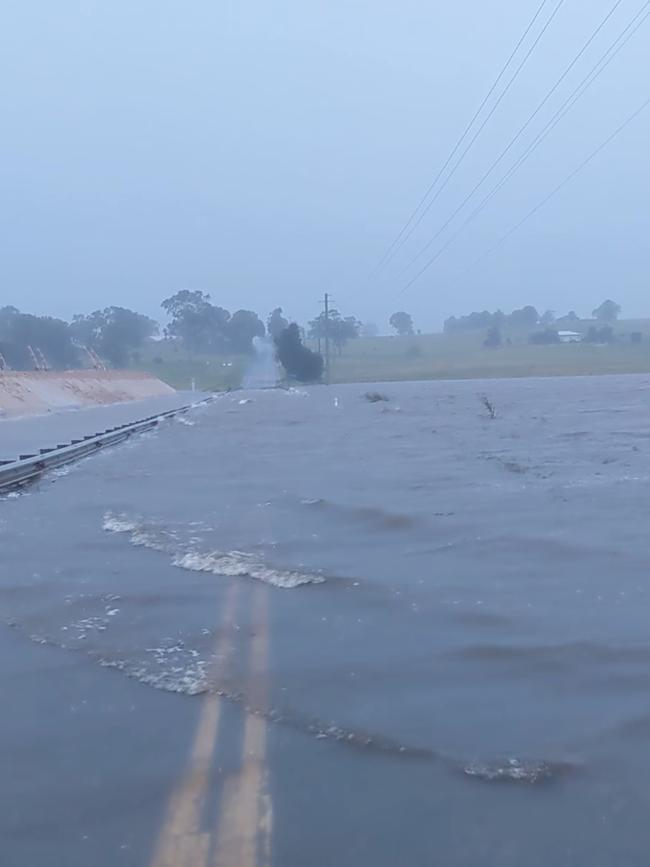
Bridgman Road between the New England Highway and Blaxland Ave remains closed, with deep water making it too dangerous to cross.
It’s among a number of road closures within the Singleton area.
Meanwhile the Hunter River is causing minor flooding at Maitland, where it’s expected to peak at 7.3m on Friday.
Major flooding is still occurring along the Wollombi Brook at Bulga.
It peaked at 6.37m on Tuesday afternoon and is falling slowly.
Further south at Wollombi it peaked at 7.95m on Monday night. No further flooding is expected there.
The region experienced its first sunny day in some weeks today.
Newcastle saw a top of 28 degrees while Singleton reached 29 degrees.
Showers are expected to return next week.
WEDNESDAY 12PM:
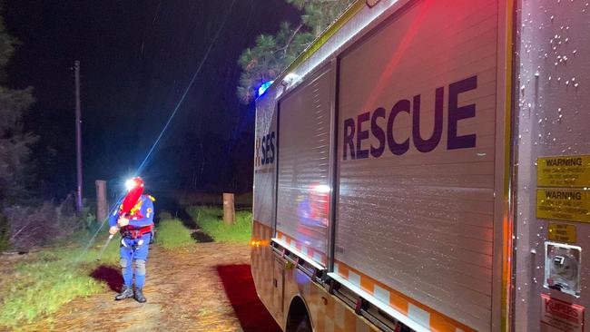
A helicopter will drop food and other emergency supplies to isolated properties at Putty, 80km southwest of Singleton.
The community has been cut off by major flooding of the Wollombi Brook.
Flooding of the waterway at Bulga is currently at 6.21m, having peaked yesterday afternoon. The water level is slowly falling.
The Hunter River is nearing 11.5m at Singleton and is expected to peak at 11.8m tonight.
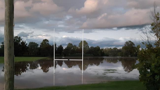
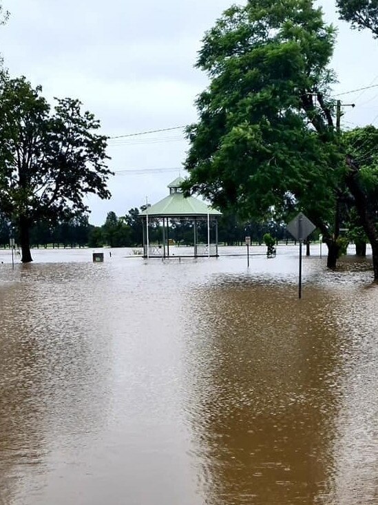
Flooding has so far been contained to the area immediately around the river, including Rose Point and Cook parks.
Singleton SES Unit said it was working on a plan should the situation deteriorate.
“There is still only an evacuation warning for some areas in place and that hasn’t changed to an order,” the unit said in a statement on Wednesday morning.
“If we see a change in this the SES will go back out to any communities that need to evacuate and will door knock again.
“Bridgman Road remains closed as well as a few more local low lying roads.
“Rose Point Park also remains closed and there is significant amounts of water over Rose Point Park and Cook Park.”
WEDNESDAY 8AM:
Rain has eased across the region but a number of flood warnings remain in place.
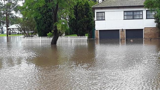
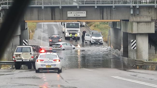
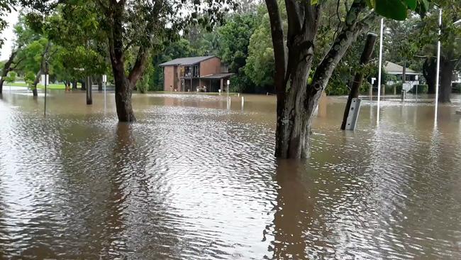
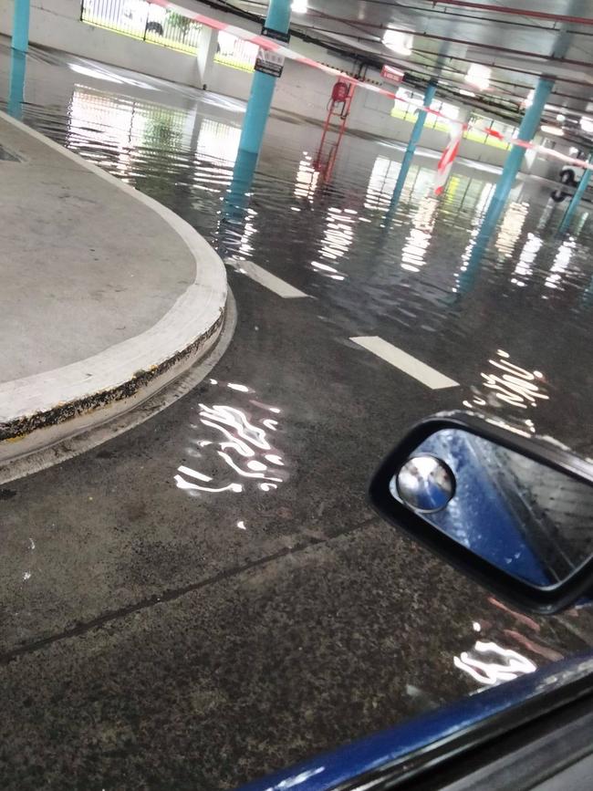
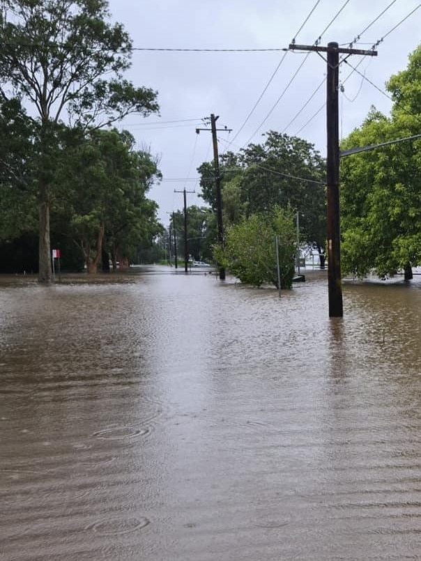
The Hunter River broke its banks at Singleton late yesterday, with water spilling over Cook and Rose Point parks.
But locals and the SES are hopeful the flooding will be contained to that area.
The river is still rising – expected to reach the moderate flood level of 11.5m at 10am and peak at 12.16m at 5am Thursday.
An evacuation warning remains in place for low-lying areas including Whittingham, Scotts Flat, Glenridding, Dunolly and Combo Lane.
Residents have been told to prepare to leave at the direction of the SES.
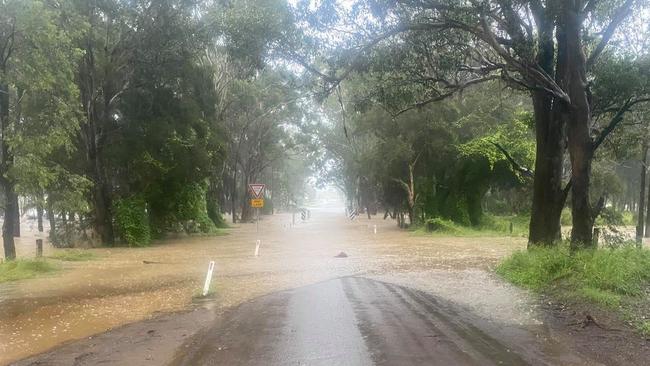
A number of roads remain closed due to flood risk or water on the road at Singleton:
- Bridgman Road (water currently still rising towards Blaxland Ave)
- Box Gap Road, Putty
- Cassells Road (causeway)
- Cemetery Lane
- Cranky Corner Road North (causeway)
- Glendon Lane (at the intersection of Glendon Road, at the intersection of Elderslie Road and at Christian Badior Bridge)
- Goorangoola Road (causeways – various)
- Lemington Road at Moses Crossing
- Mitchells Flat causeway
- Myall Creek Road (causeway)
- Oakley Lane (causeway)
- Putty Valley Road (at Putty Creek)
- Putty Road (5km North of Grey Gum Cafe due to landslip)
- Standen Drive (near Kirkton PS)
- Stanhope Road (at intersection with Lambs Valley Road)
- Stanhope Road near Stewart Creek (~300m from Elderslie Road intersection)
- Westbrook Road (causeway)
- Wollombi Road (Payne’s Crossing and just past 100km zone leaving Broke)
The Hunter River is also causing minor flooding at Maitland.
It’s currently at 6.48m and rising – expected to peak at 7.36m on Friday.
Major flooding is still occurring along the Wollombi Brook at Bulga.
It peaked at 6.37m on Tuesday afternoon and is falling slowly.
Further south at Wollombi it peaked at 7.95m on Monday night. No further flooding is expected there.
SES ADVICE
- Move vehicles under cover or away from trees.
- Secure or put away loose items around your house, yard and balcony.
- Keep at least eight metres away from fallen power lines or objects that may be energised, such as fences.
- Trees that have been damaged by fire are likely to be more unstable and more likely to fall.
- Report fallen power lines to either Ausgrid (131 388), Endeavour Energy (131 003), Essential Energy (132 080) or Evoenergy (131 093) as shown on your power bill.
- Don’t drive, ride or walk through flood water.
- Keep clear of creeks and storm drains.
- If you are trapped by flash flooding, seek refuge in the highest available place and ring Triple-0 if you need rescue.
- Be aware that run-off from rainfall in fire affected areas may behave differently and be more rapid. It may also contain debris such as ash, soil, trees and rocks.
- After bushfires, heavy rain and the loss of foliage can make the ground soft and heavy, leading to a greater chance of landslides.
- Stay vigilant and monitor conditions. Note that the landscape may have changed following bushfires.
- For emergency help in floods and storms, ring your local SES Unit on 132 500.
TUESDAY 9.30PM:
The Hunter River has broken its banks at Singleton, with water spilling across Cook and Rose Point parks.
The river has not broken the levee that separates the parks from the town centre.
The Dunolly side of the river is also flooding, with Bridgman Rd closed between the New England Hwy and Blaxland Ave due to water on the road.
The river is expected to reach 11.5m overnight and into Wednesday morning.
Residents in low-lying areas including Whittingham, Scotts Flat, Glenridding, Dunolly and Combo Lane have been urged to leave.
TUESDAY 6.30PM:
The SES is preparing to issue an evacuation order for residents of Whittingham, Scotts Flat, Glenridding, Dunolly and Combo Lane at Singleton.
The Hunter River at Singleton is likely to reach the moderate flood level of 11.5m overnight and into Wednesday morning.
Residents in low-lying areas have been told to prepare to leave at the direction of the SES.
“Storm and flood impacts may interrupt essential services such as electricity, phones, internet, water and sewerage,” the SES Hunter Unit said in a statement.
“People in these areas need to closely monitor weather and road closures and make informed decisions early based on individual circumstances.
“Residents should monitor the situation and be prepared to evacuate when instructed to do so.”
The SES said people should seek to stay with family and friends, but an evacuation centre will be opened if needed.
Residents have been told to move important items above predicted flood height, gather pets, medications, warm clothes and important documents, leave early to avoid road closures, and tell friends and family of their movements.
SES ADVICE
- Move vehicles under cover or away from trees.
- Secure or put away loose items around your house, yard and balcony.
- Keep at least eight metres away from fallen power lines or objects that may be energised, such as fences.
- Trees that have been damaged by fire are likely to be more unstable and more likely to fall.
- Report fallen power lines to either Ausgrid (131 388), Endeavour Energy (131 003), Essential Energy (132 080) or Evoenergy (131 093) as shown on your power bill.
- Don’t drive, ride or walk through flood water.
- Keep clear of creeks and storm drains.
- If you are trapped by flash flooding, seek refuge in the highest available place and ring Triple-0 if you need rescue.
- Be aware that run-off from rainfall in fire affected areas may behave differently and be more rapid. It may also contain debris such as ash, soil, trees and rocks.
- After bushfires, heavy rain and the loss of foliage can make the ground soft and heavy, leading to a greater chance of landslides.
- Stay vigilant and monitor conditions. Note that the landscape may have changed following bushfires.
- For emergency help in floods and storms, ring your local SES Unit on 132 500.
TUESDAY 5PM:
Singleton is preparing for moderate flooding overnight.
The Hunter River is still rising and expected to reach 11.5m into Wednesday morning.
Maitland will experience minor flooding earlier this evening.
The river exceeded 5.9m at Maitland about 5pm and could rise to 7.2m into the morning.
Major flooding is still occurring along the Wollombi Brook at Bulga (peaking at 6.6m) and minor flooding further south at Wollombi.
Wollombi could see a renewed river level rise to 8.6m overnight.
A severe weather warning for Newcastle, Lake Macquarie and the Hunter was cancelled on Tuesday evening, as the rain begins to ease.
TUESDAY 12.30PM:
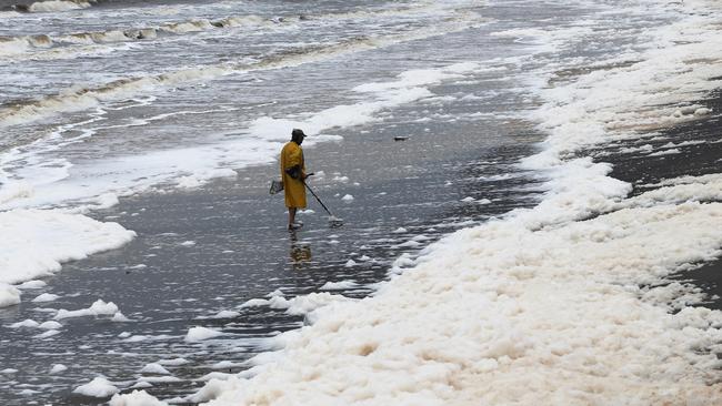
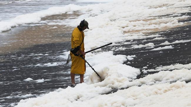
Stockton Beach has long been under threat of erosion and now it has another issue to contend with.
Wild weather and dangerous surf have caused sea foam to wash up along the beach.
As of lunchtime Tuesday, a severe weather warning remains in place for Newcastle and the lower Hunter.
The warning is for heavy rain, damaging winds, abnormally high tides and damaging surf.
River flooding is still a risk along the Wollombi Brook at Wollombi and Bulga, and the Hunter River at Maitland and Singleton.
“A strong high pressure system over the southern Tasman Sea is slowly moving east while a low pressure trough, currently over the eastern inland, continues to deepen and track to the southeast, bringing rain to the north and southeast,” the Bureau of Meteorology said in a statement.
“Heavy rainfall will begin to east about central and northeastern districts today, while developing about the southeast.
“Strong winds, damaging surf and abnormally high tides along the coast, but the areas of heavy rainfall will contract to the Southeast by the end of Tuesday or early Wednesday as the low pressure system heads off to the south coast and a drier air mass follows in the wake.”
TUESDAY 9AM:
Major flooding is occurring along the Wollombi Brook at Bulga. It is expected to reach 6.6m this afternoon.
Moderate flooding is occurring further south at Wollombi. It is expected to reach 8.6m at 10am.
Minor flooding is predicted along the Hunter River at Singleton (expected 10m) and Maitland (expected 5.9m) early this afternoon. The river may rise further to 7.2m into tomorrow morning.
MONDAY 5.15PM:
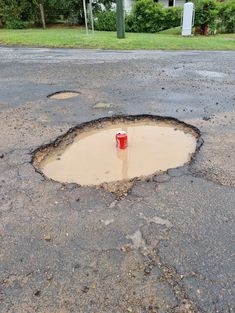
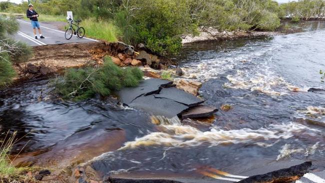
With the rain has come a mammoth clean up task for councils as they try to mend local roads which have been impacted by flooding.
Roads across Port Stephens in particular have received a battering, with widespread damage across the region, as an increased number of potholes provide an obstacle for drivers.
Some of the main roads affected have included Port Stephens Dr and Gan Gan Rd at Anna Bay, Shoal Bay Rd at Shoal Bay, Lemon Tree Passage Rd at Salt Ash, Brandy Hill Dr at Brandy Hill and High St at Wallalong.

“During this severe weather event, we’ve had works crews out fixing large potholes to make roads safe for our community,” a Port Stephens Council spokesman said.
“After severe weather events, we prioritise fixing potholes as quickly as possible.
“We had five trucks out today with crews fixing potholes right across Port Stephens and will continue this until all roads are made safe.”
READ MORE: NELSON BAY HOMES INUNDATED WITH FLOOD WATER
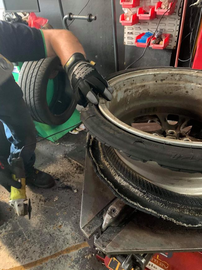
On Sunday, the crew at Fingal Bay Service Station and Tyres were inundated with calls for help from people who failed to dodge the many potholes on local roads, and came off second best.
“We had attended to seven tyres yesterday (Sunday) and had four vehicles towed to us since Friday. Today (Monday) by 12 noon we repaired and booked in 18 tyres that were damaged by people hitting pot holes,” an employee said.
“The tyres are just shredded and a lot of them are from one or two particular potholes which have been huge, massive potholes.
“The phones have not stopped today.”
Posted to their Facebook page the crew – who usually don’t work on Sundays – said they were happy to come and help the many motorists who got in a bit of trouble, as long as they brought them a feed of roast lamb.
“Obviously with this weather the pot holes are a lot worse than normal however we are always on call on Sundays and after hours,” the employee added.
“Issues caused by people hitting pot holes have been damaged suspension, buckled rims, shredded tyres from the smallest cars up to the SUV types.”
Maitland which has also been subject to minor flooding also suffered a high number of potholes.
Council said it has a full time crew attending to road surface damages across the local government area, applying a range of treatments.
“Extended periods of wet weather are one of the key factors in accelerated deterioration of road surfaces,” a Council spokesman said.

“During these periods, council reallocates its resources to increase the crews that work on repairing surface damage, focusing on short term treatments that can be applied during wet periods to ensure that safety is maintained for road users.
“Following the wet weather periods, additional treatments that may be needed are carried out as prioritised in council’s city wide road maintenance program.”
MONDAY 5PM:
Severe weather conditions and the risk of flooding in some parts of the region are expected to remain into Tuesday.
As of Monday evening, a severe weather warning remains in place for much of the state, including Newcastle, Lake Macquarie and the Hunter was reissued on Monday afternoon.
Heavy rain, damaging winds, abnormally high tides and damaging surf are forecast.
“A strong high pressure system over the southern Tasman Sea continues to drive widespread and persistent rain onto the New South Wales coast,” the Bureau of Meteorology said in a statement.
“Meanwhile, a low pressure trough in the state‘s west is deepening, bringing rain areas to the northern inland.”
A low pressure system potentially may form on Tuesday as the trough reaches the Tasman Sea.
MONDAY 4PM
Major flooding along the Wollombi Brook at Bulga is expected to continue into Tuesday.
There’s also a moderate flood warning along the Wollombi Brook at Wollombi.
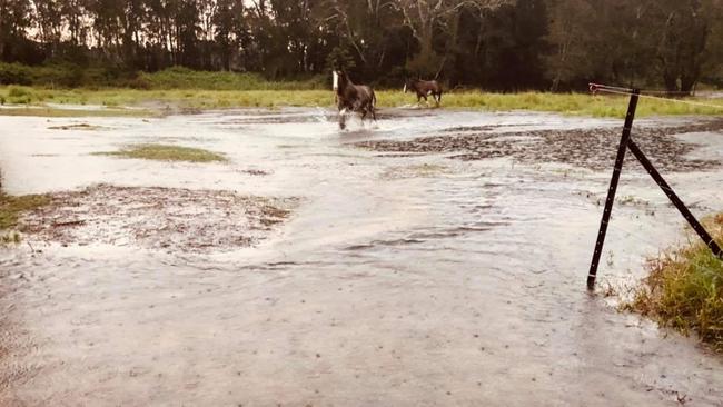
Farmers in low-lying areas have been asked to move machinery, livestock, pumps and fodder to higher ground.
Emergency crews have also been keeping a close eye on Singleton and Maitland, with the Hunter River expected to reach minor flood levels.
“Further rainfall is predicted over the remainder of Monday and Tuesday, which may cause further river rises throughout the Hunter Valley,” Hunter SES Unit said in a statement.
SES ADVICE
- Move vehicles under cover or away from trees.
- Secure or put away loose items around your house, yard and balcony.
- Keep at least eight metres away from fallen power lines or objects that may be energised, such as fences.
- Trees that have been damaged by fire are likely to be more unstable and more likely to fall.
- Report fallen power lines to either Ausgrid (131 388), Endeavour Energy (131 003), Essential Energy (132 080) or Evoenergy (131 093) as shown on your power bill.
- Don’t drive, ride or walk through flood water.
- Keep clear of creeks and storm drains.
- If you are trapped by flash flooding, seek refuge in the highest available place and ring Triple-0 if you need rescue.
- Be aware that run-off from rainfall in fire affected areas may behave differently and be more rapid. It may also contain debris such as ash, soil, trees and rocks.
- After bushfires, heavy rain and the loss of foliage can make the ground soft and heavy, leading to a greater chance of landslides.
- Stay vigilant and monitor conditions. Note that the landscape may have changed following bushfires.
- For emergency help in floods and storms, ring your local SES Unit on 132 500.
MONDAY 1.30PM:
A severe weather warning has once again been issued for Newcastle, Lake Macquarie and the Hunter.
The warning is for heavy rain, damaging winds, abnormally high tides and damaging surf.
Rain may cause flash flooding in some areas.
MONDAY 1PM:
People in low-lying parts of the Wollombi Brook area have been told to leave immediately.
An evacuation centre has been set up for those unable to go to family or friends.
The Wollombi Brook at Wollombi is peaking around 7.06 metres with minor flooding. The Wollombi Brook at Wollombi is expected to remain above the minor flood level (6.70m) during Monday with rises to moderate flooding possible on Tuesday.
The Wollombi Brook at Bulga may reach around 5.5 metres late Monday afternoon with major flooding. Further rises are possible.
A major flood warning has been issued for the area.
MONDAY 12PM:
Singleton Council has convened its incident response team.
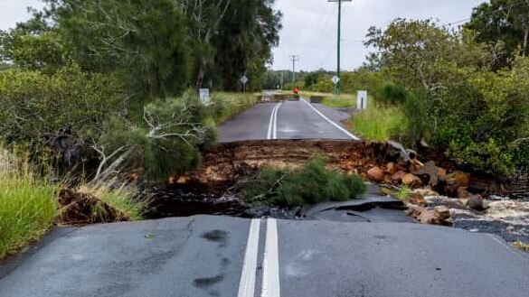
“Council crews have been working around the clock since Friday to respond to incidents and to ensure the safety of the community, including land slips on Carrowbrook Road, water over roads, and two vehicles lost in causeways,” council general manager Jason Linnane said.
“Crews are today double checking road closures as well as inspecting critical assets such as bridges and causeways for damage.
“Staff are providing twice daily briefs and will prioritise road defects on major roads.”
Residents were asked not to visit Singleton’s waste management facility until conditions ease.
MONDAY 11.45AM:
NSW premier Gladys Berejiklian said it was “pretty much a miracle” no lives had been lost, as she provided an update on the state’s flood crisis.
“So far the SES has been called out at least 8000 times,” Ms Berejiklian said.
“There are around 15,000 people who have been evacuated from around the Mid-North Coast, from their homes.
“In the Nepean, Richmond Valley region, Hawkesbury region, there have been around 3,000 evacuations to date.
“Nineteen evacuations orders have been issued with potentially more to come.”
The premier said a state emergency hub had been convened at Homebush.
“The situation is evolving,” she said.
“The heavy rains are going to continue.
“The NSW Government is taking a very holistic approach.
“All of our agencies are working together.”
Ms Berejiklian said she’d already spoken with the prime minister Scott Morrison about ADF support in flood-affected areas.
“Often when we need ADF support it’s in recovery.
“Once the rainfall subsides and the real clean up starts, that’s when we may need ADF assistance … (the prime minister) said he’d be willing to provide that support.
“While the rain is still falling, our immediately priority is to save lives.”
DISASTER RELIEF
A number of areas across the Hunter have been included in disaster recovery payments, with the state’s flood disaster expected to come with a massive clean-up bill.
Available immediately, eligible people in the local government areas of Cessnock, Dungog Shire, Lake Macquarie, Maitland, Newcastle and Port Stephens will have access to the Federal Government assistance.
Those eligible will receive a one-off payment of $1000 per adult and $400 per child to cover emergency costs. It doesn’t cover minor damage and inconvenience.
To make a successful claim, affected persons will need to show evidence and produce documents, such as proof of hospital admission or severe damage to their homes.
Claims can be made until September 2021. More info HERE.
The Insurance Council of Australia has also declared a catastrophe for large parts of NSW.
It means claims from affected policyholders will be given priority by insurers and they will be triaged to direct urgent assistance to the worst-affected property owners.
Newcastle Insurance Group’s Managing Director Gavin Walker said in any instance, people should call the SES, but then their insurers to ensure they can get to their claims quicker.
“First of call the SES if there is danger of further damage, but then ring your insurance company,” he said.
“They may need to make safe arrangements so they can get to you quicker.
Mr Walker said people need to make sure they have the right cover to start with, to ensure they don’t get caught out in events like these.
“Making sure people are covered for accidental damage, as well as fire and flood,” he added.
“If an assessor comes out and sees there is a fault in the roof or window etc. and deems it wasn’t just the storm that caused this, a claim may be denied.
“It can go on your record and becomes very hard to get affordable insurance after that.
“Brokers can manage a claim on your behalf and we can even withdraw a claim so it doesn’t go on your record if need be.”
MONDAY 10AM:
A number of roads remain closed due to flooding or damaged surface:
NEWCASTLE
- Shortland Esplanade, Newcastle
- Anderson Drive, Beresfield
LAKE MACQUARIE
- Fegan Street from Withers Street to Notley Way, West Wallsend
- Durham Drive, Edgeworth
- The Weir Road, Barnsley
- Macquarie Road, Fassifern
- Wangi Road, Toronto
- Kalaroo Road, Redhead
- Medcalf Street, Warners Bay
- Warners Bay Road, Charlestown
- Oakdale Drive, Gateshead
- Kalaroo Road, Redhead
MAITLAND
- Brush Farm Road, Maitland
- Scotch Creek Road, Millers Forest
- Martins Wharf Road, Millers Forest
- Prices Road, Millers Forest
- Cross Road, Millers Forest
- Edithville Road, Millers Forest
- Manerys Road, Millers Forest
- Reeds Road, Millers Forest
- Dockyard Road, Millers Forest
- David Road, Millers Forest
- Nalleys Creek Road, Millers Forest
- Alnwick Road to Lamb St, Millers Forest
- Woodberry Road, Woodberry
- Cessnock Road, Gillieston Heights, Testers Hollow
- Duckenfield Road, Berry Park
- Dickenson Road, Melville
- Allandale Road, Road
- Maitland Vale Road, Rosebrook
- Melville Ford Bridge, Aberglasslyn
CESSNOCK
- Old North Road, Rothbury
- Richmond Vale Road, Richmond Vale
- James Lane, Sawyers Gully
- Alkira Ave, Cessnock
- Yilgarn Ave, Cessnock
- Pangari Parade, Cessnock
- Subiaco Ave, Cessnock
- Anzac Ave, Cessnock
- Government Circuit, Kearsley
- Watagan Creek Road, Laguna
- Dairy Arm Road, Laguna
- Murrays Run Road, Laguna
- Great North Road, Laguna
- Yango Creek Road, Laguna
- Upper Yango Creek Road, Laguna
- Milsons Arm Road, Wollombi
- Narone Creek Road, Wollombi
- Paynes Crossing Road, Wollombi
- Cessnock Road, Testers Hollow
PORT STEPHENS
- Cabbage Tree Road, Williamtown
- Nelson Bay Road and Medowie Road roundabout, Williamtown
- Elizabeth Ave, Raymond Terrace
- Bourke Street, Raymond Terrace
- Adelaide Street, Raymond Terrace
- Newline Road, Raymond Terrace
- Hinton Road, Hinton
- Wallalong Road, Wallalong
- High Street, Wallalong
- Clarence Town Road, Seaham
- Newline Road, Eagleton
- Old Swan Bay Road, Twelve Mile Creek
- Hunter Street, Raymond Terrace
- Foreshore Drive, Corlette
- Wards Way, Salamander Bay
- Port Stephens Drive, Anna Bay
- Gan Gan Road, One Mile
- Nelson Bay Road, One Mile
- Moorooba Crescent, Nelson Bay
- Lily Hill Road, Nelson Bay
- Teramby Road, Nelson Bay
- Tomaree Headland
- Marine Drive, Fingal Bay
- Riverside Drive, Karuah
- Lemon Tree Passage Road, Salt Ash
- Wards Way, Salamander Bay
- Fullerton Cove Road, Fullerton Cove
SINGLETON
- Golden Highway at Mudies Creek
- Stanhope Road at intersection with Lambs Valley Road
- Mitchells Flat causeway
- Moses Crossing, Lemington Road
- Goorangoola Road
- Cranky Corner Road North
- Westbrook Road
- Cassells Road
MONDAY 9AM:
A major flood warning has been issued for Wollombi Brook and a minor flood warning for Maitland.
Major flooding is occurring along the Wollombi Brook at Bulga. It may reach around 5.5 metres late on Monday with further rises possible.
Minor flooding is occurring at the Wollombi Brook at Wollombi. It is peaking around 7.06 metres with possible further flooding on Tuesday.
Minor flooding is occurring along the lower Hunter River at Maitland.
A flood watch remains in place for parts of the state including Newcastle, Lake Macquarie and the Hunter.
A severe weather warning has been lifted for Newcastle and Lake Macquarie, but a severe weather warning for heavy rain remains in place for parts of the Hunter.
MONDAY 8AM:
Port Stephens SES unit responded to more than 100 calls for help between Thursday and Sunday.
On Sunday, while helping extract an injured person from their home, they were called to rescue an elderly person whose Williamtown home had been surrounded by flood waters.
Lake Macquarie SES responded to about 420 calls for help between Thursday and Sunday.
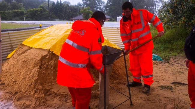
Each unit filled around 1000 sandbags on Sunday for those preparing for flooding.
Nelson Bay recorded 458mm of rain in the three days to Sunday morning, the highest ever three day total for the area since records began in 1889.
EARLIER:
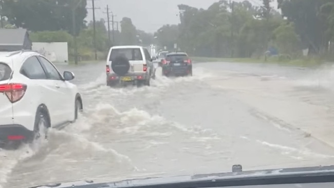
Roads have been closed and properties damaged as heavy rains across the region cause flash flooding and rivers to burst their banks.
A flood watch has been issued for parts of the state including Newcastle, Lake Macquarie and the Hunter.
Flooding is expected in those catchment areas from Sunday through to midweek.
People are reminded not to walk or drive into flood waters.
As of 7pm Sunday, a severe weather warning remained in place for Newcastle, Lake Macquarie and parts of the Hunter.
A low pressure trough along the coast is brining heavy rain and damaging winds, in addition to the risk of flooding.
Heavy rain and flash flooding have been deemed potentially life threatening in some areas.
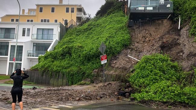
Landslips are a risk following heavy rain. Shortland Esplanade at Newcastle East has been closed due to a slip under beachfront properties. Some residents have been evacuated.
Conditions are expected to ease from Sunday night, although rain is still forecast for coming days.
As of 7pm Sunday, dozens of roads across the region were closed due to flooding.
NEWCATLE
- Shortland Esplanade, Newcastle
- Anderson Drive, Beresfield
LAKE MACQUARIE
- Fegan Street from Withers Street to Notley Way, West Wallsend
- Durham Drive, Edgeworth
- The Weir Road, Barnsley
- Macquarie Road, Fassifern
- Wangi Road, Toronto
- Kalaroo Road, Redhead
- Medcalf Street, Warners Bay
- Warners Bay Road, Charlestown
- Oakdale Drive, Gateshead
- Kalaroo Road, Redhead
MAITLAND
- Scotch Creek Road, Millers Forest
- Martins Wharf Road, Millers Forest
- Prices Road, Millers Forest
- Cross Road, Millers Forest
- Edithville Road, Millers Forest
- Manerys Road, Millers Forest
- Reeds Road, Millers Forest
- Dockyard Road, Millers Forest
- David Road, Millers Forest
- Nalleys Creek Road, Millers Forest
- Alnwick Road to Lamb St, Millers Forest
- Woodberry Road, Woodberry
- Cessnock Road, Gillieston Heights, Testers Hollow
- Duckenfield Road, Berry Park
- Dickenson Road, Melville
- Allandale Road, Road
- Maitland Vale Road, Rosebrook
- Melville Ford Bridge, Aberglasslyn
- Tocal Road, Tocal
CESSNOCK
- Old North Road, Rothbury
- Richmond Vale Road, Richmond Vale
- James Lane, Sawyers Gully
- Alkira Ave, Cessnock
- Yilgarn Ave, Cessnock
- Pangari Parade, Cessnock
- Subiaco Ave, Cessnock
- Anzac Ave, Cessnock
- Government Circuit, Kearsley
- Watagan Creek Road, Laguna
- Dairy Arm Road, Laguna
- Murrays Run Road, Laguna
- Great North Road, Laguna
- Yango Creek Road, Laguna
- Upper Yango Creek Road, Laguna
- Milsons Arm Road, Wollombi
- Narone Creek Road, Wollombi
- Paynes Crossing Road, Wollombi
- Cessnock Road, Testers Hollow
PORT STEPHENS
- Austral Street, Nelson Bay
- Bay Street, Nelson Bay
- Clarence Town Road, Seaham
- Clarence Town Road, Clarence Town
- Foreshore Drive, Corlette
- Lily Hill Road, Nelson Bay
- Marine Drive, Fingal Bay
- Moorooba Crescent, Nelson Bay
- Newline Road, Raymond Terrace
- Old Swan Bay Road, Twelve Mile Creek
- Parkes Street, Nelson Bay
- Riverside Drive, Karuah
- Teramby Road, Nelson Bay
- Wallalong Road, Wallalong
- Adelaide Street, Raymond Terrace
- Ferodale Road, Medowie
- Gan Gan Road, One Mile
- High Street, Wallalong
- Hinton Road, Hinton
- Hunter Street, Raymond Terrac
- Kangaroo Street, Raymond Terrace
- Lemon Tree Passage Road, Salt Ash
- Nelson Bay Road and Medowie Road roundabout, Williamtown
- Wards Way, Salamander Bay
There are also reports of water on the road around Sandgate, Jesmond, Hexham and Tomago.
SES ADVICE
- Move vehicles under cover or away from trees.
- Secure or put away loose items around your house, yard and balcony.
- Keep at least eight metres away from fallen power lines or objects that may be energised, such as fences.
- Trees that have been damaged by fire are likely to be more unstable and more likely to fall.
- Report fallen power lines to either Ausgrid (131 388), Endeavour Energy (131 003), Essential Energy (132 080) or Evoenergy (131 093) as shown on your power bill.
- Don’t drive, ride or walk through flood water.
- Keep clear of creeks and storm drains.
- If you are trapped by flash flooding, seek refuge in the highest available place and ring Triple-0 if you need rescue.
- Be aware that run-off from rainfall in fire affected areas may behave differently and be more rapid. It may also contain debris such as ash, soil, trees and rocks.
- After bushfires, heavy rain and the loss of foliage can make the ground soft and heavy, leading to a greater chance of landslides.
- Stay vigilant and monitor conditions. Note that the landscape may have changed following bushfires.
- For emergency help in floods and storms, ring your local SES Unit on 132 500.
Disaster assistance has been made available to 16 local government areas including Cessnock, Lake Macquarie, Maitland, Newcastle and Port Stephens.
People whose homes have been damaged or destroyed are among those eligible. For more information call 1800 018 444.
Read related topics:NSW floods
Join the conversation

From bush to Aussie rugby jersey! Country teens amazing story
Last year a teenager made his first NSW country team, played his heart out and is now inspiring other young guns from the bush as a rising star of rugby.
Read more

Four try hero, hot boot: Sydney 1st Colts rugby gets interesting
Just three rounds remain in Sydney Rugby Union 1st Colts and there is still plenty to play for, including spots in the finals series. Top try scorers, a hot boot and Rd 15 result wrap
Read more