
New mapping reveals north shore streets in line for increased density under NSW housing reforms
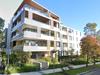
New mapping has revealed dozens of residential streets on Sydney’s north shore could be transformed with multi-storey units as part of a major shake up to the state’s planning laws.

North Shore
Don't miss out on the headlines from North Shore. Followed categories will be added to My News.
North shore councils are ramping up their fight against new housing density reforms for Sydney’s suburbs as new mapping reveals dozens of low density streets could be transformed with multi storey units.
Mosman and North Sydney Councils are the latest local government body to push back at NSW Government planning changes that would significantly increase the capacity for low and mid-rise housing in areas near town centres and train stations.
The planning overhaul is aimed at addressing Sydney’s housing shortage and meeting the National Housing Accord target of 377,000 new homes across NSW by 2029.
Prominent north shore developers have publicly backed the reforms, arguing there is a dire need for housing diversity to accommodate young families and key workers who have been priced out “huge swathes” of the region.
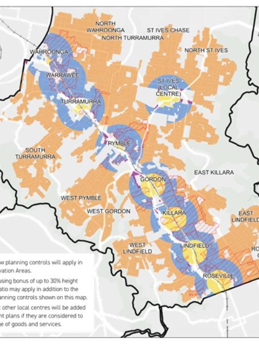
The planning changes include provisions for housing up to 21m tall – or about the size of a six storey building – within 400m of areas defined as ‘local centres’ and buildings up to 16m – or about the size of four storey building – in areas up to 800m walking distance.

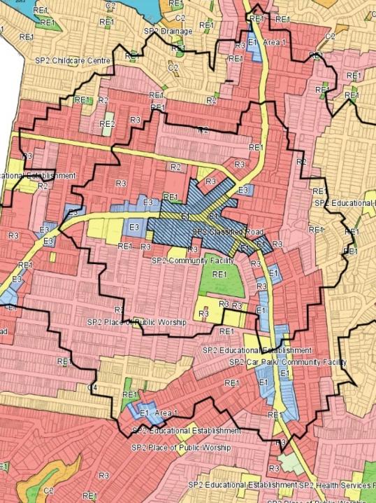
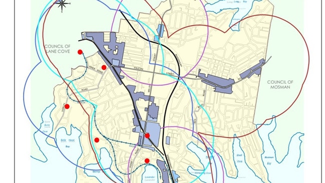
Mapping by Mosman Council has revealed the reforms could drive a development surge around the Mosman and Spit Junction town centres, stretching as far as Balmoral in the east and Macpherson St in the west.
Mapping by North Sydney Council shows the limits could see growth in almost half the local government area including suburbs such as Waverton, Kirribilli, Wollstonecraft and Neutral Bay.
Mosman Council – in an assessment of the planning changes – labelled the housing reforms “a one-size-fits-all approach” that could “radically transform the built environment”.
The assessment says increased development yields could also place “additional strain on already stretched infrastructure and services” such as schools, roads and public transport.
Mosman Council’s submission to the Department of Planning added that “consideration must be given to the individual circumstances of each local government area”.
Mark Monk, the director and chief executive of north shore developer Helm, says the reforms would support a diversity of housing on the north shore.
”The last development we undertook in Mosman took us 7.5 years to get over the line and it sold out in two hours – that highlights the demand,” he said.
“The reality is there have been very few rezonings in Mosman over the last 40 years and we’ve got a database of people wanting to downsize into apartments but won’t move because they can’t find anywhere close to the suburb they’ve lived in all their lives,” he said.
“As a consequence you have two people living in a five bedroom home while younger families aren’t able to move into homes.
“If we don’t provide a diverse range of housing we won’t have a diverse community and we’re already seeing that in Mosman.”
Many community members are meanwhile rallying against the housing reforms due to concerns rezoning would override heritage protection laws and significantly alter the character of local neighbourhoods.
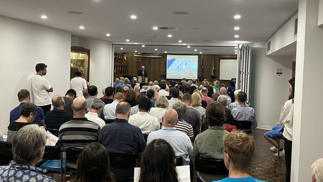
A community meeting in Ku-ring-gai last week heard multiple residents have already been approached by developers seeking to buy up properties in anticipation of the housing reforms.
Roseville local Kath Kirwan – an opponent of the reforms – says there should be laws to prevent increased density within areas defined as heritage conservation areas.
North shore developer Bill Heaton, chief executive of the Heaton Group, believes the current housing shortage is a result of councils ”holding up” new developments in their areas.
“The reforms aren’t saying ‘let’s put skyscrapers on the Balmoral slopes’, they’re about looking at where we can have medium density developments close to transport and amenities,” he said.
“At the moment, councils won’t embrace the idea and (developers) as a result have to lodge development appeals with the Land and Environment Court.”
“That’s not a long-term housing solution.
In a statement, the Department of Planning said the introduction of new forms of residential development “represents a healthy evolution of the fabric for our suburbs.”
“There is overwhelming community support for additional housing to help tackle the current housing crisis in NSW and across Greater Sydney,”, a spokesman said.
“The changes will increase the capacity for more well-located homes, close to jobs and in places where people want to live.”


The new earlybird downsizer trend
Downsizing early could be one of the best get-rich-quick schemes ever ... and there are a range of other good reasons to give up the family house.

Ouch! Passion and pain at City v Country junior rugby
City teams dominated a dramatic junior rugby showdown in Newcastle, with one Country captain playing through a suspected broken nose in a day of thrilling contests.