Port Macquarie road projects: Council report reveals status of 25 road, bridge and street upgrades
Millions of dollars in ratepayer-funded road projects are being rolled out across Port Macquarie. We’ve provided a detailed summary of the 25 council-led projects and their current status. SEE THE LIST
Mid-North Coast
Don't miss out on the headlines from Mid-North Coast. Followed categories will be added to My News.
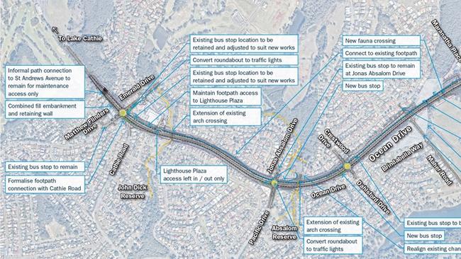
Millions of dollars are being invested into more than 25 major road, bridge and street upgrades across Port Macquarie – including the $60 million Ocean Dr duplication.
The projects are summarised in a Port Macquarie-Hastings Council report that was tabled at Tuesday night’s Transport Network Community Consultative Committee Meeting.
It lists the council’s current transport and road related projects that are being delivered, paid for by ratepayers and/or partly funded by the NSW and Federal Governments.
Thirteen roads are at the detailed design, construction ready or under construction phases, while the remaining 12 are at the strategic, planning and concept design stages.
See the breakdown of the road projects, status and their funding arrangements, below.
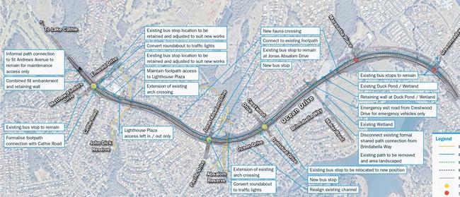
$60M OCEAN DRIVE DUPLICATION
Status: Planning Phase
What: Council is continuing to hold discussions with the Federal Government in order to mitigate the current approximately $30 million funding gap risk.
This risk needs to be mitigated prior to commencing construction. Council has resolved to commence the detailed construction planning and tender documentation development in collaboration with Transport for NSW. This will ensure that a construction tender can be released relatively quickly once the funding gap risk has been mitigated.
$17M MARIA ROAD UPGRADE
Status: planning phase
Where: Maria Road
What: It will seek to deliver the sealing of the remaining 24km of Maria River Road that is currently unsealed.
This project spans both the Port Macquarie-Hastings Council and Kempsey Shire Council Local Government Areas and is being delivered by Port Macquarie-Hastings Council through a Memorandum of Understanding with Kempsey Shire Council. The project is funded to the value of $17 million through the NSW Government Fixing Local Roads Grant scheme.
$2.7M BAGO ROAD UPGRADE
Status: construction phase
Where: Stage three from Bluewater to Azalea Avenue.
What: Two previous stages of the upgrade have now been completed, stage 1 between the Pacific Highway and Lookout Road and Stage 2 between Lookout Road to Bluewater Close. Stage 3 will be the final stage of upgrades required to Bago Road. $2.7m has been allocated to complete this stage, $1.1m of which will be provided by the NSW State Government as part of the funding grant ‘Fixing Local Roads’.
Stage 3 will complete the final 4.4kms of road rehabilitation. In additional to these works, an upgrade to the King Creek Road and Bago Road intersection will also be undertaken to widen the shoulder to allow a vehicle on Bago Road to pass while a vehicle is waiting to make a right turn into King Creek Road. Additional funds will be allocated for the upgrade of this intersection.
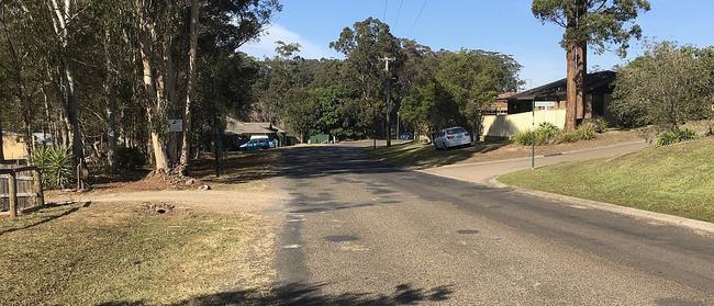
THE RUINS WAY UPGRADE
Status: construction phase
Where: Major Innes Road to Sitella Street.
What: Preliminary road resurfacing works along Major Innes Drive and The Ruins Way have been completed. These additional works were possible due to redistribution of Federal grant funding from Bago Road project due to new grant funding.
Main construction works commenced on the 20th July 2020. This project seeks to deliver The Ruins Way roadway upgrade, approximately 500m in length, between the Major Innes Rd and Sitella St intersections.
GORDON STREET AND STORMWATER UPGRADE
Status: Construction phase
Where: Gordon Street between Hastings River Drive and Horton Street
What: Funding to commence the construction of this project has been allocated in Council’s 2020/21 Operational Plan. The project has moved into the Construction phase with community engagement and construction tender preparation underway.
This project seeks to deliver the design and construction of upgrades to Gordon Street between Hastings River Drive and Horton Street. The project involves the reconstruction of the existing road pavement, upgrade to stormwater and replacement of existing water and sewer mains.
$1.6M KEW MAIN STREET UPGRADE
Status: Design phase – stage 3
Where: Kew Main Street
What: Stage 3 of the Kew Main Street project focuses on upgrading the main roundabout, to reduce approach speed and increase safety, and upgrades to the northwestern corner car park to improve functionality and amenity.
Preliminary design is now complete, final design has commenced. Council received an $800,000 grant funding under the Building Better Regions fund for a total project budget of $1,600,000. Construction will commence following design completion in late 2020/21.
LORD AND HERSCHELL STREET/OWEN AND HOME STREET
Status: Design Phase
What: This project seeks to improve the safety of the intersections at Lord and Herschell St and Owen and Home Streets with single lane roundabouts.
Detailed design and approvals suitable for construction are planned to be completed within the 2020/21 financial year. Construction timing is expected to be early 2021 for Owen and Home Street, Lord and Herschell St construction is to be confirmed.
This project aims to improve the safety of the intersections as part of the NSW Government Black Spot funding work. In addition, the two projects have been combined to enable a single source of reporting.
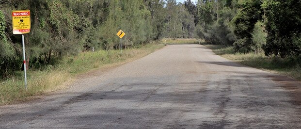
KING CREEK ROAD
Status: Design Phase
What: King Creek Road is a sub arterial road that provides access to the King Creek Rural Residential Estate, it also acts as a link road between the Oxley Highway and the Bago Road Industrial Area.
Concerns with the project area include relatively high vehicle speeds (80 km/hr) in conjunction with sweeping bends, narrow sealed shoulders and limited roadside barriers.
The objective of this project is to upgrade a 330m section of King Creek Road east of Berowra Place. The project will involve design and construction works for shoulder widening and safety barrier installation.
Project funding is from the Capital Projects, Transport and Traffic, Infrastructure Planning and includes TfNSW State Government Funding.
$830,000 THOMPSON’S BRIDGE REPLACEMENT
Status: Construction Phase
What: Thompson’s Bridge is located on Upper Rolland Plains Road approximately 9km northwest of Rolland Plains.
This project seeks to improve accessibility to the area and increase safety by replacing the existing timber bridge with a new proprietary concrete bridge across the unnamed Creek.
Works would ideally be completed by conclusion of quarter three of 2020. This project also forms part of the broader Local Roads Transport Strategy which aims to provide a safe and reliable road and transport network today, tomorrow and into the future. The project will be completed with some impact to the community and will take approximately 10 weeks to complete.
Council received $415,000 grant funding under the Federal Bridge Renewal Program for a total $830,000 project budget.
$1.4 SCRUBBY CREEK BRIDGE REPLACEMENT
Status: Construction Phase
What: The Scrubby Creek Bridge is located on Upper Pappinbarra Road approximately 14km west of Beechwood in the Upper Pappinbarra Valley.
This project seeks to improve accessibility to the valley and increase safety by replacing the existing timber bridge with a new proprietary concrete bridge across Scrubby Creek.
This project also forms part of the broader Local Roads Transport Strategy which aims to provide a safe and reliable road and transport network today, tomorrow and into the future.
The project will be completed with minor impact to the community and will take approximately 4 weeks to complete.
Council received $455,000 grant funding under the Federal Bridge Renewal Program for a total $910,000 project budget.
LORNE ROAD UPGRADE
Status: Planning Phase
What: This project initially seeks to deliver a strategic concept design to upgrade the remaining 13.5km unsealed portion of Lorne Road, and subsequently undertake construction of commencing with the highest priority section(s).
The strategic design will provide enough detail to inform the construction cost and allow for sections of the road to be designed and prioritised. The project will also see construction of the highest priority section as funding permits.
Federal grant funding of $160,000 has been confirmed to commence the investigations and concept designs for this project.
$7.4 PAPPINBARRA ROAD BRIDGE REPLACEMENT
Status: Planning Phase
What: The project seeks to deliver the design and construction of a new road bridge on Pappinbarra Right Arm Road required to replace the existing timber bridge which was destroyed by fire in November 2019.
In late 2019, Council applied for, and was successful in receiving $7.4 million in disaster funding for this replacement project. The funding application was based on replacing the existing single lane timber bridge with a single lane concrete bridge. Design tenders are currently under assessment.
BOUNDARY STREET UPGRADE
Status: Design Phase
What: This project seeks to deliver the detailed design upgrade of Boundary Street from Hastings River Drive to Oliver Road (Airport Car Park).
This upgrade will consist of road widening to dual lanes in both directions, realigned and new infrastructure and flood immunity against the 20 year flood event.
The end state being shovel ready designs and estimated construction costs suitable to support and inform construction funding application for the project.
This project aims to address the strategic growth of the region by providing a safe road environment and improved operation of Boundary Street for Port Macquarie and our broader region.
The detailed design and environmental approvals have commenced.
LAKE ROAD WEST DUPLICATION
Status: Design Phase
What: This project seeks to duplicate/upgrade Lake Road (between Fernhill Road and Jindalee Road) and between Chestnut Road and Ocean Drive.
Detailed design and approvals suitable for construction of traffic signals are complete for the upgrade of the Jindalee and Fernhill Road intersections. Concept designs have been completed for the duplication of the section from Chestnut Road to Ocean Drive.
Consideration will be given to funding the commencement of construction for the upgrade of the Jindalee/Fernhill Road intersections in 2021/22 Operational Plan.
Consideration will also be given to commencing the detailed designs for the duplication of the section from Chestnut Road to Ocean Drive.
HASTINGS RIVER DRIVE UPGRADE
Status: Design Phase
What: This project seeks to upgrade the remaining section of the Hastings River Drive Upgrade between Hughes Place and Boundary Street to four lanes.
Detailed design and approvals suitable for construction are planned to be completed within the 20/21 financial year.
Construction timing is yet to be determined and is subject to funding allocation. This project aims to address the strategic growth of the region by providing a safe road environment and improved capacity and operation of Hastings River Drive.
JOHN OXLEY DRIVE UPGRADE
Status: Design Phase
What: This project seeks to deliver the design for the upgrade of John Oxley Drive from Kingfisher Road to The Ruins Way.
Detailed design and approvals suitable for construction are planned to be completed within the 2020/21 financial year.
Construction timing is yet to be determined and is subject to funding allocation. This project forms part of the broader Lake Innes planning and aims to provide a safe road environment and to improve the capacity and operation of John Oxley Drive.
BEACH TO BEACH SHARED PATHWAY
Status: Design Phase
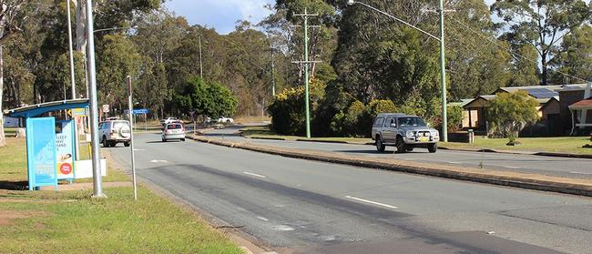
The Beach to Beach Shared Path is a community based project that aims to deliver 11 kilometres of uninterrupted footpath/cycleway between North Haven Beach and Pilot Beach in Dunbogan.
The path will follow the banks of the local river system creating a scenic route that begins in North Haven, loops through Laurieton and ends on Pilot Beach adjacent to the starting point.
SCHOOLS TO SCHOOL PATHWAY PROJECT
Status: Design phase
What: The project seeks to improve vehicular and pedestrian safety along Ocean Drive, between Laurieton and Kew through design and construction of the remaining sections of shared pathway and pedestrian refuges.
Project planning for the design works is currently underway.
PROPOSED AIRPORT ACCESS ROAD
Status: Investigation Phase
What: The options planning workshop with TfNSW for the Airport Access Road and the Oxley Highway occurred on 18 March 2020. TfNSW have modelled several intersection configurations for the proposed Airport Access Road and Oxley Highway, including the revised intersection layout options and removing the need to realign Fernhill Road leg.
This modelling is being reviewed to ensure all traffic generating development is included.
The final Technical report from TfNSW has not been provided to Council as yet. A further planning workshop on the improvement options along the Oxley Highway is planned for 4 December 2020.
OCEAN DRIVE HASTINGS RIVER DRIVE CORRIDOR PLANNING PROJECT
Status: Deliver Phase
What: The Corridor Strategy project is for the delivery of a long-term corridor strategy for the corridors along Blackmans Point to Kendall. To support such a strategy, the project will conduct investigations, data gathering, analysis, and strategy development, through the engagement of Professional Services and
The Corridor Strategy will align with a number of strategies to improve safety, traffic efficiency and sustainability on the region’s transport network.
BRIL BRIL ROAD SEALING AND UPGRADE
Status: Investigation Phase
What: The need for this project has been raised by the community of Rollands Plains over a long period of time due the current poor quality of the road geometry and surface (currently unsealed) leading to increased travel times and risks to driver safety.
At Council’s ordinary meeting 16 October 2019, Council resolved (based on a Councillor Notice of Monition) to carry out preconstruction works to a value of $450,000 noting that future funding may be made available following completion of the design in the order of $6,000,00.
BEECHWOOD ROAD UPGRADE — STAGES 5 AND 6
Status: Design Phase
What: This project seeks to deliver the design and preconstruction activities related to the upgrade of Beechwood Road between Riverbreeze Drive and Yippin Creek Road (Stage 5) and Yippin Creek Road to Waugh Street (Stage 6).
There is no commitment to construction for either stage at this point in time.
Council resolved at the October 2020 meeting to adopt a 6-8 month road closure as the preferred construction methodology. The concept design for Stage 6 will now be completed.
PEMBROKE ROAD/STONEY CREEK ROAD UPGRADE
Status: Design Phase
What: This project will deliver construction designs for the upgrade of the Pembrooke Road / Stoney Creek Road intersection, including the sealing of Stoney Creek Road.
This project will also include the upgrade of three single lane timber bridges (two on Stoney Creek Road and one on Pembrooke Road).
The bridge on Pembrooke Road is the last single lane timber bridge on Pembrooke Road causing a pinch point on a northern link arterial road. This location also has a bad crash history with a fatality at the bridge in 2018.
The engineering scoping study is complete with detailed design continuing to be delivered in 2020/21
KINDEE BRIDGE MANAGEMENT STRATEGY AND DESIGNS
Status: Design phase
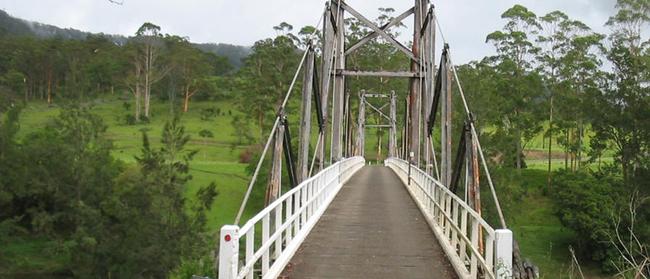
This project seeks to deliver a management strategy and designs for Kindee Bridge as it approaches 100 years old. This unique heritage (Local LEP listing) cable truss suspension bridge was constructed in 1936 as one of the first bridge crossings of the Hastings River.
It was designed for 10 tonnes and current still has that load limit today. It has undergone major maintenance works throughout it life with more planned in 2019/20 – 2020/21.
As the bridge nears 100 years old a detailed management strategy and designs are required to ensure the properties in the Kindee area can continue to receive an adequate level of service from the transport network.
The Management Strategy is planned to be completed by the end of 2020 with concept designs commencing in the 2020/21 financial year.
GORDON AND HORTON STREETS TRAFFIC SIGNALS
Status: Design Phase
This project seeks to deliver the design for the upgrade to the Gordon Street and Horton Street intersection to traffic signals. Detailed design and approvals suitable for construction are planned to be completed within the 2019/20 and 20/21 financial years.
Construction timing is yet to be determined and is subject to funding allocation. The project aims to provide a safe road environment and to improve the operation of the Gordon and Horton Street intersection.
Final Transport for NSW approvals will need to be part of the construction pre-planning once construction funding has been confirmed. Consideration is being given to funding the commencement of construction in the 2021/22 Operational Plan.


