
How 5 years of development for the Northern Beaches Hospital changed Frenchs Forest
Aerial images show the dramatic differences brought by years of construction and roadworks to Frenchs Forest for the new Northern Beaches Hospital, Robbie Patterson reports.
Manly
Don't miss out on the headlines from Manly. Followed categories will be added to My News.
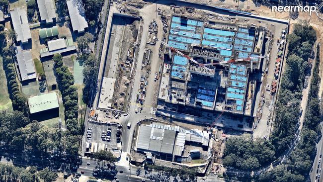
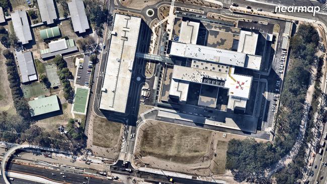
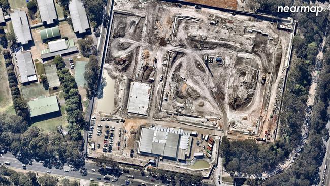
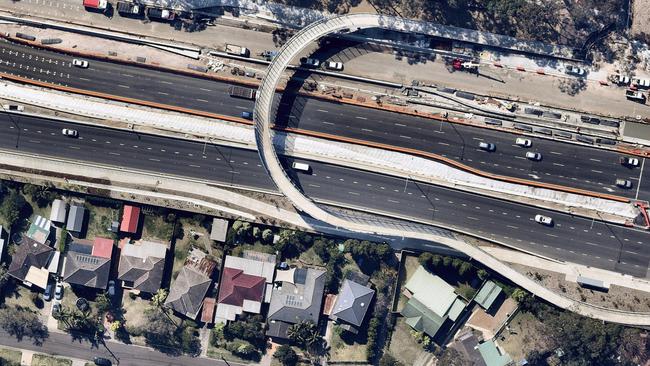
AERIAL images taken over the past five years show the overwhelming change construction for the Northern Beaches Hospital and associated roadwork has brought upon Frenchs Forest.
The images, taken in 2013 by Nearmap, shows a lush landscape which — $1 billion worth of demolition and construction later — has become possibly the most significant piece of infrastructure the peninsula has seen.
Residents often complain that development has “taken the forest out of Frenchs Forest” and these pictures certainly give traction to their thoughts.
Nearmap executive Shane Preston said the images — which include a changing graphics interchange format (GIF) showing various forms of demolition and construction — reveal the true impact on the landscape.
“Nearmap’s imagery reveals just how extensively northern Sydney’s suburban landscape has shifted over the past few years,” Mr Preston said. “Accompanying the completion of the new hospital, the NSW Government is also upgrading roads around the vicinity to provide patients and locals with a better travel experience, increased capacity on the road network and improved access through the area.”

With more development to come — the structure plan for the area surrounding the hospital and a land release at Ingleside are also planned — this could be just the beginning. And the peninsula has been slated for an 18 per cent increase in population by 2036, meaning there could be more growing pains.
Mr Preston said his aerial imaging technology could help governments plan better for the future.
“As Sydney continues to evolve, access to technology like aerial imagery and 3D models of the real world will play a crucial role in aiding urban planners, local governments and key stakeholders involved to make strategic decisions throughout the life cycle of large-scale projects,” he said.
“It starts with a new approach to planning.
“We operate in a 3D world but we’re still taking a 2D approach to planning. Visualising proposed development sites and its wider surroundings in 3D is important to make more informed and accurate long-term decisions.
“This approach will enable us to build liveable cities of the future.”
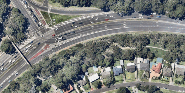
Karingal Crescent, which is to the south of Warringah Rd, has bore more than its fair share of the brunt of disruptions as a result of roadworks for the hospital.
The structure plan, which has again been delayed due to bureaucratic red tape and government departments squabbling, should see 3000-plus apartments in buildings up to 12 storeys. When the first version of the plan — which has now been made a priority precinct by the NSW Planning Department — was put out the street’s residents felt let down.
Tim Pace, whose single-dwelling property could be rezoned to allow terrace-style housing, argued their house, which used to back onto a grassy reserve (far left) would now back onto Warringah Rd. “Being in Karingal Crescent, we have had our lives basically turned upside down with the way things have been constructed around us,” he said when a revised plan was released in August last year.
Since then the Planning Department has taken on more consultation and was expected to come back late this year with a new plan to rezone around the hospital.