
South coast floods: Kangaroo Valley township likely isolated for days after multiple landslides
A south coast town has been cut off by road and likely left isolated for days only hours after hundreds of residents were ordered to evacuate from their homes in Shoalhaven.
Illawarra Star
Don't miss out on the headlines from Illawarra Star. Followed categories will be added to My News.
A south coast town has been cut off by road and likely left isolated for days after landslides closed traffic to multiple major roads, as fierce winds and heavy rains continue to cause chaos.
NSW SES announced on Tuesday evening that multiple landslides over recent days had caused significant damage to roads leading into the Kangaroo Valley township.
The town of less than a thousand was cut off to the outside world as a result, with the road from Cambewarra to Fitzory Falls and the Kangaroo Valley Rd closed to all cars.
Transport for NSW said their priority was to clear the landslips at Cambewarra Mountain as soon as possible, but warned it might take several days, according to a statement.
The closure comes after hundreds of residents were ordered to evacuate from their homes in Sussex Inlet and St Georges Basin in Shoalhaven by midday amid fears flood peaks will leave homes isolated.
The order was given by NSW SES shortly after 11am on Tuesday, with homeowners on 23 roads in the region being affected.
Shelters have been set up at Sussex Inlet Bowling Club and Bomaderry Bowling Club.
NSW SES warned that once floodwaters enter St George Basin, properties will be flooded.
“Road access will be lost, as well as sewerage lines and power to the area” according to NSW SES.
“If you remain in the area after midday, you will be trapped and it may be too dangerous for NSW SES to rescue you.”
In Sussex Inlet, residents were warned once the flood levels reach 1.4m, parts of the area will be isolated, possibly without power.
The full list of affected roads in the area are River Rd, Cater Crs, Banksia St, Fairview Crs, Nielson Ln, Wunda Ave, Jacobs Dr, Poole Ave, Ellmoos Ave, and Sussex Inlet Rd.
In St Georges Basin, the affected roads are The Park Dr, Mountains St, Larmer Ave, the eastern side of Fairway Dr, Walmer Ave, Sanctuary Point Rd, Old Erowal Bay, Page St, McGowen St, Prentice Ave, Island Point Rd, Graham Ave, and Loraylin Ave.
Residents in areas nearby to those affected are advised by NSW SES to be on alert.
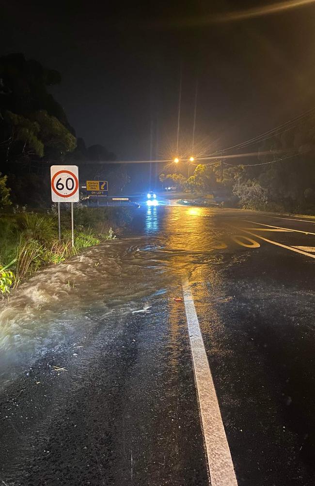
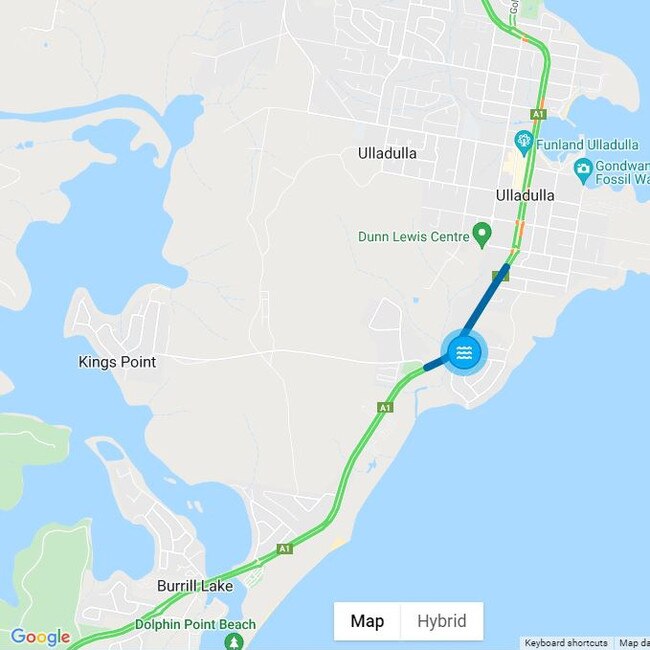
It comes as the busy Princes Hwy in Ulladulla has been closed by rising flood levels as the south coast and Illawarra regions continue to grapple with heavy rainfall and severe storms.
The main arterial road was closed at 5.28am on Tuesday, according to Transport for NSW.
The closure is between Hollywood Ave and Kissing Point Dr in the popular tourist town, an area which most mornings is usually full with cars travelling between the region’s main towns, including Batemans Bay and Nowra.
The closure comes as residents of Sussex Inlet and St Georges Basin in Shoalhaven have been told to prepare to evacuate as “very heavy” rains continue to swell already oversaturated catchments across the south coast and Illawarra regions.
NSW SES urged residents on Monday afternoon with homes on the eastern end of The Park Dr in St Georges Basin, following the Tomerong Creek, as well as low lying areas of eighteen Sussex Inlet streets, they should prepare to leave sometime on Tuesday.
Some roads in Sussex Inlet might become inaccessible, according to NSW SES, who said they have been in contact with affected residents.
Evacuation centres have been set up at Bomaderry Bowling Club and Sussex Inlet Bowling Club.
The Jervis Bay catchment received more than 120mm on Monday with 120-250mm forecast for Tuesday.
That comes as emergency services warn that both St Georges Basin at Island Point Rd and Sussex Inlet will exceed minor flooding levels on Monday evening.
St Georges Basin is expected to exceed 1.2m on Monday, with the river likely to exceed moderate flood levels overnight, NSE SES warned, before reaching a major flood level of 1.8m on Tuesday night.
At Sussex Inlet, the minor flood level of 0.9m is expected to be surpassed on Monday evening, before a the moderate level of 1.2m is passed overnight, according to forecaster.
The major flood level of 1.8m is forecast to possibly be reached on Tuesday night.
When that occurs, NSW SES warned homes would be inundated, while others would become isolated.
The full list off affected areas in Sussex Inlet are: Jacobs and Lakehaven Drives, River and Sussex Inlet Roads, Wunda, Poole, Ridge, Edgewater, Riveria and Ellmoos Avenues, Banksia Street, Fairview, Lagoon, Carter, Paradise Crescents, Neilsen Lane, Mary and Thora Streets.
The order comes as the affect of heavy rains and severe winds is felt across the region.
Heavy rain over the Bega River catchment since Mon
day evening has also caused minor flooding along the Bega River at Bega on Tuesday morning.
Very heavy rainfall is forecast for the remainder of Tuesday into Wednesday.
Illawarra
Floodwater rescue
Fire and Rescue NSW crews have rescued trapped motorists from vehicles stuck in floodwaters at Wollongong overnight.
Just after 10.30pm, firefighters responded to reports of a number of vehicles submerged in flood water on Springhill Road.
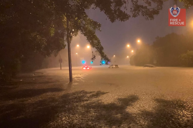
On arrival, crews reported several vehicles stranded, with floodwaters rising up to the doors.
One person was on the roof of a car and others were trapped inside their vehicles.
In torrential rain and with flood waters rising, crews managed to safely remove two people from one vehicle, and a third from another.
In an act of community support, nearby residents provided the motorists with blankets and warm cups of tea.
Acting Superintendent Mathew Sigmund from Fire and Rescue NSW (FRNSW) said this is a timely reminder that calling Triple Zero (000) for an emergency can be the difference between life and death.
Road closures and public transport
MOUNT OUSLEY: Mt Ousley Rd (M1 Princes Mwy) is closed northbound at Memorial Drive, due to flooding. Light vehicles can use Bulli Pass as an alternative route. Heavy vehicles are being parked. pic.twitter.com/SIp74HDu8U
— Live Traffic NSW (@LiveTrafficNSW) March 7, 2022
- Albion Park – Terry St/Illawarra Hwy between Tongarra Rd and M1 Princes Hwy. Water over the road. Reduce your speed, Exercise caution, Check signage.
- Bulli Pass – Princes Highway between M1 Princes Motorway and Lawrence Hargrave Drive. Traffic affected in both directions.
- Kiama bends – One north bound lane remains closed after multiple landslides.
- Mount Ousley -M1 Princes Motorway at Memorial Drive. Geotechnical investigations. Motorway closed in northbound direction.
- Buses replacing trains between Kiama and Bomaderry.
For live information check Live Traffic NSW
School closures
South Coast
Road closures
- Araluen Road – Kiora Bridge.
- Bodalla – Silo Farm Bridge.
- Cambewarra Mountain – Moss Vale Road between Barfield Road and Kangaroo Valley Road closed in both directions due to a landslide.
- Moruya – Dwyers Creek Road, at the causeway.
- Mystery Bay – Sunnyside Road, at the causeway.
- Nelligen – Old Bolaro Road, the causeway.
- Nelligen – River Road, at the causeway
- Buses replacing trains between Kiama and Bomaderry.
Eurobodalla
- Dwyers Creek Rd, Moruya - at the causeway
- •Old Bolaro Rd, Nelligen - at the causeway
- •Silo Farm Bridge, Bodalla
- •Sunnyside Rd, Mystery Bay - at the causeway
- •Kiora Bridge, Araluen Road
- •River Rd, Nelligen - at the causeway
Bega Valley Shire
- Buckajo Rd, Buckajo
- Tathra Bermagui Rd, Wapengo
- Angledale Rd
- Angledale Rd, Angledale
- Benny Gowings Rd, Murrah
- Big Jack Mountain Rd, Burragate
- Big Jack Mountain Rd, Rocky Hall
- Church Ln, Tantawangalo
- Devils Hole Rd, Wyndham
- East St, Bega
- Forest Ln, Millingandi
- Jacksonia Grove, Bega
- Millingandi Rd, Millingandi
- Millingandi Shortcut Rd, Millindandi
- Murrays Flat Rd, Tarraganda
- Old Wallagoot Rd
- Orchard Rd, Rocky Hall
- Parrabel St, Bega
- Tarlingtons Ln, Candelo
- Wallagoot Ln, Wallagoot
- Wandella Rd, Wandella
- Yankees Gap Rd, Bemboka
Shoalhaven
- Moss Vale Rd - Landslip
- Meroo Rd, Bomaderry
- Edwards Ave, Bomaderry
- Hanigans Rd, North Nowra
- Bolong Rd, North Nowra
- Shoalhaven Heads Rd, Shoalhaven
- Forest Rd, south of Nowra
- Greens Road, Greenwell
- Nowra Quinn’s Ln, Nowra
- Callala Beach Rd, Calalala Bay
- Woollamia Rd, Woollamia
- Wunda Ave, Sussex Inlet
- Currowan Western Distributor
- Greenwell Point Rd, Pyree - Damaged
- Culburra Rd, Pyree - Damaged
For live information check Live Traffic NSW
School closures
- Kangaroo Valley Public School
- Nowra Christian School
- Ulladulla High School
Eurobodalla
Eurobodalla has had its tenth natural disaster declared in the 28 months since the Black Summer fires started in November 2019.
The declaration means the NSW and federal government will provide funding support for repairs to be made to local roads damaged by flooding, with council to cover the first $29,000.
As the water recedes, council crews will be assessing the damage and starting repairs.
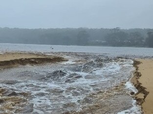
Durras Lake opened naturally on Sunday afternoon. Council staff had been monitoring the situation and had a crew positioned to open it to the ocean on Monday morning.
Little Lake in Narooma and Coila Lake in Tuross Head has been opened since last week.
All sports grounds in the shire have also been closed.
Flood warnings for the Deua River have been cancelled after overnight rises peaked below the minor flood line.
NSW SES announced on Monday the river had reached on 4m, well below the 4.4m threshold.
Shoalhaven
Between 100-200m, of rain is forecast for Shoalhaven region over the coming days, according to local council.
NSW SES is continuing to watch the Shoalhaven River as it swells from heavy rains, with minor to moderate flood warnings being issued for Nowra and Terara.
According to the Shoalhaven City Council, the river has risen to 2.53m, but is forecast to rise to 3.3m on Monday afternoon before possibly reaching a peak of 3.5m that evening.
As a result, the Comerong Island Ferry has been shuddered, while road closures in some areas have halted kerb side collection.
The Kangaroo Valley Recycling and Waste Depot has also been shut.
After much controversy last week, the Shoalhaven Heads remains open after being mechanically opened last week, alongside Lake Tabourie.
Current Dam levels are:
- Bamarang Dam – 47mm above Top Water Level
- Danjera Dam – (Not Known – Loss of Power)
- Porters Creek Dam – 196mm above
- Tallowa Dam (Water NSW owned) – 2310mm above
- Cambewarra Dam – 820mm above TWL (no alert)


‘Stab everybody’: Man released after violent assault, wild pursuit
A knife-wielding attacker who violently assaulted and threatened residents in a Wollongong home, before leading police on a wild 150km/h chase, has successfully appealed his prison sentence.

‘Life or death’: Alarm over city judges ruling on bush bail cases
A plan to have city magistrates remotely dealing with bail applications from the country has raised alarm about fairness and the possibility of recidivist offenders getting out more often.