
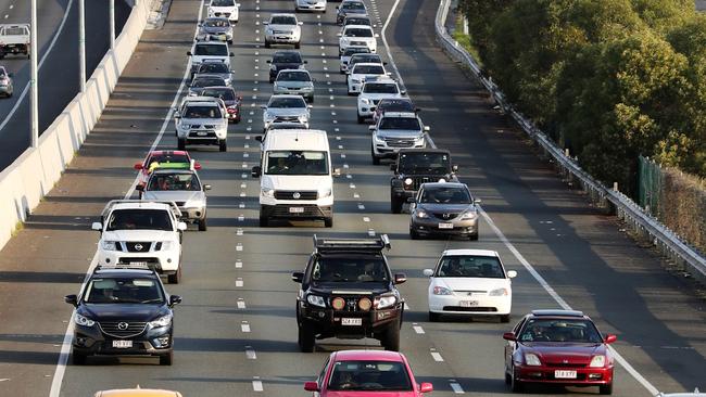
Bathurst traffic: Crashes, delays, updates
The daily commute is better with a little planning. Here's some roads it might be best to avoid today
Hyperlocal
Don't miss out on the headlines from Hyperlocal. Followed categories will be added to My News.
Latest traffic alerts and road works for the Bathurst region:
Traffic incidents since midnight: 1
Roadworks to avoid: 25
New roadworks this week: 0
Roadworks projects to be completed in the next 30 days:
0
Traffic incidents by suburb (most recently updated items are listed first):
Oberon
Notavailable(NotAvailable)
Affected street: Duckmaloi Road near Junction Road
Alert created at 5.02am, July 23. Last updated at 6.31am, July 23.
Advice: Reduce your speed. Exercise caution.
Woodstock
Notavailable(NotAvailable)
Affected street: Mid Western Highway near Sheet of Bark Road
Alert created at 10.52pm, July 22. Last updated at 12.02am, July 23.
Advice: Reduce your speed. Exercise caution. Police are directing traffic on site with intermittent closures expected.
Parkes
Notavailable(NotAvailable)
Affected street: Bogan Road near Newell Highway
Alert created at 11.57am, April 10. Last updated at 9.48am, July 18.
Advice: Allow extra travel time. Check signage. Bogan Road, between the Bypass and the Peak Hill Road (the old Newell Highway) will be permanently closed to traffic with resident access only.
Parkes
Notavailable(NotAvailable)
Affected street: Newell Highway near Parkesborough Road
Alert created at 11.37am, April 10. Last updated at 9.26am, July 4.
Advice: Check signage. Allow extra travel time. Traffic has been switched to the new Parkes Bypass. Data provided by Google Maps may not be up to date.
Jenolan
Notavailable(NotAvailable)
Affected street: Jenolan Caves Road near Binoomea Ridge Trail
Alert created at 4.24pm, September 4. Last updated at 5.01am, June 23.
Advice: Check signage. Use diversions. There is no access to Jenolan Caves. A section of Jenolan Caves Rd remains closed.
Roadworks by suburb (most recently updated items are listed first):
Parkes
Notavailable(NotAvailable)
Affected street: London Road near
Alert created at 12.21pm, May 10. Last updated at 7am, July 23.
Ends: 7am, July 23
Advice: Reduced speed limit. Check signage. Alternating (stop/slow) traffic conditions will be in place to allow motorists to pass in one direction at a time. Traffic controllers will be on site to direct motorists. Motorists are advised to allow additional travel time.
Vittoria
Notavailable(NotAvailable)
Affected street: Mitchell Highway near Bathurst
Alert created at 11.22am, March 18. Last updated at 11.02am, July 22.
Ends: 6pm, December 19
Advice: Reduced speed limit. Check signage. Alternating (stop/slow) traffic conditions will be in place to allow motorists to pass in one direction at a time. Traffic controllers will be on site to direct motorists. The speed limit outside work hours is 60km/h. Motorists are advised to allow approximatelyFive minutes of additional travel time.
Eugowra
Notavailable(NotAvailable)
Affected street: Paytens Bridge Road near Paytens Bridge over Lachlan River
Alert created at 11.10am, March 21. Last updated at 6pm, July 21.
Ends: 12.59am, August 9
Advice: Reduced speed limit. Check signage. Alternating (stop/slow) traffic conditions will be in place to allow motorists to pass in one direction at a time. Traffic controllers will be on site to direct motorists. Motorists are advised to allow approximatelyFive minutes of additional travel time. Vehicles over 3m wide are not permitted to travel across Paytens Bridge.
Bathurst
Notavailable(NotAvailable)
Affected street: Stewart St near Durham Street
Alert created at 9.23am, July 3. Last updated at 7am, July 21.
Ends: 6am, August 31
Advice: Reduced speed limit. Check signage. Traffic control, lane closures and a reduced speed limit will be in place on the intersection at Stewart and Durham St from Monday 28 July to Sunday 31 August. No work will take place on Friday and Saturday nights.
Parkes
Notavailable(NotAvailable)
Affected street: Newell Highway near Peak Hill Road
Alert created at 9.12am, July 18. Last updated at 10.39am, July 18.
Ends: 7pm, July 24
Advice: Check signage. Reduced speed limit. The speed limit outside work hours is 80km/h. Motorists are advised to allow approximatelyFive minutes of additional travel time
Leadville
Notavailable(NotAvailable)
Affected street: Golden Highway near Merotherie Road
Alert created at 9.19am, July 18. Last updated at 9.21am, July 18.
Ends: 12.59am, August 26
Advice: Check signage. Exercise caution. Traffic control will be in place 24hrs a day. The speed limit outside work hours is 40km/h. Motorists are advised to allow approximatelyFive minutes of additional travel time.
Merriwa
Notavailable(NotAvailable)
Affected street: Golden Highway near Bow River Bridge
Alert created at 12.05pm, July 16. Last updated at 4.20pm, July 17.
Ends: 6pm, August 29
Advice: Reduced speed limit. Check signage. Contraflow traffic conditions will be in place to allow motorists to pass in both directions. Wide loads greater thanFive metres will be temporarily stopped by traffic control to allow cones or work vehicles to be moved for safe passage. Use UHF channel 40 or contact 0413 368 282, 1-2 hours prior to travel for assistance through the work site.
Hampton
Notavailable(NotAvailable)
Affected street: Duckmaloi Road near Jenolan Caves Road
Alert created at 8.41am, July 17. Last updated at 3.33pm, July 17.
Ends: 7pm, July 25
Advice: Reduced speed limit. Check signage. Portable traffic lights will allow motorists to pass in one direction at a time. Motorists are advised to allow approximately 10 minutes of additional travel time. The speed limit outside work hours is 60km/h.
Merriwa
Notavailable(NotAvailable)
Affected street: Golden Highway near
Alert created at 2.45pm, July 11. Last updated at 3.31pm, July 17.
Ends: 5pm, August 7
Advice: Reduced speed limit. Check signage. Alternating (stop/slow) traffic conditions will be in place to allow motorists to pass in one direction at a time. Motorists are advised to allow approximatelyFive minutes of additional travel time. Wide loads greater than 3.5 metres will be temporarily stopped by traffic control to allow cones or work vehicles to be moved for safe passage. Contact UHF channel 23 for assistance through the work site.
Little Hartley
Notavailable(NotAvailable)
Affected street: Old Great Western Highway near Ambermere Drive
Alert created at 8.13am, February 23. Last updated at 1.28pm, July 17.
Ends: 7pm, August 30
Advice: Check signage. Reduced speed limit. Alternating (stop/slow) traffic conditions will be in place to allow motorists to pass in one direction at a time. Traffic controllers will be on site to direct motorists. Old Great Western Highway past Ambermere Drive can be accessed via Coxs River Rd.
Cudal
Notavailable(NotAvailable)
Affected street: The Escort Way near Future Mobility Testing and Research Centre
Alert created at 2.59pm, July 1. Last updated at 9am, July 17.
Ends: 5pm, September 19
Advice: Reduced speed limit. Check signage. Changed traffic conditions include single lane closures and a reduced speed limit of 40 km/h during work hours. Motorists should allow up to five minutes extra travel time and follow the direction of traffic control and signs.
Peak Hill
Notavailable(NotAvailable)
Affected street: Caswell Street near
Alert created at 1.23pm, June 16. Last updated at 5.18pm, July 14.
Ends: 6pm, July 30
Advice: Reduced speed limit. Check signage. Essential road maintenance will take place on the following sections of Caswell Street: Bingara Street to Narra Street Mingelo Street to Ween Street North of Ingalba Street Wet weather has delayed this work that was originally scheduled for completion by Sunday 20 July
Rankins Springs
Notavailable(NotAvailable)
Affected street: Mid Western Highway near Sims Gap
Alert created at 4.05pm, July 11. Last updated at 4.05pm, July 11.
Ends: 6pm, July 28
Advice: Reduced speed limit. Check signage. Alternating (stop/slow) traffic conditions will be in place to allow motorists to pass in one direction at a time. Traffic controllers will be on site to direct motorists. Motorists are advised to allow approximately 10 minutes of additional travel time.
Mount Victoria
Notavailable(NotAvailable)
Affected street: Great Western Highway near Victoria Street
Alert created at 12.05pm, March 18. Last updated at 9.09am, July 10.
Ends: 11.45pm, December 31
Advice: Use diversions. Check signage. All westbound traffic to be detoured during work hours. July westbound closures dates : 7- 10, 13, 15-17, 21-24, 29-31 July. Road closure lines provided by Google Maps may not be up to date.
Bell
Notavailable(NotAvailable)
Affected street: Bells Line of Road near
Alert created at 2.19pm, February 26. Last updated at 12pm, July 8.
Ends: 7pm, July 31
Advice: Reduced speed limit. Allow extra travel time. Night works will not be occurring on Fridays. Alternating (stop/slow) traffic conditions will be in place to allow motorists to pass in one direction at a time. Traffic controllers will be on site to direct motorists. Motorists are advised to allow approximately 15 minutes of additional travel time between North Richmond and Dargan.
Blayney
Notavailable(NotAvailable)
Affected street: Mid Western Highway near
Alert created at 11.42am, June 17. Last updated at 1.18pm, July 3.
Ends: 7pm, July 23
Advice: Exercise caution. Allow extra travel time.
Cowra
Notavailable(NotAvailable)
Affected street: Lachlan Valley Way near Bulkhead Road
Alert created at 1.59pm, June 27. Last updated at 1.59pm, June 27.
Ends: 7pm, July 30
Advice: Reduced speed limit. Check signage. Alternating (stop/slow) traffic conditions will be in place to allow motorists to pass in one direction at a time. Traffic controllers will be on site to direct motorists. Motorists are advised to allow approximatelyFive minutes of additional travel time.
Dunedoo
Notavailable(NotAvailable)
Affected street: Golden Highway near Lewis Road
Alert created at 2.10pm, October 31. Last updated at 1.49pm, June 27.
Ends: 7pm, September 14
Advice: Reduced speed limit. Check signage. Alternating (stop/slow) traffic conditions will be in place to allow motorists to pass in one direction at a time. Traffic controllers will be on site to direct motorists. Motorists are advised to allow approximatelyFive minutes of additional travel time.
West Wyalong
Notavailable(NotAvailable)
Affected street: Newell Highway near Charcoal Tank Road
Alert created at 12.53pm, April 14. Last updated at 2.21pm, June 26.
Ends: 7pm, August 29
Advice: Reduced speed limit. Allow extra travel time. Single-lane closures will be in place for the duration of the work. Traffic controllers will be on site to direct motorists. Vehicles wider than 4.8 metres must contact the project team two days before travel on 0456 823 904 to arrange access. Vehicles over 4.5m are required to pull over and call 0358810126 to be escorted through the worksite.
Birriwa
Notavailable(NotAvailable)
Affected street: Castlereagh Highway near Barneys Reef Road
Alert created at 3.27pm, June 25. Last updated at 3.27pm, June 25.
Ends: 7pm, September 30
Advice: Check signage. Reduced speed limit. A 600m section of the Castlereagh Highway will be closed with alternating traffic in place until the end of September 2025. Traffic controllers will be on site to direct motorists.
Cassilis
Notavailable(NotAvailable)
Affected street: Golden Highway near Sotts Lane
Alert created at 10.53am, February 21. Last updated at 5.06am, June 23.
Ends: 7pm, July 31
Advice: Check signage. Exercise caution. Portable traffic lights will allow motorists to pass in one direction at a time. The speed limit outside work hours is 60km/h. Motorists are advised to allow approximately 10 minutes of additional travel time. Drivers of Oversize/Overmass are required to contact site on UHF Channel 25 or contact works supervisor 0429 504 654 prior to travel.
Jenolan
Notavailable(NotAvailable)
Affected street: Jenolan Caves Road near The Bicentennial National Trail
Alert created at 11.43am, September 5. Last updated at 4.55am, June 23.
Ends: 11.45pm, December 31
Advice: Avoid the area. Plan your journey. There is no access to Jenolan Caves. Repair work is ongoing. A section of Jenolan Caves Rd remains closed
Larras Lee
Notavailable(NotAvailable)
Affected street: Mitchell Highway near Larras Lee Road
Alert created at 11.41am, March 20. Last updated at 12.03pm, June 13.
Ends: 6pm, August 31
Advice: Reduced speed limit. Check signage. Alternating (stop/slow) traffic conditions will be in place to allow motorists to pass in one direction at a time. Traffic controllers will be on site to direct motorists. Motorists are advised to allow approximatelyFive minutes of additional travel time.
Blayney
Notavailable(NotAvailable)
Affected street: Mid Western Highway near
Alert created at 4.33pm, December 19. Last updated at 7.46am, April 4.
Ends: 6.30pm, August 31
Advice: Check signage. Exercise caution. Alternating (stop/slow) traffic conditions will be in place to allow motorists to pass in one direction at a time. Traffic controllers will be on site to direct motorists. Motorists are advised to allow approximatelyFive minutes of additional travel time.
Warroo
Notavailable(NotAvailable)
Affected street: Warroo Bridge Road near
Alert created at 10.19am, February 28. Last updated at 5am, March 3.
Ends: 6pm, October 27
Advice: Reduced speed limit. Check signage. Warroo Bridge replacement. Motorists are advised to allow additional travel time.
Today's hyperlocal stories are available here.
The previous Bathurst traffic article can be viewed here.

Everybody appearing at Armidale Local Court, Wednesday, July 23
Here is a list of matters listed at Armidale Local Court on Wednesday.
Everybody appearing at Port Kembla Local Court, Wednesday, July 23
Here is a list of matters listed at Port Kembla Local Court on Wednesday.