
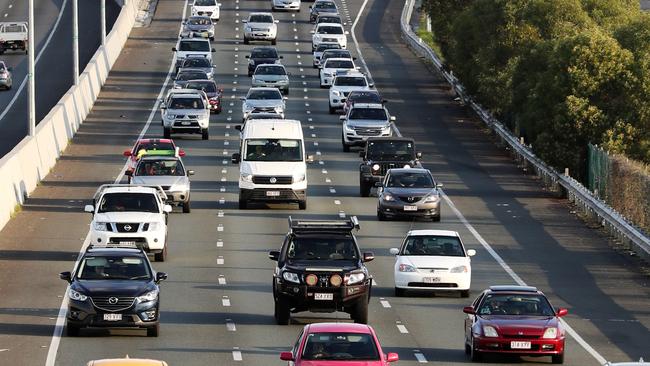
Central Sydney traffic: Crashes, delays, updates
The daily commute is better with a little planning. Here's some roads it might be best to avoid today
HyperLocal
Don't miss out on the headlines from HyperLocal. Followed categories will be added to My News.
Latest traffic alerts and road works for the Central Sydney region:
Traffic incidents since midnight: 10
Roadworks to avoid: 15
New roadworks this week: 5
Roadworks projects to be completed in the next 30 days:
0
Traffic incidents by suburb (most recently updated items are listed first):
Sydney
Notavailable(NotAvailable)
Affected street: Sydney Harbour Bridge near
Alert created at 9.20pm, July 18. Last updated at 9.20pm, October 22.
Advice: Reduced speed limit. Check signage. Changes to traffic conditions will be in place on the Sydney Harbour Bridge at various times while the bridge and other infrastructure are being upgraded and maintained. These changes include a combination of lane closures and speed reductions. At least one lane will be maintained in each direction during work hours.
Darlinghurst
Notavailable(NotAvailable)
Affected street: Eastern Distributor near Bourke St on-ramp
Alert created at 8.10pm, October 22. Last updated at 8.16pm, October 22.
Advice: Reduce your speed. Prepare to merge.
Sydney
Notavailable(NotAvailable)
Affected street: Western Distributor near Sydney Harbour Bridge
Alert created at 5.55pm, October 22. Last updated at 6.40pm, October 22.
Advice: Allow extra travel time.
Dawes Point
Notavailable(NotAvailable)
Affected street: Sydney Harbour Bridge near
Alert created at 5.42pm, October 22. Last updated at 5.51pm, October 22.
Advice: Reduce your speed. Exercise caution.
Sydney
Notavailable(NotAvailable)
Affected street: Macquarie Street near Albert Street
Alert created at 11.41am, October 9. Last updated at 5.30pm, October 22.
Advice: Check signage. Special event clearways will be in place for a planned Police Operation. From 1pm to 5:30pm on Tuesday 22 October clearways will be in effect on: Macquarie St between Albert St and Sydney Opera House roundabout – includes taxi rank on eastern side (both sides) Clearways are strict no-parking zones for all vehicle types and apply even to local residents and TfNSW Mobility Scheme Permit holders. Check signs carefully as vehicles left in clearways will be towed and a fee applies. If your vehicle is towed, you can search your vehicle registration at the Find My Car website to find its new location, or alternatively call 132 701 to speak to an operator.
Mascot
Notavailable(NotAvailable)
Affected street: Mill Pond Road near General Holmes Drive
Alert created at 4.43pm, October 22. Last updated at 5.10pm, October 22.
Advice: Prepare to merge. Allow extra travel time.
Woolloomooloo
Notavailable(NotAvailable)
Affected street: Eastern Distributor near Macquarie Street
Alert created at 3.48pm, October 22. Last updated at 4.06pm, October 22.
Advice: Exercise caution.
Sydney
Notavailable(NotAvailable)
Affected street: Elizabeth Street near Liverpool Street
Alert created at 1.26pm, October 22. Last updated at 2.25pm, October 22.
Advice: Reduce your speed. Exercise caution.
Zetland
Notavailable(NotAvailable)
Affected street: Tweed Place near Ebsworth Street
Alert created at 1.11pm, October 8. Last updated at 12.31pm, October 22.
Advice: Allow extra travel time. Expect delays. Road closures and clearways will be in place for a planned Police Operation in Zetland. Road closures: From 10:30am to 12:30pm: Tweed Pl will be closed between Ebsworth St and Paul St. Managed residential and delivery driver access to carpark only. Special event clearways will be in effect from 8:30am to 12:30pm on Tweed Pl between Ebsworth St and western end of road (both sides) and the shared zone between Tweed Pl (western end) and Paul St (northern side). Clearways are strict no-parking zones for all vehicle types and apply even to local residents and TfNSW Mobility Scheme Permit holders. Check signs carefully as vehicles left in clearways will be towed and a fee applies. If your vehicle is towed, you can search your vehicle registration at the Find My Car website to find its new location, or alternatively call 132 701 to speak to an operator.
Glebe
Notavailable(NotAvailable)
Affected street: Wentworth Park Road, Cowper Street, Mitchell Street, Wentworth Street near
Alert created at 11.29am, October 9. Last updated at 12.31pm, October 22.
Advice: Check signage. Special event clearways will be in place for a planned Police Operation. From 8:30am to 12:30pm on Tuesday 22 October clearways will be in effect on: Cowper St between Wentworth Park Rd and Wentworth St (both sides) Mitchell Ln East between Wentworth Park Rd and end of road (both sides) Mitchell St between Wentworth Park Rd and Wentworth St (both sides) Park Ln between Mitchell St and Cowper St (both sides) Wentworth Park Rd between Mitchell St and Cowper St (both sides) Wentworth St between Mitchell St and Cowper St (both sides) Clearways are strict no-parking zones for all vehicle types and apply even to local residents and TfNSW Mobility Scheme Permit holders. Check signs carefully as vehicles left in clearways will be towed and a fee applies. If your vehicle is towed, you can search your vehicle registration at the Find My Car website to find its new location, or alternatively call 132 701 to speak to an operator.
Surry Hills
Notavailable(NotAvailable)
Affected street: Crown Street near Devonshire Street
Alert created at 11.51am, October 9. Last updated at 12pm, October 22.
Advice: Check signage. Special event clearways will be in place for a planned Police Operation. From 8am to 12pm on Tuesday 22 October clearways will be in effect on: Crown St between Devonshire St and Jesson St (western side) Crown St between Davies St and Devonshire St (eastern side) Clearways are strict no-parking zones for all vehicle types and apply even to local residents and TfNSW Mobility Scheme Permit holders. Check signs carefully as vehicles left in clearways will be towed and a fee applies. If your vehicle is towed, you can search your vehicle registration at the Find My Car website to find its new location, or alternatively call 132 701 to speak to an operator.
Redfern
Notavailable(NotAvailable)
Affected street: George St near Phillip Street
Alert created at 11.48am, October 9. Last updated at 12pm, October 22.
Advice: Check signage. Special event clearways will be in place for a planned Police Operation. From 7:30am to 12pm on Tuesday 22 October clearways will be in effect on: George St between (opposite) no. 151 George St and Phillip St (western side) Phillip St between Cope St and George St (northern side) Clearways are strict no-parking zones for all vehicle types and apply even to local residents and TfNSW Mobility Scheme Permit holders. Check signs carefully as vehicles left in clearways will be towed and a fee applies. If your vehicle is towed, you can search your vehicle registration at the Find My Car website to find its new location, or alternatively call 132 701 to speak to an operator.
Forest Lodge
Notavailable(NotAvailable)
Affected street: Parramatta Road near Ross Street
Alert created at 10.54am, October 22. Last updated at 11.12am, October 22.
Advice: Exercise caution.
Surry Hills
Notavailable(NotAvailable)
Affected street: Chalmers Street near Cleveland Street
Alert created at 11.49am, October 11. Last updated at 10.48am, October 22.
Advice: Check signage. Exercise caution. Special event clearways will be in place at the following locations to facilitate Sydney Trains trackwork replacement bus operations. Chalmers Street, western side, between Cleveland Street and Devonshire Street Chalmers Street, eastern side, between Cleveland Street and Rutland Street Special event clearways are strict no-parking zones for all vehicle types, and also apply to local residents and TfNSW Mobility Scheme Parking Permit holders. Vehicles left in clearways will be towed and a fee applies.
Mascot
Notavailable(NotAvailable)
Affected street: M5 Motorway near General Holmes Drive
Alert created at 9.36am, October 22. Last updated at 10.10am, October 22.
Advice: Expect delays.
Mascot
Notavailable(NotAvailable)
Affected street: M5 Motorway near Airport Tunnel
Alert created at 7.59am, October 22. Last updated at 8am, October 22.
Advice: Prepare to merge.
Eastlakes
Notavailable(NotAvailable)
Affected street: Southern Cross Drive near Gardeners Road
Alert created at 6.58am, October 22. Last updated at 7.17am, October 22.
Advice: Expect delays.
Surry Hills
Notavailable(NotAvailable)
Affected street: Chalmers Street near Cleveland Street
Alert created at 5.57pm, September 18. Last updated at 2am, October 19.
Advice: Check signage. Exercise caution. Special event clearways will be in place at the following locations to facilitate Sydney Trains trackwork replacement bus operations. Chalmers Street, western side, between Cleveland Street and Devonshire Street Chalmers Street, eastern side, between Cleveland Street and Rutland Street Special event clearways are strict no-parking zones for all vehicle types, and also apply to local residents and TfNSW Mobility Scheme Parking Permit holders. Vehicles left in clearways will be towed and a fee applies.
Roadworks by suburb (most recently updated items are listed first):
Sydney
Notavailable(NotAvailable)
Affected street: Elizabeth Street near St James Road
Alert created at 9.06pm, October 22. Last updated at 9.06pm, October 22.
Ends: 5am, October 28
Advice: Reduced speed limit. Check signage. Contraflow traffic conditions will be in place to allow motorists to pass in both directions. Intermittent stoppages may be required.
St Peters
Notavailable(NotAvailable)
Affected street: Princes Highway (King Street) near Darley Street
Alert created at 3.58pm, September 25. Last updated at 2.54pm, October 22.
Ends: 5am, November 1
Advice: Check signage. Reduced speed limit. Alternating (stop/slow) traffic conditions will be in place to allow motorists to pass in one direction at a time.
St Peters
Notavailable(NotAvailable)
Affected street: Princes Highway (King Street) near Darley Street
Alert created at 2.50pm, October 22. Last updated at 2.50pm, October 22.
Ends: 5am, November 1
Advice: Check signage. Reduced speed limit. Alternating (stop/slow) traffic conditions will be in place to allow motorists to pass in one direction at a time.
Alexandria
Notavailable(NotAvailable)
Affected street: McEvoy Street near Harley Street
Alert created at 4.59pm, October 3. Last updated at 2.30pm, October 22.
Ends: 8pm, October 29
Advice: Reduced speed limit. Check signage. Contraflow traffic conditions will be in place to allow motorists to pass in both directions.
Glebe
Notavailable(NotAvailable)
Affected street: Wentworth Park Road near Bridge Road
Alert created at 9.45am, October 22. Last updated at 9.45am, October 22.
Ends: 8.30pm, October 26
Advice: Use diversions. Check signage. Contraflow traffic conditions will be in place to allow motorists to pass in both directions.
Alexandria
Notavailable(NotAvailable)
Affected street: McEvoy Street near Harley Street
Alert created at 4.43pm, October 9. Last updated at 5am, October 22.
Ends: 5am, October 22
Advice: Reduced speed limit. Exercise caution. Contraflow traffic conditions will be in place to allow motorists to pass in both directions.
Mascot
Notavailable(NotAvailable)
Affected street: M5 East Motorway near General Holmes Drive
Alert created at 2.08pm, October 21. Last updated at 2.13pm, October 21.
Ends: 5am, November 13
Advice: Use diversions. Allow extra travel time.
Newtown
Notavailable(NotAvailable)
Affected street: King Street near Mary Street
Alert created at 10.35am, October 21. Last updated at 10.35am, October 21.
Ends: 5am, November 4
Advice: Check signage. Reduced speed limit. Alternating (stop/slow) traffic conditions will be in place to allow motorists to pass in one direction at a time.
Darlinghurst
Notavailable(NotAvailable)
Affected street: Bayswater Road near Cross City Tunnel
Alert created at 11.54am, September 11. Last updated at 9.06am, October 21.
Ends: 5am, October 25
Advice: Check signage. Allow extra travel time. Alternating (stop/slow) traffic conditions will be in place to allow motorists to pass in one direction at a time.
St Peters
Notavailable(NotAvailable)
Affected street: Airport Drive on-ramp near M8 Motorway
Alert created at 12.37pm, October 16. Last updated at 6.18am, October 17.
Ends: 5am, October 25
Advice: Check signage. Use diversions. The Gardeners Rd and Euston Rd westbound on-ramps will remain open. The Airport Dr on-ramp to head north on M8 Mwy towards Parramatta (M4 Mwy) will remain open.
Mascot
Notavailable(NotAvailable)
Affected street: General Holmes Drive near Ross Smith Avenue
Alert created at 4.57pm, October 16. Last updated at 4.59pm, October 16.
Ends: 4.30am, October 29
Advice: Reduced speed limit. Check signage. Alternating (stop/slow) traffic conditions will be in place to allow motorists to pass in one direction at a time.
Darlinghurst
Notavailable(NotAvailable)
Affected street: Eastern Distributor northbound on-ramp near Macquarie Street
Alert created at 4.09pm, October 16. Last updated at 4.09pm, October 16.
Ends: 5am, November 8
Advice: Check signage. Use an alternative route.
Woolloomooloo
Notavailable(NotAvailable)
Affected street: Sir John Young Crescent near Crown Street
Alert created at 12.07pm, June 3. Last updated at 4.03pm, October 11.
Ends: 5.30am, November 8
Advice: Use diversions. Check signage. This closure is in conjunction with the closure of Cross City Tunnel s exit ramp to Sir John Young Cres.
Sydney
Notavailable(NotAvailable)
Affected street: Domain tunnel (Cahill Expressway) near Cowper Wharf Road
Alert created at 9.47am, October 10. Last updated at 12pm, October 10.
Ends: 5am, December 11
Advice: Use diversions. Allow extra travel time.
Surry Hills
Notavailable(NotAvailable)
Affected street: Cleveland Street near Pitt Street
Alert created at 2.20pm, October 2. Last updated at 12.44pm, October 6.
Ends: 5am, October 30
Advice: Reduced speed limit. Check signage. Alternating (stop/slow) traffic conditions will be in place to allow motorists to pass in one direction at a time.
Today's hyperlocal stories are available here.
The previous Central Sydney traffic article can be viewed here.

Everybody appearing at Central District Court, Thursday, October 24
Here is a list of matters listed at Central District Court on Thursday.

Everybody appearing at NSW Local and Environment Court, Thursday, October 24
Here is a list of matters listed at NSW Local and Environment Court on Thursday.