
Covid NSW: Covid cluster hot spots revealed in new suburb map
Covid case numbers are continuing to decline across NSW as reduced isolation periods are set to come into effect this week. Explore our interactive map:

Central Sydney
Don't miss out on the headlines from Central Sydney. Followed categories will be added to My News.
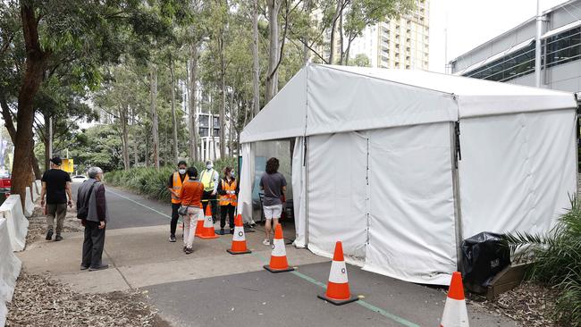
Covid case numbers are continuing to decline across NSW as reduced isolation periods are set to come into effect this week.
Figures from NSW Health show 3334 cases and 25 deaths were recorded in the latest 24 hour reporting period.
In the last week there was a 28.9 per cent decline in the number of new reported cases with 22,999 cases, down from 32,343 in the previous seven day period.
The trend has led to fewer hospitalisations with 1530 people in hospital with Covid-19 as of Wednesday – down from 1756 last week – and 29 people in ICU, down from 36.
NSW Health said the “current wave of transmission is in decline as evidenced by decreasing hospitalisations and PCR positivity”.
In a sign NSW is now living with the virus, the routine reporting of Covid-19 information including case numbers and deaths will be reported on a weekly basis – rather than daily – from tomorrow.
New isolation periods will also come into effect from tomorrow, cutting the isolation period from seven to five days except in vulnerable settings such as disability and aged care.

NSW Health said it would continue to alert the public to any Covid-19 “developments of concern”.
A breakdown of the current Covid cases has revealed parts of regional NSW and southwest Sydney continue to record the highest number of cases per resident population.
In the Inverell area, the active case number rate per population is 1.05 per cent, followed by Bourke with a rate of 0.982 per cent, Orange with 0.981 per cent and Shellharbour with a rate of 0.92 per cent.
Campbelltown has a rate of 0.9 per cent, Camden has 0.895 per cent and Dubbo has 0.892 per cent.
SEE HOW MANY ACTIVE CASES ARE IN YOUR SUBURB
*Click on the three horizontal lines in the top left of the map. You can then choose between active case by LGA or by suburb.
Latest postcode data shows the Campbelltown postcode of 2560 has the highest overall number of cases with 786 active cases.
The Liverpool postcode of 2170 is another hotspot with 708 active cases.
In The Hills district, the 2155 postcode – taking in suburbs including Kellyville – has 492 active cases while the neighbouring 2153 postcode, taking in Baulkham Hills has 358.
The Blacktown postcode of 2148 has 459 cases, the Penrith postcode of 2750 has 411 cases and the Parramatta postcode of 2150 has 203 cases.
The 2570 postcode, taking in suburbs from Nattai to Camden, has 560 active cases, and the 2145 postcode taking in Wentworthville has 500.
The Hornsby postcode in the city’s north has 268 active cases, while the Dee Why postcode of 2099 has 187, the 2066 postcode taking in Lane Cove has 185 cases and the 2065 postcode taking in St Leonards has 159.
In the city’s east, Randwick’s 2035 postcode with 201 cases, the 2036 postcode in the Botany region with 189 active cases and the 2031 postcode, taking in Clovelly has 173.
Outside Sydney, Tamworth has 473 active cases, Orange has 427 active cases, Dubbo has 424 active cases and Wagga Wagga has 319.
Case numbers remain high on the Central Coast with the 2250 postcode, which takes in Gosford, recording 696 cases while the 2259 postcode has 576 cases.
In the Illawarra region, the Wollongong 2500 postcode has 285 active cases and the neighbouring 2530 postcode in Dapto has 281 active cases.


‘Bring your bins in people’: Calls to crackdown on bad bin-haviour
Residents in inner Sydney, could soon require a permit if they want to leave their bins on the kerb, as part of a bid to rid the streets of clutter.

‘They’re off’: $962m king’s look into real estate woes
Australia’s newly crowned best-selling property agent has revealed an eye-opening look into what really happens behind the scenes when it comes to selling and buying our homes.