North Entrance: DA lodged for seawall blames management of Tuggerah Lake opening for erosion
Widening The Entrance Channel to alleviate flooding in Tuggerah Lake is like ‘robbing Peter to pay Paul’ according to a new report, which blames it for erosion at North Entrance.

Central Coast
Don't miss out on the headlines from Central Coast. Followed categories will be added to My News.
When a man and his excavator joined dozens of locals with shovels frantically trying to open a second channel to alleviate flooding in Tuggerah Lake in February 2020, little did they realise they were inadvertently paving the way for the single worst erosion event to ever hit North Entrance Beach five months later.
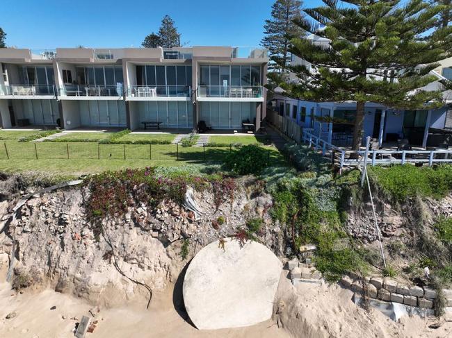
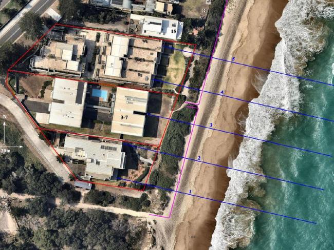
That is the shock claim in a new report lodged as part of an application for a 90m-long seawall to protect three sets of residential flat buildings, which have been under threat from coastal erosion since July 2020.
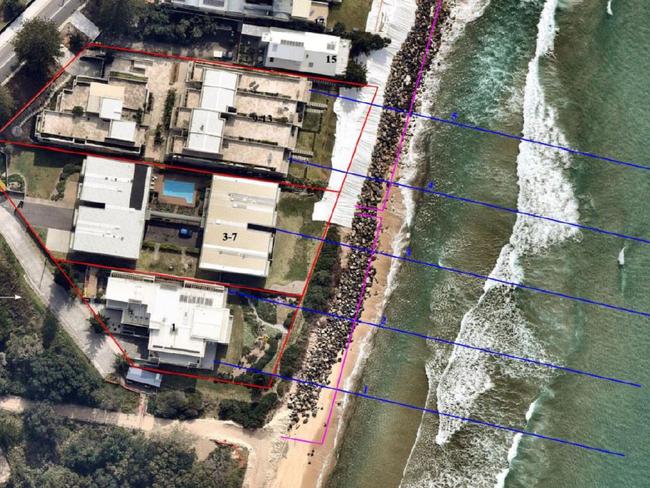
The owners of the three strata plans for the properties from 1-13 Hutton Rd, The Entrance North, have lodged a development application (DA) to build a terraced seawall entirely on their lands at an estimated cost of $2.99m.
Designed by Peter Horton, of Horton Coastal Engineering, the 90m-long, 6.5m tall wall would be made from reinforced concrete supported on concrete piles driven deep underground and anchored to the coast by equally deep rods set at an angle to prevent it from ever “toppling over” in the event of a big enough storm.
The DA placed the blame for the worst erosion event ever recorded at North Entrance Beach since 1941 squarely on the mismanagement of The Entrance Channel.

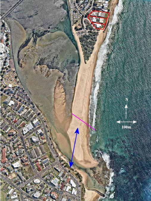
It states when storms and big seas hit in July 2020 and again in 2021, the entrance to Tuggerah Lake was open well north of its usual position closest to Memorial Park.
“This was a significant factor causing the (North Entrance) beach erosion at the site in 2020 and 2021, and the lack of beach recovery since,” the DA states.


“The significant contribution of Tuggerah Lake entrance management to the loss of sand
at North Entrance Beach cannot be understated.
“The breakout of the entrance hundreds of metres north of its usual position in 2020, and formation of a flood channel running alongshore to the north which persisted for months, resulted in sand being transported away from the site alongshore and not being able to return cross-shore to the site from offshore bars. Similar processes also occurred in 2021.
“These breakout events in 2020 and 2021 have caused significant loss of beach volume not only on the subaerial beach, but offshore where the sand losses have delayed and reduced the recovery of sand volumes on the beach.”
The DA states “study boundaries” in developing the Tuggerah Lakes, Open Coast and Coastal Lagoons management plans meant the “direct link between entrance management and North Entrance Beach sand volumes” was never adequately identified.


So in a case of robbing Peter to pay Paul, the efforts to open a second channel to the north to alleviate flooding around Chittaway Bay and Long Jetty in February 2020, may have inadvertently enabled massive erosion that threatened to topple properties into the sea at The Entrance North by July.
In response to the erosion, Central Coast Council carried out emergency works by placing rock boulders and geotextile matting at the site in late July and early August.
The DA states that if The Entrance Channel was managed appropriately, sand would return to the beach and all but cover the proposed seawall, allowing council to remove the emergency boulders which were “inadequate” and posed a safety risk to beachgoers.
The plans, which will have to go before the Hunter Central Coast Regional Planning Panel for determination, state the wall would have a lifespan of 60 years.


