
Coastal erosion threat may be worse than council maps show
MAPS being used by NSW Councils to identify areas at highest risk from rising seas and coastal erosion may be dangerously underestimating the number of houses in the firing line.
Central Coast
Don't miss out on the headlines from Central Coast. Followed categories will be added to My News.
THOUSANDS more NSW properties than first thought may be at risk of severe coastal erosion according to new modelling.
The modelling suggests that coastal hazard maps being used by councils may significantly underestimate how many properties could be impacted in the medium to long term by rising sea levels and erosion.
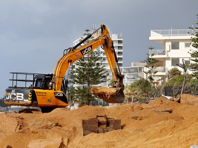
As many as 2718 NSW coastal addresses could have more than half of their land damaged by erosion by the year 2050 - more than double the number currently expected by councils.
The numbers get even worse in the 50 years after that when 5076 addresses could potentially have more than half of their land hit by erosion - compared with the 3315 estimated in current coastal hazard mapping.
The study of shoreline changes was conducted by the NSW office of Environment and Heritage and published in the Journal of Marine Science and Engineering in December.
Unlike previous studies, the new modelling divides the NSW coastline into sections and subsections and factors in unique local conditions such as coastal geography, wave patterns, hydrology and the way sand moves on and off shore.
It demonstrated that a one-sea-level-rise-scenario fits all approach needed a rethink, and there could be significant impact variations at local scale.
What the modelling suggests
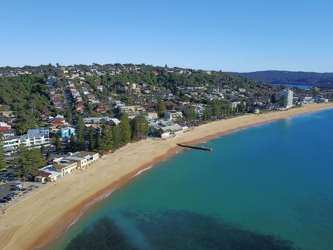
■ Coastal erosion predictions for the present were probably accurate enough - with highest erosion exposure likely on the Central Coast and Greater Sydney .
■ There will be an increase in coastal erosion exposure in all NSW coast regions this century - and most of the increase will be for addresses where at least a quarter of the lot will be impacted.
■ In the years from 2050 to 2100 the Northern Rivers, Mid North Coast and Illawarra Shoalhaven regions could experience a dramatic increase in the number of exposed properties and the degree of exposure.
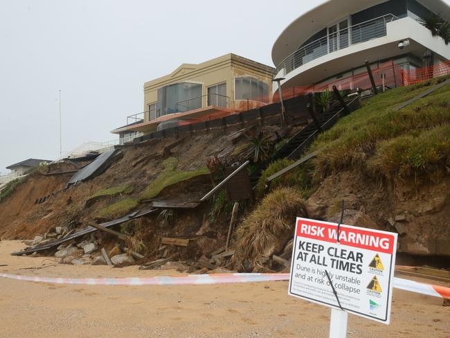
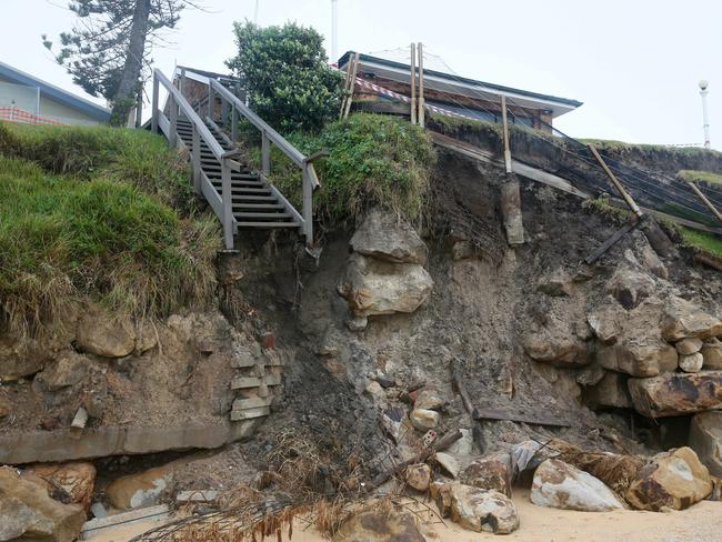
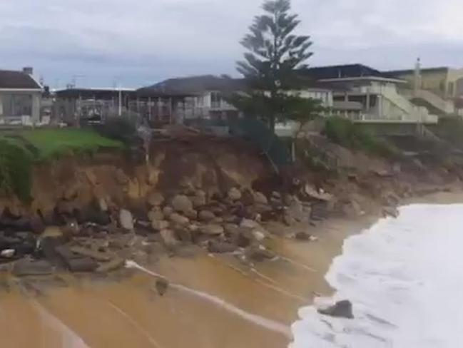
■ Almost all the properties immediately fronting Wamberal Beach may be exposed to severe beach erosion caused by extreme coastal storms.
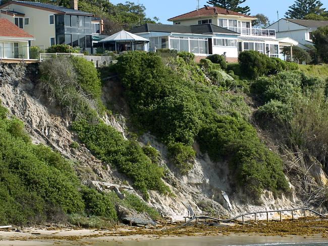
Fifteen coastal erosion hotspots have previously been identified in NSW including Noraville, The Entrance North, Norah Head and Wamberal-Terrigal on the Central Coast and Bilgola, Mona Vale, Collaroy and Narrabeen in Sydney
Report lead author Coastal and Marine scientist Dr Michael Kinsela was unavailable for comment.
Coastal expert: Decide what to sacrifice
Newcastle University senior lecturer and coastal scientist Dr Hannah Power said the latest research added to understanding of how future sea level rises would impact on property and infrastructure.
“If we look at the open coast, beaches like Wamberal are at risk of high levels of coastal erosion during big storms such as the one we saw in June 2016,” Dr Power said.
“During that storm, lots of sand was moved offshore. Some of that comes back over time as beaches are cyclical and change with time.
“While there may or may not be future net losses of sand from beaches, we can say that as sea levels rise, the impact zone where waves are able to erode a beach will shift the erosion zones landwards.
“Based on our best knowledge, and even with some gaps in our understanding, we can be confident in saying that we will see erosion into areas where we have dwellings and infrastructure.
“In fact, this is happening in places around the state right now.”
Dr Power said sea level rise problems would not be confined to the open coast.
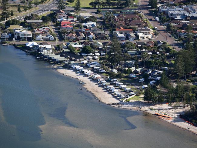
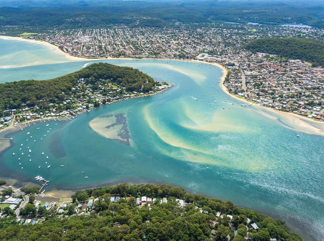
“In estuarine locations around places like Woy Woy, Gosford and Brisbane water erosion is less likely but tidal inundation will become more of an issue as sea level rises,” Dr Power said.
“Sydney’s Fort Denison tide gauge is the main primary tide gauge for the state and two of the top five water levels ever recorded occurred this summer. One occured in December 2017 and one occured in January 2018,” she said.

The Fort Denison tide guage records span 120 years - among the longest period in the world. Over that time maximum high tides have exceeded 2.28m only three times (June 1956, May 1974, April 1990) and often associated with storms. The recent peaks of 2.27 and 2.28m were in summer, during calm weather.
Dr Power said some sea level rise was inevitable, even if carbon emissions could be halted today.
There will continue to be sea level rise beyond what we have already seen - the science on this is clear.
“It’s just a matter of what the magnitude of the sea level rise will be,” she said.
She said communities and councils would have to decide what they would save and what would be sacrificed and how the cost would be met.
“Avoiding increasing the problem through sensible planning is far better than responding to problems,” she said.
“We do need to prepare for sea level rise.
“For the infrastructure and dwellings that are at risk of erosion and inundation, what we do will come down to an economic cost benefit analysis.
“But what we really need to do is ensure we’re planning sensibly for the future. This is absolutely critical.
“The results from this latest research suggest that we need solid investment in coastal management and to plan appropriately for our coastal regions to ensure we mitigate the risk and don’t create more problems that what we already have.”
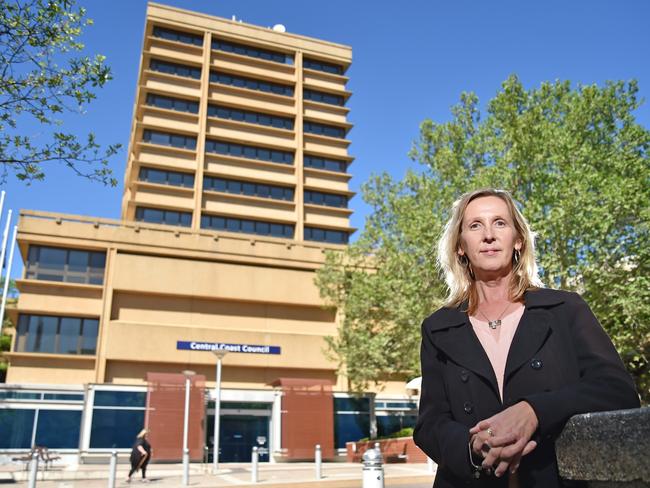
Mayor calls for more action
Central Coast Council Mayor Jane Smith will seek to refocus the council’s efforts to prepare for the impacts of climate change in a mayoral minute to Monday night’s council meeting.
Speaking before the meeting Cr Smith said the council needed to “prepare for and mitigate” for a range of climate change impacts including sea level rise, extreme weather events, and rising temperatures.
Cr Smith said she expected all kinds of council infrastrucutre would be exposed to negative climate change impacts including sewerage systems, parks, and some roads.
Cr Smith said that under State Government legislation, the cost of doing remedial work in areas affected by erosion or inundation will be carried by whoever stands to benefit most.

‘Like the Honey Badger’: U16 players to watch at City v Country rugby
Young guns in the U16s City v Country battle will be playing for more than pride and victory on Sunday. Rising stars - including ones likened to the Honey Badger and Brian To’o - to watch

Serial drink driver avoids jail after 6th offence behind the wheel
An Ettalong roofer with a shocking record of drink-driving and licence breaches has been sentenced after being caught behind the wheel while suspended and over the limit for the sixth time.