
Aitkenvale gets 51mm of rain in 2 hours as flash flooding hits city
More than 100mm of rain has fallen in some parts of the region today, with flash flooding and river rises closing roads. SEE ALL THE PHOTOS + latest forecast >>
Townsville
Don't miss out on the headlines from Townsville. Followed categories will be added to My News.
3.30pm: With Upper Major Creek recording 101mm of rain in under six hours, eyes are on the Haughton River this afternoon as it rapidly rises.
As of 3.30pm, water was at 4.52m and rising, and there was not yet any flood warnings for the bridge between Townsville and Ayr.
It comes as isolated storms caused flash flooding across parts of Townsville, with Aitkenvale hardest hit, copping 65mm in six hours.
The downpour led to water gushing over roads and rising to the wheel arches of many cars.
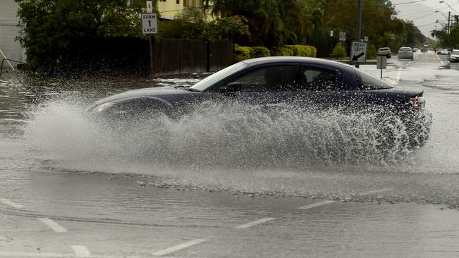
Earlier: Heavy sudden downpours have left a number of suburban streets awash.
Water on Wotton St has reached the lower parts of car doors.
The Aplins Weir gauge recorded 37mm of rain in just an hour while Townsville Airport received 29mm and Louisa Creek 27mm.
Aitkenvale received 51mm in the 2 hours to midday.
There have also been reports of localised flooding in Gulliver.
Wishing I’d bought gum boots yesterday. #townsville pic.twitter.com/EU0cTaDP6N
— Caitlan Charles (@ccharles93) January 29, 2020
A downpour of more than 70mm of rain in an hour has triggered a landslide, forcing close a road.
Mount Spec Rd leading from Crystal Creek to Paluma has been closed as a result of debris on the road.
Paluma copped 71mm of rain fell in just an hour shortly before 7am.
In the regions, heavy rain and damaging winds are expected across Northwest Queensland today.
Heavy rain, which may lead to flash flooding, is likely about the Gulf Country, southwestern Peninsula, North West, western Northern Goldfields and Upper Flinders, and far northern Channel Country districts tonight, the weather bureau warned.
It said six hourly rainfalls of 100mm to 200mm are likely, and locally heavier falls were possible.
Damaging winds, with gusts more than 90km/h, are also expected.
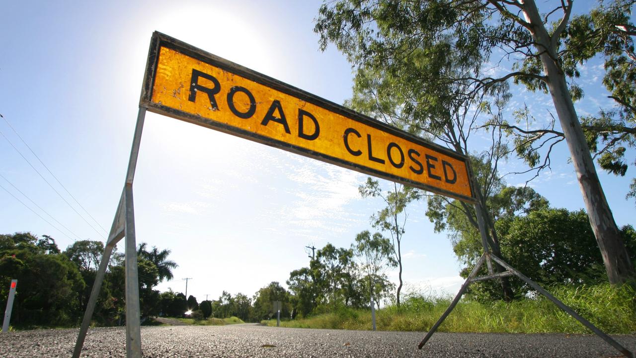
Flash flooding has closed a number of roads near Hughenden, Richmond and Cloncurry.
A tropical low over the Gulf Country near Normant will begin to move southwest later today and should out of Queensland this evening.
A number of North Queensland schools have been closed following record-breaking rainfall.
Home Hill State High School, Jarvisfield State School and Kalamia State School will be closed on what is the second day of the new school year.
The small community of Rita Island, outside of Ayr, was drenched by 529mm in 24 hours while Ayr copped 421mm and Groper Creek got 418mm.
Flash flooding is still affecting roads in the region, including the Bruce Highway in Ayr with water over the road at Plantation Creek. A single lane of the highway remains in operation at Home Hill.
RELATED
In pictures: North, Central Qld awash
Wet first day has kids swap school shoes for thongs
The Department of Transport and Main Roads warned motorists not to drive through floodwaters.
More rain is expected in the Burdekin today, with a chance of a thunderstorm delivering heavy falls.
>> Subscribe now: 28 days of unlimited access for just $1
In Townsville today there is a very high chance of showers. Possible storms could deliver heavy rainfall.
Where the rain fell
Rainfall of more than 100mm was recorded around Ingham from 9am Tuesday to 8am today.
Ingham Depot: 172mm
Ingham Pump Station: 159mm
Cardwell Gap: 153mm
Gairloch: 153mm
Paluma: 147mm
Poverty Hill: 144mm
Sings Farm: 142mm
Halifax: 122mm
Rita Island: 100mm
Rollingstone: 57mm
Upper Bluewater: 32mm
Dalrymple Road: 19mm
Woolshed: 13mm
Originally published as Aitkenvale gets 51mm of rain in 2 hours as flash flooding hits city