
South Australia set for a wet weekend with rain on the radar across the state
As South Australia is finally graced by much-needed rain, an earlier storm has left a devastating impact on a busy metro coastal area.
SA News
Don't miss out on the headlines from SA News. Followed categories will be added to My News.
As much-needed rain starts to fall across the state on Friday, damage from last week’s storm has been revealed.
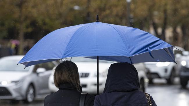
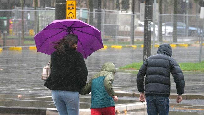
Friday’s wild weather has seen Sealink ferries cancelled, with coastal and marine weather warnings in place and wind and rain expected across the state all weekend.
The fresh warnings comes after coastal residents and visitors to Glenelg were warned to take care after last week’s storm caused damage to the North Esplanade coast path.
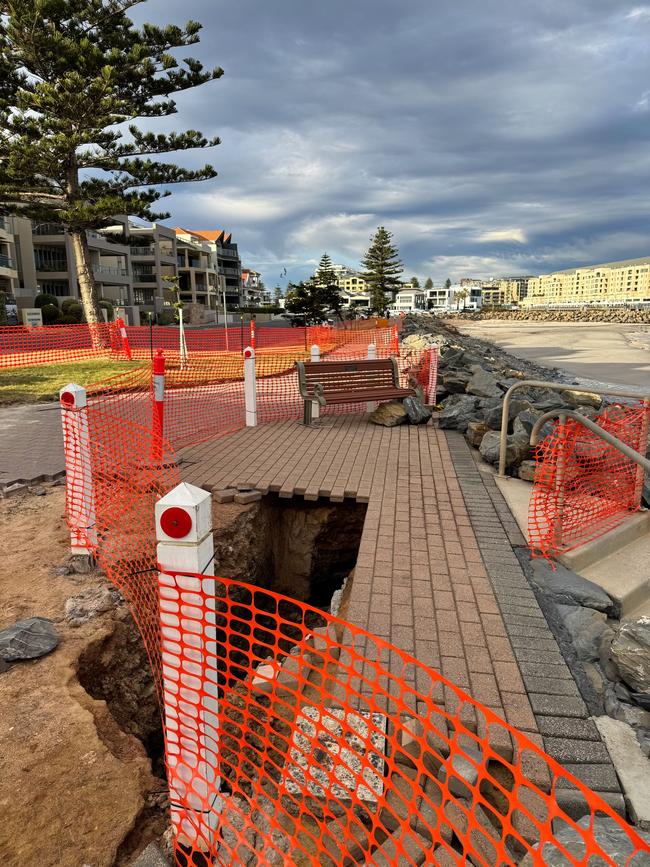
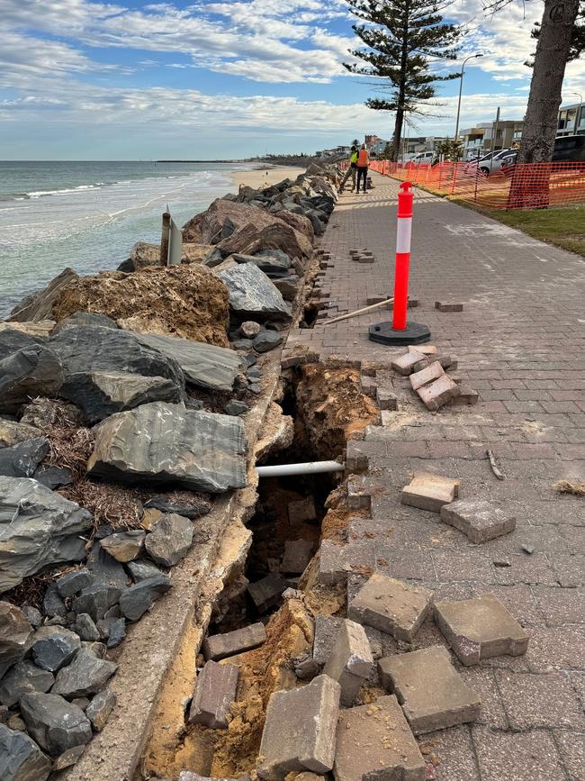
The City of Holdfast Bay said the council’s engineering team was investigating the extent of damage with a large section currently fenced off.
“Approximately 220 lineal metres of the coast path was damaged, in particular the infrastructure under the paved footpaths and parts of the rockwall,” the council posted online.
“As investigations continue, the footpath will remain off-limits to the public with structural and coastal engineering consultants expected to assess the damage early next week.
“We’ll keep the community informed on the next steps however the roads around the fenced areas remain open as normal.”
Much-needed rain started to hit South Australia on Friday morning, as the state prepares for a King’s Birthday long weekend soaking.
Adelaide’s West Tce gauge recorded 5.4mm of rain overnight and this morning, with similar readings around northern and southern suburbs.
Mount Lofty has so far received 13mm while on Kangaroo Island, Parndana has seen 15mm of rain overnight.
Meaningful rain is predicted to hit SA’s agricultural areas during the day on Friday after the state endured a severe deficiency of autumn rainfall.
Jamestown, in the state’s Mid North, has recorded 3mm overnight and the rainfall is expected to build today before a promising forecast of up to 20mm and 25mm for each of Saturday and Sunday.
Even more is tipped for the Mount Lofty Ranges, Kangaroo Island and the southeastern districts with 20-30mm possible on Saturday.
In the state’s South-East, Naracoorte and Keith are set for up to 20mm on Saturday.
Adelaide is tipped for a very high chance of showers continuing on Friday, most likely in the afternoon and evening with up to 15mm set to fall.
The rain will continue from Sunday until Tuesday in the agricultural areas, becoming more isolated early next week.
The rain is expected to hang around in Adelaide on Sunday with up to another 15mm forecast and continue into Monday, with up to 8mm.
With the rain comes the cold, with a maximum temperature of 17C tipped for Adelaide on Friday, 16C on Saturday before dropping to a max of 13C on Sunday. Apparent “feels like” temperatures are far colder.
It will be chilly in the Adelaide Hills, with Mount Barker set for a top of 15C on Thursday before a top of just 11C is tipped by Sunday when the top temperatures are in the low teens across the state.
More Coverage


Originally published as South Australia set for a wet weekend with rain on the radar across the state

Sticky-finger bandit’s late-night stack snatch at iconic CBD eatery
An overnight intruder wasn’t after a stack of hot cakes when he forced his way into one of Adelaide’s most iconic eateries – but what he did take, left a sour taste in the owners’ mouths.

Commute derailed: What 6-month tram shutdown means to you
Major disruption looms for Adelaide commuters as the entire tram network shuts down this weekend. See how your ride to work will be hit.