
Shocking before and after satellite photos show full scale of Tonga tsunami devastation
Days after a tsunami devastated Tonga, before-and- after images show exactly how much damage the catastrophic event caused.
Travel Incidents
Don't miss out on the headlines from Travel Incidents. Followed categories will be added to My News.
Shocking before and after satellite photos have revealed the full scale of the devastation caused by the catastrophic tsunami in Tonga, which is even visible from space.
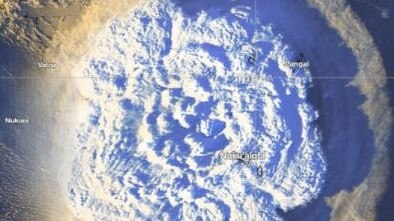
Images taken around 12 hours after the Hunga Tonga-Hunga Ha’apai volcano erupted, show the island has completely disappeared, The Sun reports.
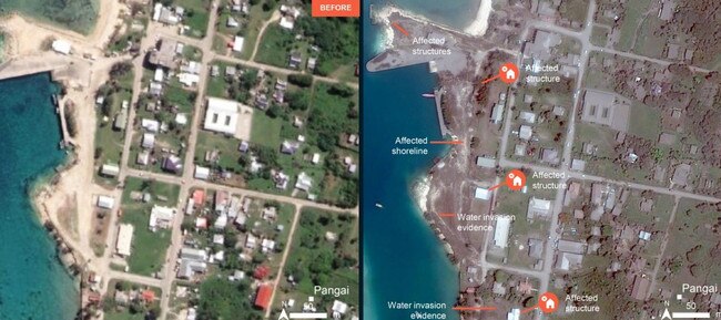
Tonga’s main island, Tongatapu, has been heavily affected in the wake of the disaster, with water damage visible to the northern and southern sides from the satellite imagery.
While initial reports do not suggest mass casualties, one person – a British aid worker – has been reported dead and the eruption has also caused damage to the islands of Uoleva and Nomuka.
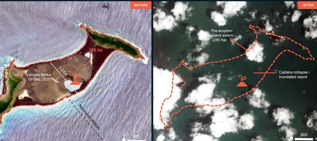
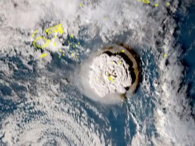
Hunga Tonga-Hunga Ha’apai last erupted in 2014. But early data suggests Saturday’s eruption was the biggest since Mount Pinatubo erupted in the Philippines 30 years ago, New Zealand-based volcanologist Shane Cronin told Radio New Zealand.
He said: “This is an eruption best witnessed from space.”
And there may be more to come.
“Further volcanic activity cannot be ruled out,” the UN Office for the Coordination of Humanitarian Affairs (OCHA) said in the update today.
It added that the official assessments have not been released yet as communications have been badly hit.
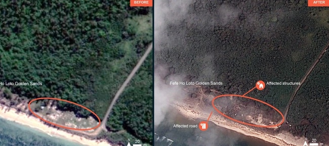
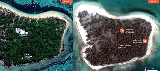
Maxar Technologies also released the following satellite images showing the devastating aftermath of the eruption.
Body of aid worker found
Concern has been mounting for the inhabitants of two small low-lying islands – Fonoi and Mango – after a distress beacon was detected.
According to the Tonga government, 36 people live on Mango and 69 on Fonoi.
It comes as the body of the missing British charity worker Angela Glover, 50, was discovered by her husband James earlier today.
Two more people have drowned at the coast of Peru after the tsunami sparked high waves.
The eruption was felt as far away as Fiji, New Zealand, the US and Japan.
Aid workers have warned 80,000 of Tonga’s residents could be affected.
Meanwhile, Australia and New Zealand have sent surveillance flights today to assess the damage.
Australia’s Minister for the Pacific Zed Seselja said Australian police had visited beaches and reported significant damage with “houses thrown around”.
Tonga’s deputy head of mission in Australia Curtis Tu’ihalangingie said Tonga was concerned about the risk of aid deliveries spreading Covid-19 to the island, which is free of the virus.
“We don’t want to bring in another wave – a tsunami of Covid-19,” Mr Tu’ihalangingie told Reuters.
Resort wiped out
The Haatafu Beach Resort, on the Hihifo peninsula, 20km west of the capital Nukualofa, was completely wiped out, the owners said on Facebook.
The family that manages the resort ran for their lives through the bush to escape the tsunami, the post said. The whole western coastline has been completely destroyed along with Kanukupolu village, the post said.
The Red Cross said it was mobilising its network to respond to what it called the worst volcanic eruption the Pacific has experienced in decades.
Alexander Matheou, the federation’s Asia Pacific regional director, said water purification, providing shelter and reuniting families were the priorities – but they had yet to establish direct contact with colleagues on the ground and were relying on estimates based on similar previous disasters.
This article originally appeared on The Sun and has been republished with permission

Originally published as Shocking before and after satellite photos show full scale of Tonga tsunami devastation

Bizarre last moments of missing Aussie mum
Authorities have revealed the mysterious timeline of a missing Aussie mum’s movements in Mexico before her daughter was found abandoned.
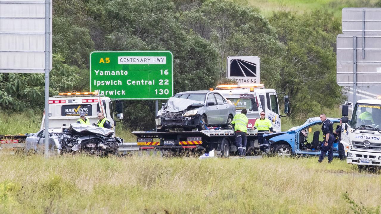
Four dead in Mother’s Day horror
Four people have died in multiple crashes across Queensland on Mother’s day, marking a horror weekend on our roads.