Major flood emergency for Wide Bay, Burnett regions after 650mm deluge in 24 hours
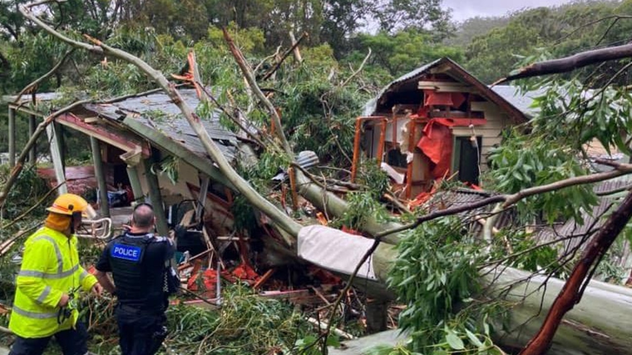
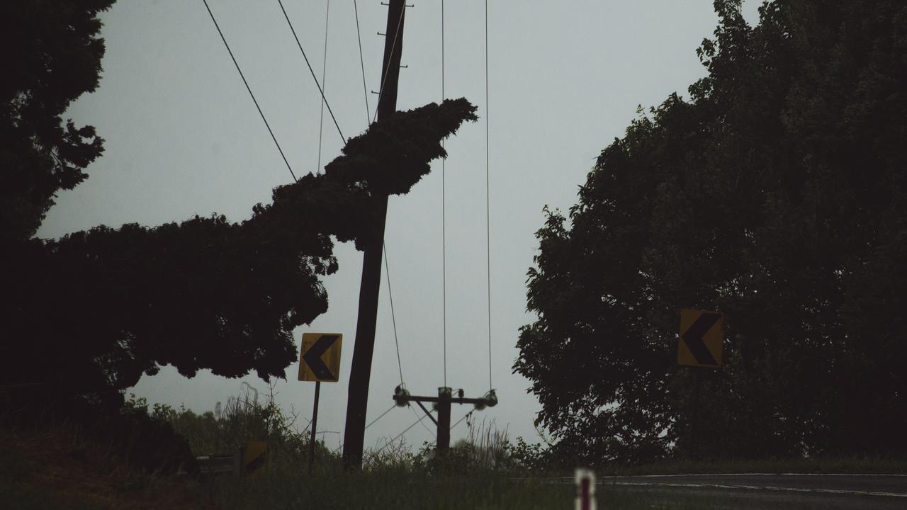
A man is dead, a teenage girl is missing, highways have been washed away and towns are cut following an “incredibly rare” weather event that dropped 673mm of rain over the Wide Bay region, sparking a major flood emergency.
QLD weather news
Don't miss out on the headlines from QLD weather news. Followed categories will be added to My News.
A man is dead, a teenage girl is missing, highways have been washed away and towns are cut following an “incredibly rare” weather event that dropped 673mm of rain over the Wide Bay region, sparking a major flood emergency.
The weather events of the past 24 hours far surpass those from the first 24 hours of Cyclone Yasi – which in 2011 saw 200-300mm of rain slam north Queensland in a 24-hour time period – meaning there has not been a rain event as severe in living memory in Queensland.
A 14-year-old girl is missing and feared caught in floodwaters after she and a 40-year-old man were forced to evacuate their Toyota Camry early on Saturday morning.
A statement from Queensland Police said police and emergency services were called to reports the man and girl had become caught in floodwaters near the Burnett Highway and Murgon Gayndah Roads at Booubyjan (near Gympie) in the early hours of the morning.
“It is believed the pair were in a Toyota Camry sedan and managed to get out of the vehicle before it was swept away,” police said.
Crews and aerial assets struggled to reach the pair due to deluged roads and extreme weather conditions, police said.
A 22-year-old man is understood to have drowned in a vehicle after being swept away in floodwaters about 7.30pm on Friday in Kanigan. A police spokesman said the incident happened on Cherry Tree Rd.
The young Sunshine Coast man was found alone in his ute this morning after an extensive search involving police and fire swift water crews.
Reports of the man’s ute being swept into flood waters off Cherry Tree Creek Rd, near the Bruce Highway, first came about 7.30pm Friday.
The man’s body was finally retrieved from the ute – which was swept away in flood waters about 7.30pm on Friday – on Saturday afternoon.
Rescue crews have been unable to access many areas smashed by the freak deluge which dumped more than half a metre of water over parts of central Queensland.
Queensland Fire and Emergency Services has revealed between 9am Friday and 2.30pm Saturday, 38 water rescues took place across the state.
During the same time period, there were 141 requests for SES assistance in the North Coast region.

An emergency alert has been issued for Maryborough residents, who have been warned the Mary River will not reach its peak of about 9 metres until Sunday.
Speaking at a media conference in Brisbane, Queensland Premier Annastacia Palaszczuk said people should “be prepared”.
The Bureau of Meteorology said overnight, a very intense rain situation unfolded, which was “incredibly rare”.
“It’s produced thunderstorms that have sat stationary … but overnight … it’s produced a lot of rainfall in a very small area,” a BOM meteorologist said during the 11.30am press conference.
“This was incredibly rare. We rarely see thunderstorms sustain in the same region for such a long period of time.
“The magnitude of what we saw really escalated during the night. It was a really evolving situation.”
The rain was localised around the Gympie area but there remain several threats of flash flooding, with more rainfall expected over the hours to 4pm.
Marodian, southwest of Gympie recorded an extraordinary 673mm since 9am Friday while 650mm has fallen at Mt Kanigan, northwest of Gympie, 523mm at Glenwood and 464mm at Brooyar.
RACQ spokeswoman Lauren Ritchie said the weather events of the past day were far more significant than even Cyclone Yasi.
“Cyclone Yasi had between 200-300mm of rain in the first 24 hours, this is nearly more than three times as much,” she said.
“We haven’t seen a rain event quite like this before and the sheer amount has caused significant damage to the road network and we expect will cut hundreds of roads for several days.
Deputy Queensland Police Commissioner Steve Gollschewski said it was a “very live and evolving” emergency. “We’ve seen a large number of people already trapped and a significant number of rescues,” he said.
He urged the impacted communities to listen to the radio and stay well informed with what’s happening around them.
He said there are sufficient resources, and several rescue capabilities had been deployed.
He said 23 people in 11 vehicles have been located so far.
The situation for another 15 people remains tense, as the Premier revealed emergency crews have been unable to reach them.
“They’re working to access these people, so we’ll be updating you throughout the day,” Ms Palaszczuk said.
The condition of the 15 remains unknown.
Four people have been rescued from raging floodwaters in central Queensland and taken to hospital in Bundaberg.
Some parts of the Bruce Hwy have been opened, while localised flooding continues to keep some regions cut off.
The Bruce Hwy has been opened to single-lane traffic at Gutchy Creek between Gympie and Tiaro
However, just 100km north, the highway remains shut due to extensive flood damage at Duingal Creek, north of Appletree Creek. Many more roads also remain closed.
.

Ms Palaszczuk thanked all emergency services and SES crews for going to extraordinary efforts for helping those in the region that has copped the deluge as part of the aftermath of ex-tropical cyclone Seth, which hasn’t moved and has been sitting over the Wide Bay region for some time.
“We do have locally intense rainfall which may lead to flash flooding,” Ms Palaszczuk said.
Granville, a rural suburb of Maryborough, will be completely isolated in a matter of hours, as disaster management teams plan to shut off the Granville Bridge.
The Lamington Bridge, which spans the Mary River, has also been closed.
At 11.20am on Saturday, and emergency alert was issued for Maryborough, warning that the Mary River wouldn’t reach its peak until Sunday morning.

“The Mary River is expected to exceed the major flood level of nine metres in the greater Maryborough area on Sunday morning and properties in the area may experience flooding based on the predicted flood height,” the alert said.
“Residents are advised to prepare to move to higher ground, secure their belongings and warn others.
“An evacuation respite centre has been set up at the Brolga Theatre from 1pm today.”
Woolworths has advised that its Maryborough store will be closing an hour earlier today due to expected flooding.
A spokesman said the store would be closing at 5pm to allow staff and customers to get home safely.
Flooding in Gympie is expected to peak on Saturday afternoon and at 2pm, Gympie Regional Council issued an Emergency Alert for Goomeri, Kilkivan and Woolooga residents advising that significant flooding is impacting the area and residents should stay in their homes.

Fraser Coast Mayor George Seymour is expected to enter into disaster management meetings with the Premier late Saturday morning.
RAINFALL TOTALS
- Marodian – 673mm
- Mt Kanigan – 650mm
- Miva 567mm
- Glenwood – 523mm
- Brooyar 464mm
- Mt Joseph 449mm
- Broowena – 408mm
- Old Range Road – 326mm
- Kilkivan – 288mm
- Pomona 210mm
- Mt Glorious – 164mm
- Mapleton – 126mm
- Kin Kin – 116mm
- Eumundi – 109mm
- Yandina 102mm
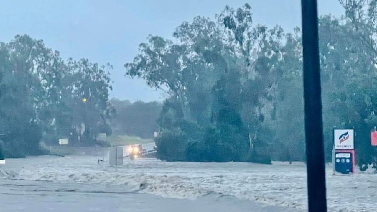
Flooding is also occurring on the Bruce Hwy at Apple Tree Creek while Booyal Roadhouse is under water.
The D’Aguilar Highway is also closed in both directions at Kilcoy due to flooding in Kilcoy Creek.
It comes as Queensland Fire and Emergency Services responded to about 20 calls for help in the North Coast overnight.
A QFES spokeswoman said the calls from the Sunshine Coast to Gympie included people in flooded houses and cars being swept into floodwater.
QFES crews were called to Tansey Hall Rd at Tansey this morning after reports of a person stuck in floodwaters.
“They used a motorised craft to bring two people back to dry land and they all made it back safely,” the spokeswoman said.
“The crews are just finishing up there now, they are still on scene.”
Further north at Booyal, four people were rescued from a flooded house.
The rural fire brigade was called to the home about 6.30am.
“They made their way in, and exited with four people safe,” the spokeswoman said.

Three people were pulled from flood water at Ganulda in the early hours of Saturday.
Four QFES crews were the first on scene at Miva Rd where a car was swept into water just after 1am.
Two swiftwater rescue technicians pulled a person from the water and brought them back to dry land using an inflatable craft.
“They also located another two people in the same area who were in a truck and they also took them back to dry land,” the QFES spokeswoman said.
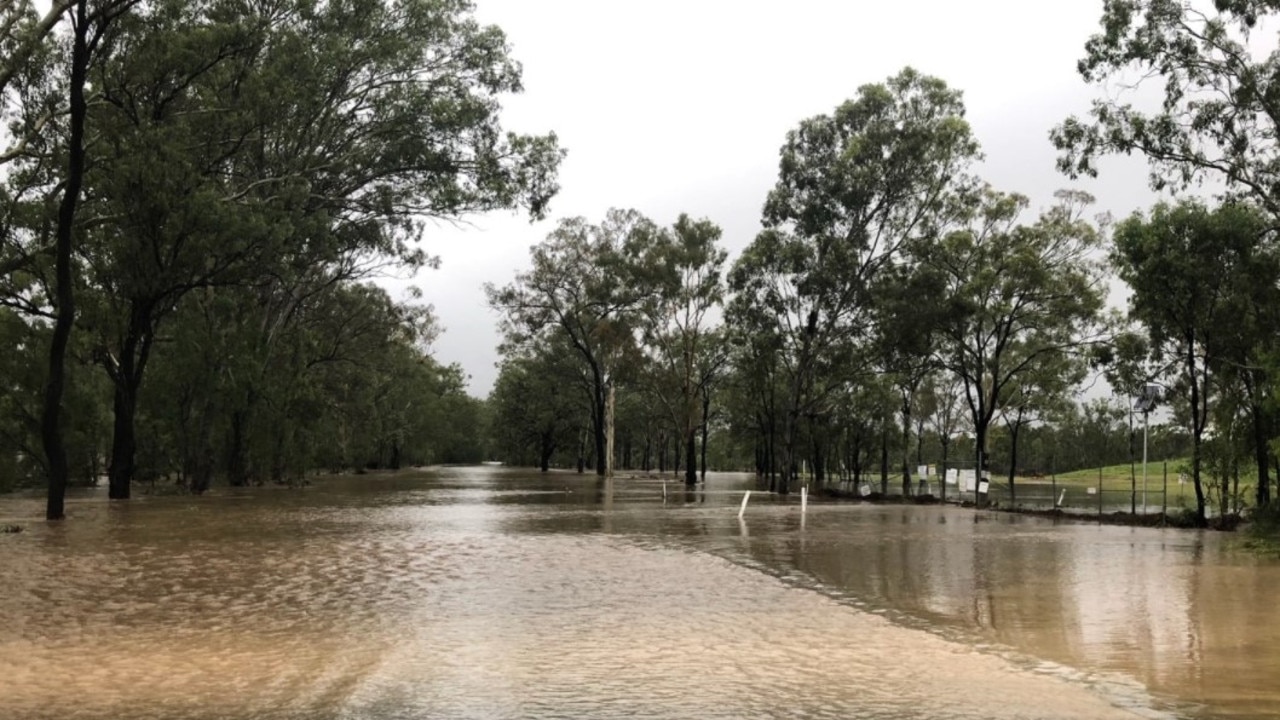
Crews were also called to Woolooga, near Gympie, just after midnight and rescued another person after reports of a car stuck in floodwater.
QFES reported a quick rescue at Brooweena Woolooga Rd.
QFES Assistant Commissioner Steve Smith said there have been 38 requests for assistance across the impacted region.
“This is a very fluid event, instances are still being responded to- 18 incidents remain open,” Mr Smith said.
“We do urge caution. If you can stay at home and stay safe- stay at home.”
132500 is the number to call for SES help, while if in a life endangering situation, call triple-0.
There have been 673 reported power outages by the Fraser Coast Regional Council.
Impacted areas include: Gundala, Gundiah, Mount Urah, Netherby, St Mary, Tiaro, Calgoa, Glen Echo, Miva, Munna Creek, Woolooga, Sexton, Theebine, Granville, Antigua, Aramara, Dunmora, Ferney, Grahams Creek, Gungaloon, Mungar, Owanyilla, Pilerwa, Pioneers Rest, Thinoomba, Tinana, Yengarie, Yerra, Broweena, Glenbar and Paterson.
According to the local council, the loss of supply is due to damage.
Intense rainfall which may lead to dangerous and life-threatening flash flooding has occurred between Paradise Dam and Mt Kanigan during the night. Further rain is continuing in the area and may reach intense rates during the morning.

Gympie Regional Council issued an emergency alert about 7.30am for all residents in its local government area regarding possible major flooding. Residents are advised to stay off the roads.
They have also been advised to stay tuned to BOM for updates and warnings.
Police have issued an urgent warning to motorists in the Wide Bay region.
Road closures and road conditions can change in an instant, say police, who have warned Wide Bay Burnett locals to reconsider their need to travel.
“During and immediately after severe weather events traversing roadways, either in vehicles or on foot, can be extremely hazardous as water levels can rise and fall quickly,” Queensland Police said in a statement.
“If driving, please travel with extreme caution and drive to the prevailing weather and road conditions – plan your trip, allow additional travel time, incorporating travel at low speeds, delays and diversions.”
A major flood warning remains in place for the Mary River, while a moderate flood warning is in place for the Balonne River.
There is also a minor flood warning for Barambah Creek.
Police have also urged parents and caregivers to keep a watchful eye of youngsters around flood water.
“Parents are also reminded to ensure their children are not playing in flood prone waterways, watercourses and drains as water levels can rise quickly,” Queensland Police said.
Late on Friday night an ‘emergency alert’ was issued by the Fraser Coast Regional Council for major flooding in Miva and Tiaro, south of Maryborough.
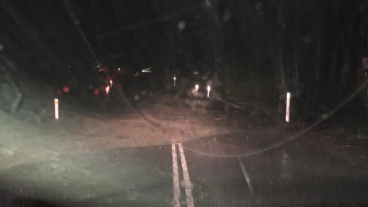
Evelyn Smith feared the worst on Friday night as she watched her shipping containers, trailers and cars float past her family’s Glenwood home.
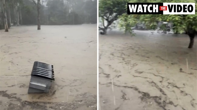
The woman, who had just moved to the Gympie region from southern Queensland, said a wall of water appeared “out of nowhere” about 7pm.
“It literally looked like the Mary River was coming through the front of our property,” Ms Smith said.
“The roar of the water going past the front of the house was the scariest thing I’ve ever experienced.
“We’ve lost everything.”

Ms Smith’s family lost three cars and a fitted-out 12m bus overnight as they watched shipping containers, camper trailers and car trailers tumbling through the water.
Water rose to the top step of her sister’s built-up house where they sought shelter and they feared they had also lost their cats who were found alive in a top cupboard of the bus this morning.
“Everyone is okay, we’ve just lost a lot,” Ms Smith said.
A river is still flowing through the 1.6 acre property this morning with debris scattered in every direction.
Dozens of people were reported as taking refuge at United Petroleum in Gunalda with one person reporting on Facebook that “there are so many cars here. It’s crazy”.
Another reported “currently no roads are open in or our of Gunalda”.
Mike Fry said it had been pouring for hours.
“All the fences are gone, people’s gear is washed into them, cars are under water, houses and sheds inundated,” he said.
“It’s the worst I’ve seen in 16 years, by a very large margin.”
At 8.15pm on Saturday, BOM issued a severe thunderstorm warning for Taroom, Miles and Biloela, while Mount Seaview recorded 51mm of rain in the 45 minutes to 8:09pm
A major flooding warning was also in place for the Mary River downstream of Gympie, while minor flooding was likely in the Mary River at Gympie. There were also reports of levels rising at Six Mile Creek and Tinana Creek.
Meanwhile, Kilkivan Tansey Rd at Kilkivan was blocked by flood waters and emergency services were conducting a number of rescue operations in the Gympie region just before midnight.
Significant hourly rainfall totals
- Old Range Road – 99mm to 2am
- Mt Goonaneman – 118mm to 12.45am
- Mt Kanigan – 112mm to midnight
- Biggenden – 101mm to midnight
- Mt Kanigan – 99mm to 11pm
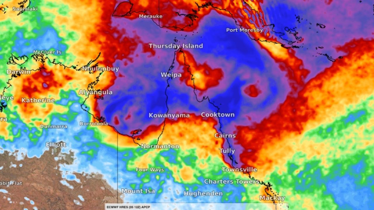
The rainfall is a result of ex-Tropical Cyclone Seth which continues to deliver deluges between Gladstone and the Sunshine Coast, with some pockets expected to receive another 70mm on Saturday.
But a new threat is emerging over the Gulf of Carpentaria with a monsoon stretching more than 1000km.
Bureau of Meteorology modelling predicts there is up to a 50 per cent chance that the system will morph into a full-blown cyclone over the next 48 hours with effects to be felt from Cardwell to the tip of the Cape.

Weather bureau hazard response co-ordinator Brooke Pagel said the next couple of days would be critical for the new monsoon system and its likely impact on the state’s northern territories.
“We are definitely keeping an eye on it,” she said.
“There is a moderate chance it will develop into a cyclone.
“We will have a more accurate idea after the weekend.”

She said it was unlikely to affect the South East, which will be subjected to the remnants of Seth over the coming days.
“Seth has weakened over the last couple of days and is now a really weak low but you’ll still see some showers and storms and isolated heavy falls for the next few days,” she said.
Some areas around Gladstone can expect up to 70mm of rain over the weekend while falls in the range of 5-40mm will impact other regions from the Fraser Coast to Sunshine Coast.
Hinterland areas of the Sunshine Coast recorded up to 90mm in 24 hours to Friday while areas around Gympie reached up to 80mm.
Further south, the Gold Coast has begun the clean-up after days of wet weather combined with huge seas to leave much of the Tourist Strip as a soggy mess.
On Friday, bulldozers moved in to clean up an iconic Gold Coast surf club which was battered by the ex-tropical cyclone.
Currumbin Vikings Surf Club was among spots hardest hit by 4-5m swells and king tides which pummelled southeast Queensland earlier in the week.
Waves surged through the club carpark, smashing steel doors on a concrete storage bunker off their hinges and sweeping a shipping container used to store equipment onto the beach.
Beer kegs were also swept into the ocean and a fence destroyed.

The Vikings carpark was left covered with tonnes of sand and Gold Coast City Council bulldozers and bobcats moved in on Friday morning to clean up the mess.
Club CEO Michael Sullivan said he had never seen the surf surge into the carpark with such force.
“It was crazy,” he said.
“We often get water through the carpark during big swell and king tide events but this was next level.”
Another large swell is forecast to hit next week.
Originally published as Major flood emergency for Wide Bay, Burnett regions after 650mm deluge in 24 hours


