
Qld weather: Severe thunderstorm forecast for SEQ as temperatures soar
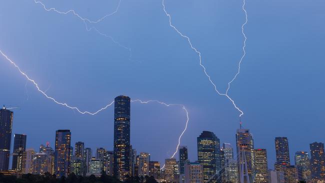
The weather bureau has forecast potentially severe thunderstorms containing damaging winds and hail that could hit SEQ by this afternoon following a major spike in temperatures.

QLD News
Don't miss out on the headlines from QLD News. Followed categories will be added to My News.
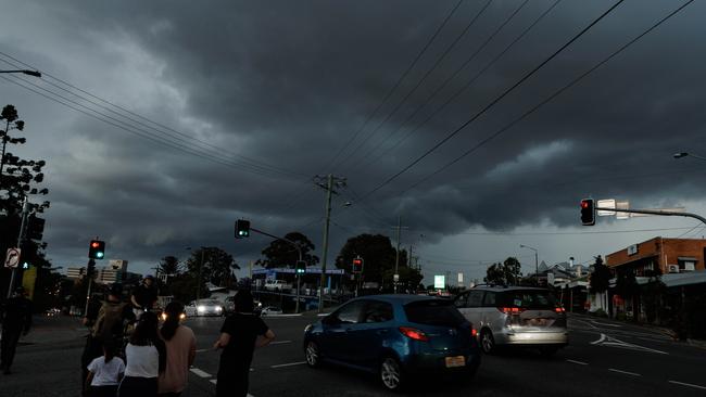
Potentially severe thunderstorms have been forecast to smash the southeast later today as Queensland swelters through sizzling temperatures.
The Bureau of Meteorology has forecast maximum temperatures of up to 35C triggering the possibility of damaging thunderstorms.
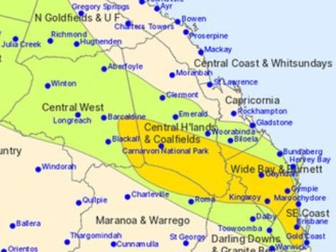
Severe storms have been forecast for SEQ, Central Queensland and the far northwest parts of the state, most likely to hit by this afternoon and evening.
No warnings have been issued.
According to Senior Meteorologist Angus Hines, Brisbane is expected to hit a scorching 33C, while coastal areas such as the Gold Coast will be slightly cooler at 29C.
Further inland, Ipswich is likely to bear the brunt of the heat, with temperatures forecast to soar to a blistering 35C.
“Pretty warm conditions are expected across the southeast,” Mr Hines noted, adding that the day will start out mostly sunny, but there is a chance of an afternoon shower or thunderstorm. “The sun is out at first – but there is a chance of an afternoon shower or thunderstorm across the area, and even the outside chance of a severe thunderstorm.”
While rainfall is not expected to be significant, the bureau warns that any thunderstorms could bring strong winds and possibly hail.
“The storms, if they do develop, don’t look like they’ll bring too much rainfall, but they do bring a risk of some damaging wind and some large hailstones,” Mr Hines said.
The warm weather won’t just be confined to the southeast.
Much of Queensland will experience hot conditions, with inland regions also facing the possibility of thunderstorms, particularly across the Wide Bay and Central Highlands areas. Meanwhile, northern coastal regions, including Bundaberg and the Tropical North, will enjoy mostly settled, dry weather.
Looking ahead to Sunday, temperatures are set to drop slightly, with Brisbane expected to cool down to a more comfortable 28C.
“It’s likely to cool off a little bit tomorrow [Sunday]. Doesn’t become cold, necessarily, but we might see Brisbane go from 33C today down to about 28C tomorrow, and we’ll see a similar drop in temperature of between three and five degrees for much of the rest of the southeast as well,” Mr Hines said.
No severe thunderstorm warnings have been issued at this stage, but the bureau will continue to monitor storm development closely throughout the day.
“Warnings for thunderstorms tend to be issued only once the storms begin to develop, so there’s a chance we’ll see some later today,” Mr Hines said.
Strong wind warnings are already in place for marine areas along the Sunshine and Gold Coast and Moreton Bay.
Originally published as Qld weather: Severe thunderstorm forecast for SEQ as temperatures soar

Qld rich lister’s seven-year battle for threatened wildlife permit
Graham Skroo Turner has slammed state government bureaucrats over delays in approving permits to help save threatened native wildlife fearing it will drive critically endangered animals to extinction.

‘We deserve more’: TV host’s fury at fatal chopper crash probe
Channel 7 presenter Jim Jefferies who lost his nephew in an army helicopter crash off the Whitsunday coast last year has slammed an inquiry into the disaster.