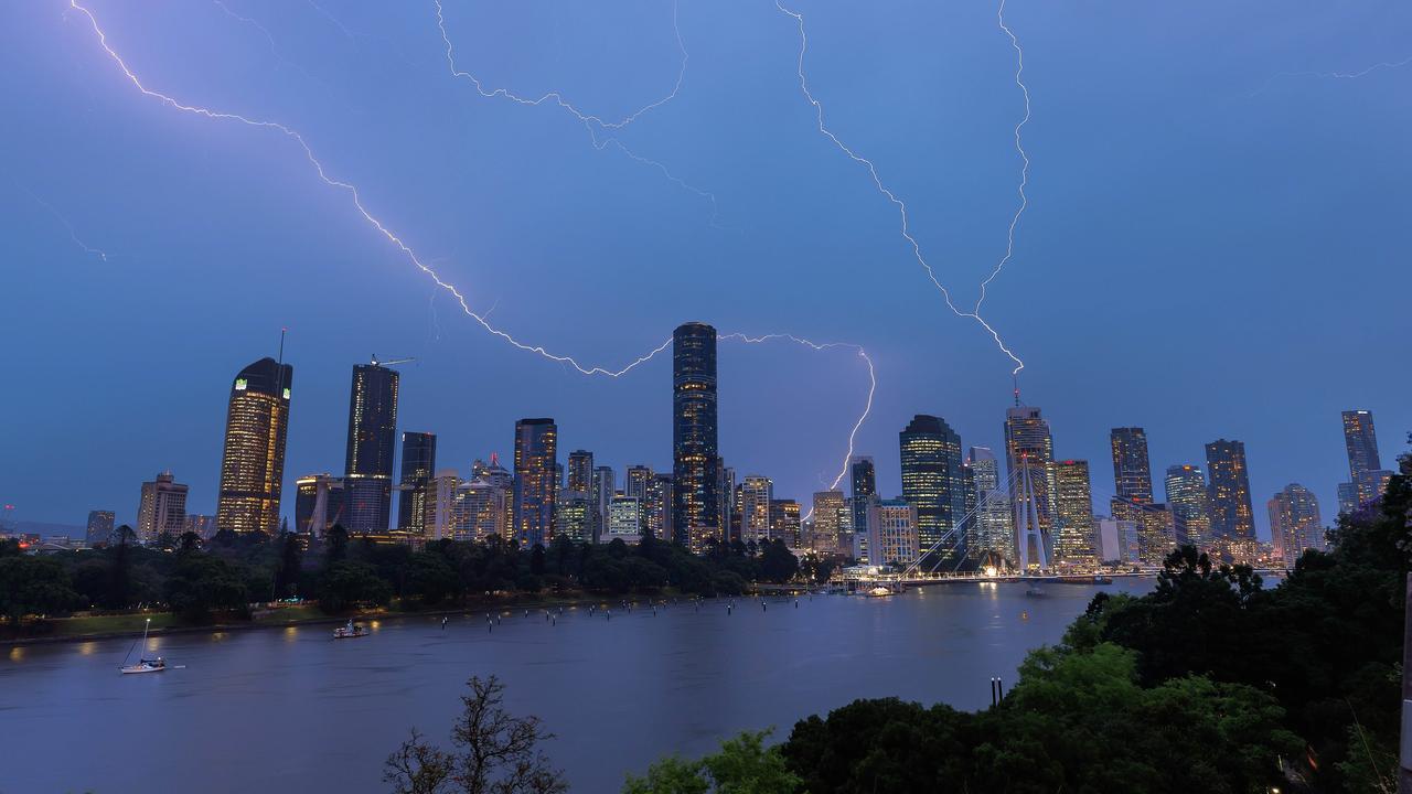
Qld weather: Latest news and photos from southeast storms
Storm activity has shifted northwest of Brisbane after the capital and City of Moreton Bay were in the firing line. LATEST UPDATES
QLD News
Don't miss out on the headlines from QLD News. Followed categories will be added to My News.
Storm activity has shifted northwest of Brisbane after earlier threatening the capital along with the City of Moreton Bay.
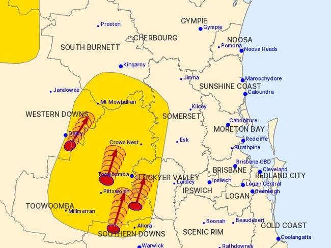
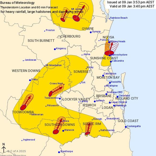
Severe storms active near Kingaroy continued to move north towards the Cherbourg and Proston areas.
A severe thunderstorm warning for Cherbourg and parts of Gympie and South Burnett areas about 7.50pm warned of heavy rainfall, large hailstones, and damaging winds.
More than 1800 South East Queensland were without power Thursday afternoon and 63mm of rain fell in the 30 minutes to 3.24pm at Jordan St near Caloundra.
South East Queensland was saturated by rainfall on Thursday, with the heavier falls recorded north of Brisbane.
From 9am to 9pm, the heaviest falls were on the Sunshine Coast, with 91mm recorded at Mooloolaba, 80mm at Caloundra, 79mm at Upper Lamerough, 77mm at Aroona, 72mm at Meridan Plains, 60mm at Bells Creek South, and 54mm at Sippy Downs.
Outside of the Sunshine Coast, 54mm fell at Caboolture and Burpengary, while 50mm was recorded at Maroon Dam.
Closer to Brisbane, the city recorded 30mm, while Bowen Hills and Hendra recorded 29mm.
Significant falls were also recorded in the Darling Downs and Lockyer Valley with 34mm at Upper Lockyer, 28mm at Highfields and Oakey, while 26mm fell at Spring Bluff.
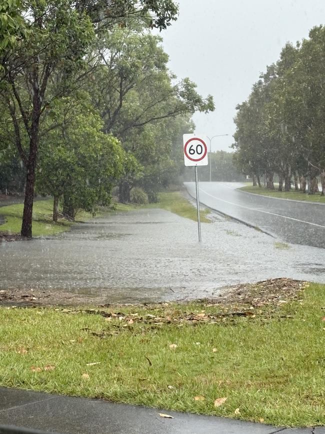
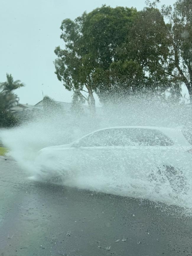
Meanwhile at 3.15pm it was reported a fallen tree branch has caused more than 1700 people to lose power on the Sunshine Coast.
According to an Energex spokesman, a tree branch fell on overhead powerlines at Caloundra Rd, Little Mountain, causing about 1739 customers to lose power. The outages were largely restored by 5pm, with just 141 Energex customers without power across the southeast.
“We have a tree branch on mains and that’s causing the outage,” the spokesman said earlier.
“A crew has been dispatched and they shouldn’t be too far away.”
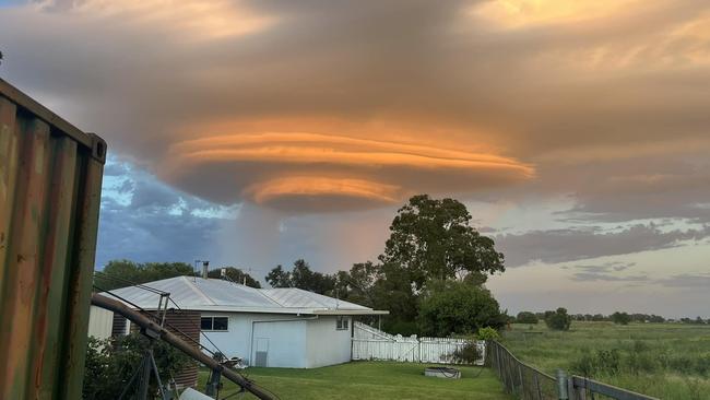
A rare storm cloud formation was spotted in the Darling Downs in the early hours of this morning.
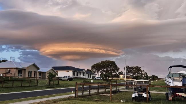
A lenticular storm cloud formation was seen during a storm that moved towards Oakey and other areas north of Toowoomba around sunrise.
According to the Bureau of Meteorology, lenticular clouds are near-stationary, lens-shaped clouds that usually form when air is lifted over an elevated area—typically by stronger winds—and a wave is formed in the flow.
The formation was photographed by local residents in Catella, Meringandan, and Meringandan West just after 5am.
Higgins Storm Chasing described the clouds as a “UFO looking storm”.
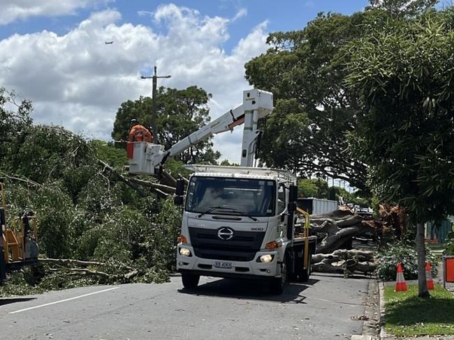
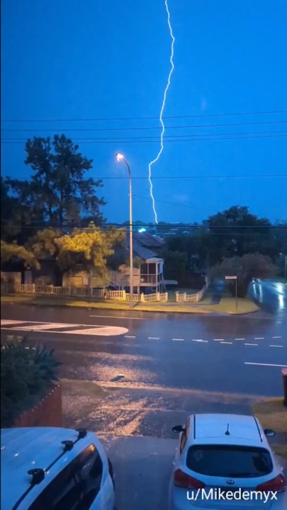
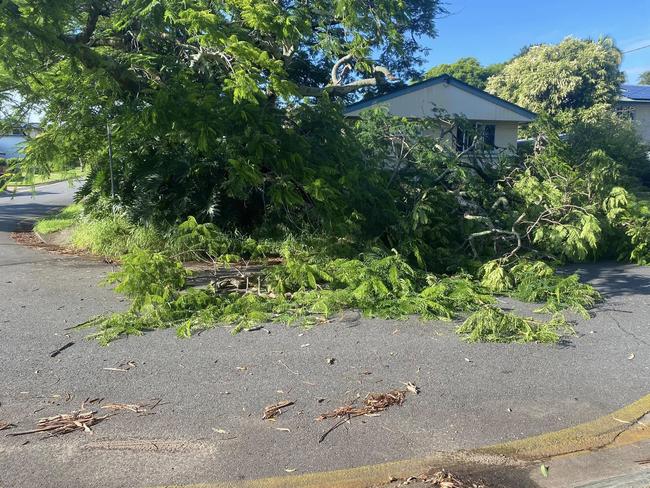
Thursday’s storm activity come after an intense system hit multiple parts of the state’s south late Wednesday night, including Brisbane, with clean-up efforts still underway Thursday morning.
Bureau community information officer Daniel Hayes earlier said an upper level trough pushed through southern Queensland brought wild storms to parts of Maranoa and Warrego, Darling Downs and into Brisbane overnight.
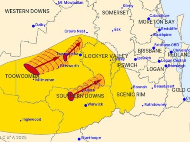
“Falls around Brisbane pushed up to 50mm. We did see some falls to 60 to 70mm. We had 57mm in an hour come down a Maroon Dam with a total of 64mm,” Mr Hayes said.
58mm of rain was recorded in 47 minutes at Goolman in Ipswich, 45mm in 30 minutes south of Ripley and 30 to 40mm in Brisbane.
“Most of the activity this morning has been back through the southern downs and to Scenic Rim and Lockyer Valley areas, and we do still have severe thunderstorm warnings active in that area at the moment.”
Mr Hayes said storms will continue to develop later this afternoon for parts of the south east and will ease going into Sunday.
“We may see activity increasing through Friday and Saturday, probably peaking around Saturday. The trough is going to continue to lie through the inlet areas, and we’ll still have that ridge along the coast that is pushing moisture into the trough,” Mr Hayes said.
“That will allow continuation of shower and storm activity.”
Meanwhile, western Queensland is set to swelter and is facing severe heatwave conditions, with Mr Hayes warning that some parts could see mid 40Cs even high 40Cs in the coming days.
“Longreach, Birdsville are going for 44C today and I think 47C by Saturday, looking and continuing high temperatures through there,” Mr Hayes said.
It comes after parts of Brisbane and the Gold Coast were smashed by severe thunderstorms overnight with heavy rain and wild winds unleashing on the southeast.
Emergency services were called to Indooroopilly about 9.30pm on Wednesday after reports of a man who was trapped in his car which had been hit by a fallen tree.
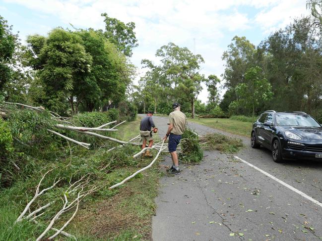
Multiple paramedics attended the scene and assessed a man, aged in his 70s, who was trapped by his arm.
The man was taken to the Royal Brisbane and Women’s Hospital in a stable condition.
More than 20 call-outs were made to SES since 4pm on Wednesday. There were 12 calls made for Brisbane, five for Moreton Bay, two to Ipswich, two to Redlands, two South Burnett and one for Toowoomba mainly for trees and structural assistance.
According to Energex, 170 homes and businesses are without power in Indooroopilly following the severe weather. About 200 customers are also without power in Brookfield and Windsor.
On Wednesday 58mm of rainfall was recorded at Goolman Alert in the hour to 8:57pm, 45mm was recorded at South Ripley (Wards Rd) in the 30 minutes to 8:53pm, 47mm was recorded at Washpool Alert in the 30 minutes to 8:22pm, and 57mm was recorded at Maroon Dam HW Alert in the hour to 7:38pm.
Earlier 72mm of rainfall was recorded at Queen Mary Falls in the hour to 6:58pm, 53mm was recorded at Carrs Lookout in the 30 minutes to 6:39pm, and 44mm was recorded at White Swamp in the 30 minutes to 6:54pm.
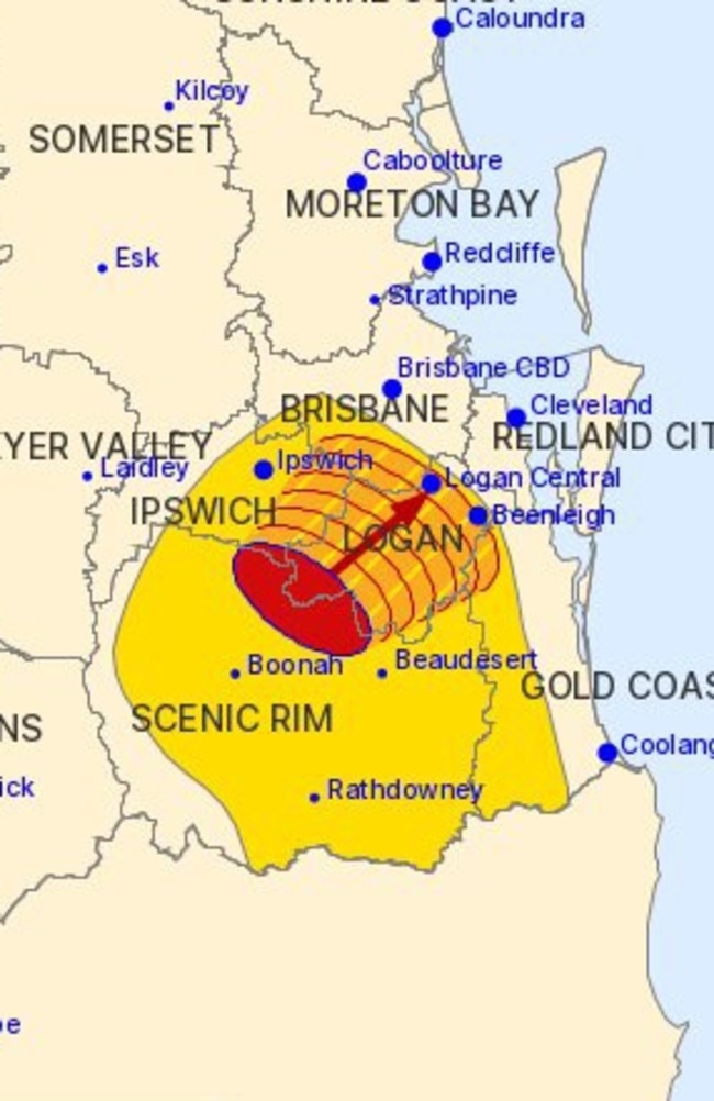
“They are forecast to affect Little Nerang Dam, Mudgeeraba and Canungra by 7.15pm and the area northeast of Kingaroy, Cherbourg and Goomeri by 7.45pm.”
Heavy falls have been recorded in the Scenic Rim late on Wednesday afternoon and parts of the southwest have copped hail.
A more general severe thunderstorm warning is also current for parts of the Central Highlands and Coalfields, Wide Bay and Burnett, Maranoa and Warrego, Darling Downs and Granite Belt and Southeast Coast regions. Locations which may be affected include Taroom, Injune and Carnarvon National Park.

Photographs on social media reveal large and widespread hail near St George, in Queensland’s southwest and the Bureau says 3cm was observed in that area, while 2cm hail was reported in Roma about 4.30.
It’s the start of what the Bureau of Meteorology says could be a volatile period throughout Queensland.
The chance of thunderstorms continues from Thursday across much of Queensland and are forecast to bring severe storms, producing damaging wind gusts in the south.
Bureau community information officer Daniel Hayes warned of the potential for daily storms through inland parts of the state throughout the week.
“The may start to develop later this afternoon with a few storms in the Maranoa and Warrego and with storms showing in that area, and activity in northern NSW south of the border Scenic Rim,” Mr Hayes said on Wednesday.
“90km wind gusts in parts of Darling Downs, Granite Belt and Scenic Rim and parts of the Maranoa and Warrego.”
Mr Hayes said storm activity would increase over the coming days and shower activity would become more widespread with the potential for storms to produce more than 100mm of rain.
There is the possibility of severe thunderstorms inland between Emerald and Toowoomba on Friday.
“Shower activity looking 10 to 15mm each day through Friday to Sunday and elements of hit and miss in some areas. As there will be thunderstorms in the mix some isolated heavier falls will push into the 50mm in some areas,” Mr Hayes said.
“It’s possible with some areas receiving 10 to 15mm and thunderstorms in the mix; you could see some accumulations go over the 100mm over the coming days.”
“Likely that will be fairly isolated showers, in the Central Highlands and Wide Burnett but can’t rule out that it might affect the south east.”
Originally published as Qld weather: Latest news and photos from southeast storms


