
NSW weather about to get wild with snow, floods, wind, dust storms predicted to hit state
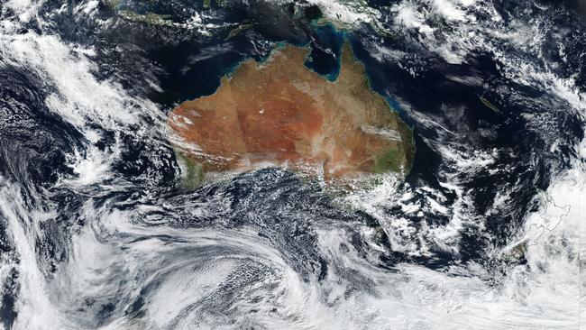
From avalanche warnings to dust storms, flooding and gale force winds, NSW is about to experience an unusual weather event not seen in 15 years, including a dumping of heavy snow in the southern, central and northern tablelands.
NSW
Don't miss out on the headlines from NSW. Followed categories will be added to My News.
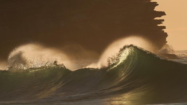
- Surfer drowns in huge surf during wild Sydney flooding
- Wild weather hits Sydney after bus rescued from flash flooding
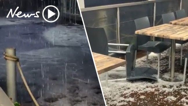
An “unusual” weather event is bringing the full spectrum of phenomena to NSW, with heavy snow, dust storms, flooding, gale force winds and fires hitting the state this week.
Winds averaging from 60km/h to gusts of up to 90km/h are predicted from today until late Sunday, with strong winds lifting dust from drought stricken country west of Bourke and pushing it east.
Bureau of Meteorology East Region Manager Jane Golding said the unusual weather event hadn’t been seen in 15 years, and would bring unprecedented snow to the southern, central and northern tablelands.
“These could be our coldest days all year ... unusually cold temperatures this time a year with eight to ten degrees below average,” Ms Golding said.
Here's where the #snow could fall on the weekend. The ranges could receive snowfalls on and off from Friday night to Sunday. If you're in those areas drive safely and to conditions. Check out our MetEye map to see where and when the snow is forecast: https://t.co/cIKmJ8Sl08 pic.twitter.com/GGJdyYYQgd
— Bureau of Meteorology, New South Wales (@BOM_NSW) August 20, 2020
Temperatures will feel in the single digits in Sydney despite predicting to hit 16 degrees, as wind chill from a deep southern trough sets in.
Snow will reach low levels of NSW, with Goulburn, Bathurst, Oberon, Katoomba and Canberra expecting a dusting.
The snow will even reach north to areas like Barrington Tops.
“Some places that don’t normally see snow could see 36 hours, so the duration is unusual,” Ms Golding said.
Those hoping to go skiing this weekend should take extra care, and keep up to date with the snow resort’s warnings.
“People planning on skiing, there is a higher than usual risk of avalanches this weekend,” Ms Golding said.
“With the wind and low visibility ... back country skiing might not be too pleasant,” she said.
Minor flood warnings have been issued for the St Georges Basin at Sussex Inlet extending to Friday afternoon.
The Shoalhaven region experienced its worst flooding in 30 years earlier this month and the gusty winds could leave the area vulnerable to falling trees.
“NSW has seen quite a bit over the last few months, starting with the fires, February floods, more floods in March and even in the last month we’ve had a few decent systems off the coast,” Ms Golding said.
The wind also battered the fire burning in Duranbah north of Byron, the fire scorching 400 hectares of land fanned by the strong winds.
Severe Weather Warning for DAMAGING WINDS in Hunter, Illawarra & parts of Mid North Coast, South Coast, Central Tablelands & Southern Tablelands.
— NSW SES (@NSWSES) August 20, 2020
WINDY CONDITIONS FOR EASTERN NSW
View all #weather warnings @BOM_NSW : https://t.co/svH9b1p1E3 #GetReady https://t.co/dmaR5EnsyQ pic.twitter.com/oI5m7UrJAy
The SES is preparing for a busy weekend with tree and power lines predicted to fall.
“We’ve done 160 jobs in the past 24 hours to 11am this morning, and the SES has activated our snow plans,” NSW SES Commissioner Carlene York said.
“There are concerns with floods the root systems become destabilised and it is more likely trees will fall over,” she said.
Those in the tablelands should think twice about heading out on the roads over the weekend with snow likely to turn to ice on the road.

The warnings follow Wednesday’s wild winds which lashed much of eastern NSW late, with Kurnell hit by gusts of 87km/h wind gust and winds in Willamtown near Newcastle reaching 80km/h.
Eight cars were crushed under tonnes of scaffolding in Gosford yesterday after high winds brought the scaffolding crashing down.
A woman, aged about 45, was understood to have been walking past when the scaffolding gave way and suffered a head injury. The Bureau of Meteorology reported a wind gust at Gosford of 59km/h just moments before the incident.
Elsewhere in NSW, the RFS is working to get control of a bushfire burning at Duranbah, less than an hour north of Byron.
The fire broke out yesterday, and it is believed to be started by a landowner doing their own hazard reduction burning, or ‘pile burning’.
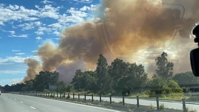
“While conditions overnight eased, stronger north westerly winds are forecast to strengthen through the day,” the RFS said.
“It is suspected that this fire began from an escaped private burn. Although there has been recent rain, grass areas remain quite dry and under current conditions it’s important to be careful and keep any eye on any burns on your property. It is expected that strong winds will continue across parts of the state until at least Sunday,” they said on social media.
The fire became out of control as it spread through the grassy vegetation. Crews from Murrwillumbah, Tweed and other local brigades are fighting to establish containment lines around the blaze.
Water bombers were called in to try and extinguish the blaze.
Advice: Pacific Hwy, Duranbah (Tweed LGA). While conditions overnight eased, stronger NW winds are forecast to strengthen today. Those in the area of Clothiers Ck Rd, Forest Hill Rd and Tanglewood areas should monitor conditions and take advice from firefighters in area. #NSWRFS pic.twitter.com/sAgGS2K87V
— NSW RFS (@NSWRFS) August 19, 2020
RFS spokesman Greg Allan yesterday said the fire was “unique”. “North-westerly winds are pushing in a south-easterly direction, but the fire is actually burning back onto the wind,” Mr Allan said.
“That‘s why areas to the north and south should monitor the fire in case conditions change,” he said.
Mr Allan said it was a good reminder to land owners to always notify neighbours and fire authorities when preparing to conduct pile burning.

Schools given new targets to boost student performance
Public schools across NSW have been put on notice to drastically boost students’ academic performance and attendance rates, with the Minns government today unveiling 16 ambitious new targets to arrest rapidly declining marks.

Burke accused of not inviting rival MP to citizenship extravaganza
Fowler MP Dai Le claims she did not get an invite to Tony Burke’s industrial-scale citizenship ceremony in Olympic Park. His office claims she ignored the invitation.