
Wet winter predicted after washed-out summer
A new weather pattern will bring a wet winter on the back of record-breaking rain over summer, while more is on the way ahead of Easter.
NSW
Don't miss out on the headlines from NSW. Followed categories will be added to My News.
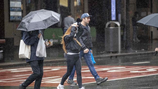
Australia may be on the path to a wet winter on the back of record-breaking rain over summer despite sunny skies over Easter.
The Bureau of Meteorology predicted one part of the state would see the wet continue over the Easter break, with most wet conditions “easing” from Thursday.
“Easing of showers (on Friday) in parts while the north showers expected to continue into the long weekend,” the BOM wrote online on Wednesday.
The Greater Sydney forecast for Thursday is a maximum of 22C, with between 8 to 20mm of rain expected from late morning and afternoon showers before fine and sunny conditions on Friday, Saturday and Sunday.
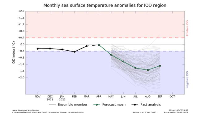
But meteorologists have warned of the potential of a negative Indian Ocean Dipole (IOD), a climate system responsible for driving higher than average rainfall, which could hit the West Coast this winter.
An IOD is when sea surface temperatures differ in the west and east areas of the Indian Ocean, which then makes Australia’s climate warmer or cooler and can cause droughts or floods.
A negative IOD means cooler temperatures are recorded in the ocean’s western pole, bringing more westerly winds and increased cloudiness to Australia’s northwest and more rain in the nation’s south.
Weatherzone meteorologist Ben Domensino said the system could cause heavy rain across the majority of the country.
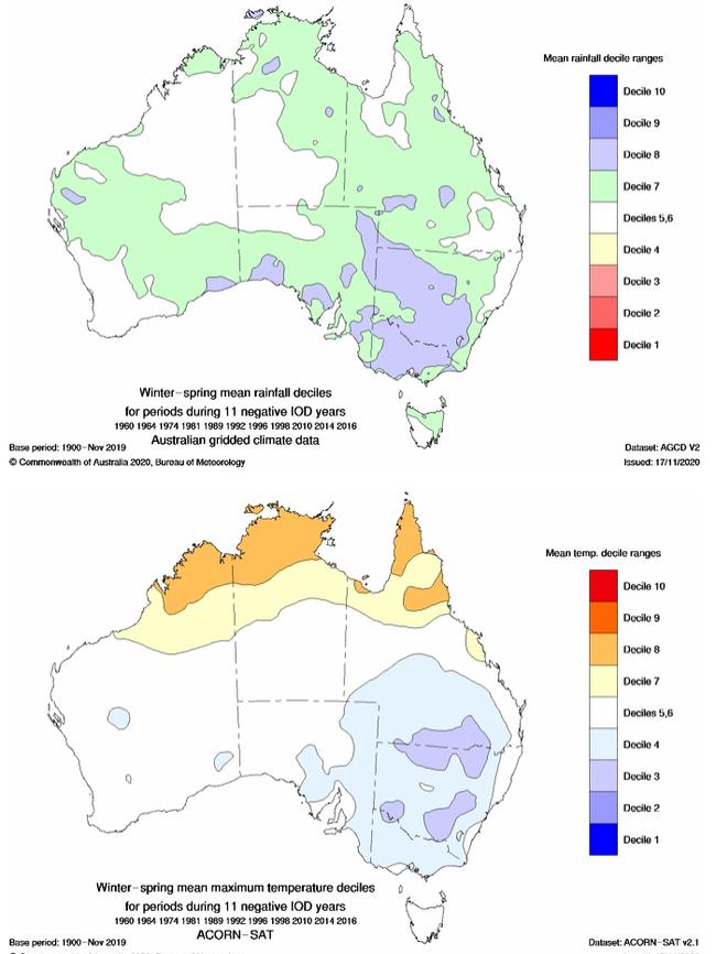
“Typically a negative IOD causes above average rain over large areas of North Western, Central and Southern Australia, and then extends to inland parts of Eastern Australia too,” he said.
“It basically impacts parts of every inland state and territory.”
As the East Coast begins to recover from damaging rains and floods that had been aggravated by La Niña, Mr. Domensino warned of more of the same.
“A negative IOD and La Niña behave very similarly. They both put more moisture into the air and increase the chance that you’ll receive above average levels of rain.
“Given La Niña is lasting longer than usual, if we do see that negative IOD develop, there won’t be much time in between them. It’ll basically transfer from one to the other.”
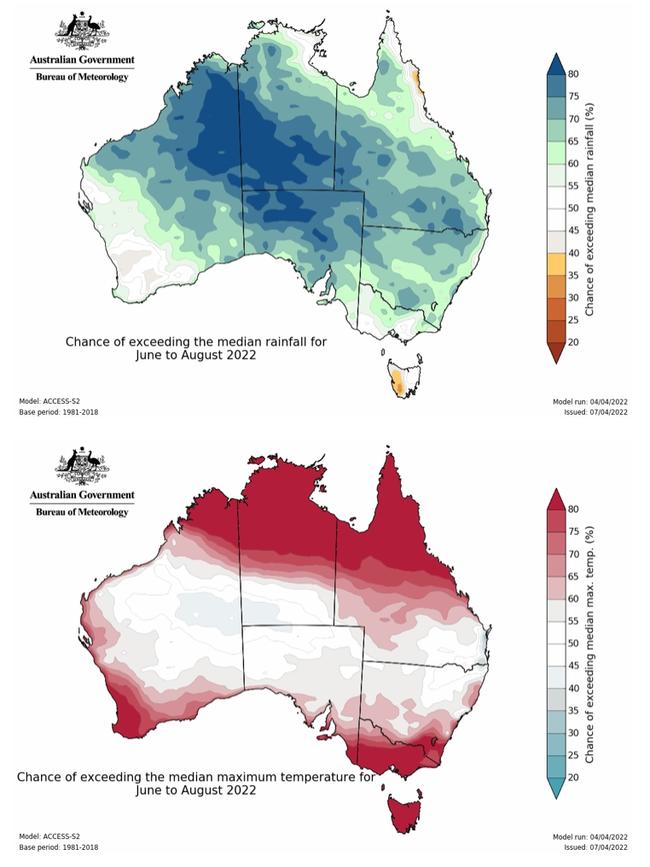
Mr. Domensino stressed, however, that the modelling was not able forecast heavy rain in any particular areas at this point.
“We don’t really know whether that will happen beyond the next fortnight. We can broadly say that above average rain is an increased chance, but we can’t really say how much rain will fall.”
The Australian Bureau of Meteorology has said that while modelling on the IOD remains unreliable this far in advance, climate change has led to “a trend towards a greater proportion of rainfall from high intensity short duration rainfall events”, like those experienced across the East Coast over summer.


Gaza Carr crash: Ex-premier under fire over Israel comments
Jews slam ‘relevance’-deprived former premier Bob Carr for comparing Israel to 20th century tyrants Josef Stalin and Mao Tse-Tung.

More NSW public sector job cuts on the way
A new round of sweeping staff cuts have rocked the public sector after the NSW Department of Primary Industries and Regional Development announced on Monday they would slash up to 165 jobs.